MyTopo
Patsy Draw Wyoming US Topo Map
Couldn't load pickup availability
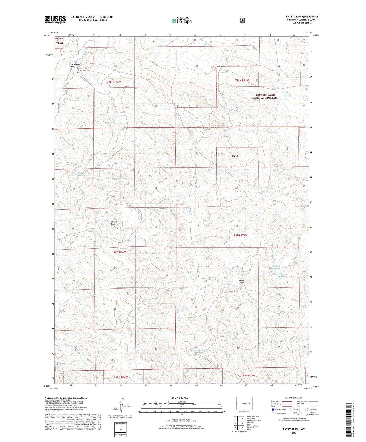
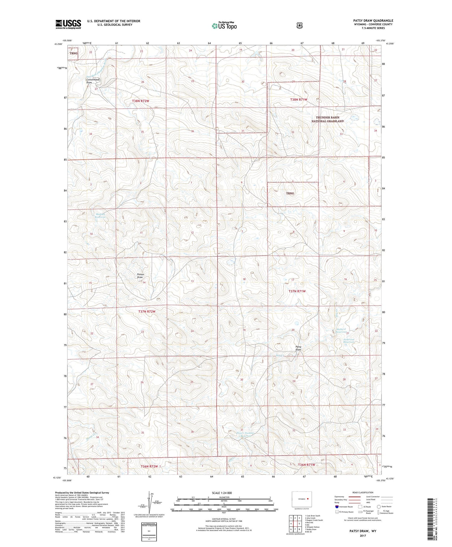
2021 topographic map quadrangle Patsy Draw in the state of Wyoming. Scale: 1:24000. Based on the newly updated USGS 7.5' US Topo map series, this map is in the following counties: Converse. The map contains contour data, water features, and other items you are used to seeing on USGS maps, but also has updated roads and other features. This is the next generation of topographic maps. Printed on high-quality waterproof paper with UV fade-resistant inks.
Quads adjacent to this one:
West: Red Hill
Northwest: Coal Draw South
North: Alta Creek
Northeast: Dugout Creek South
East: Bill
Southeast: Bill SE
South: Bobby Draw
Southwest: Whipple Hollow
Contains the following named places: Anderson Reservoir, Ballard Dam, Ballard Reservoir, Church Well, Cottonwood Draw, Dry Creek Number 1 Dam, Dry Creek Number 1 Reservoir, Government Dam, Madsen Reservoir, Patsy Draw, Tillard Ranch, Warren Well