MyTopo
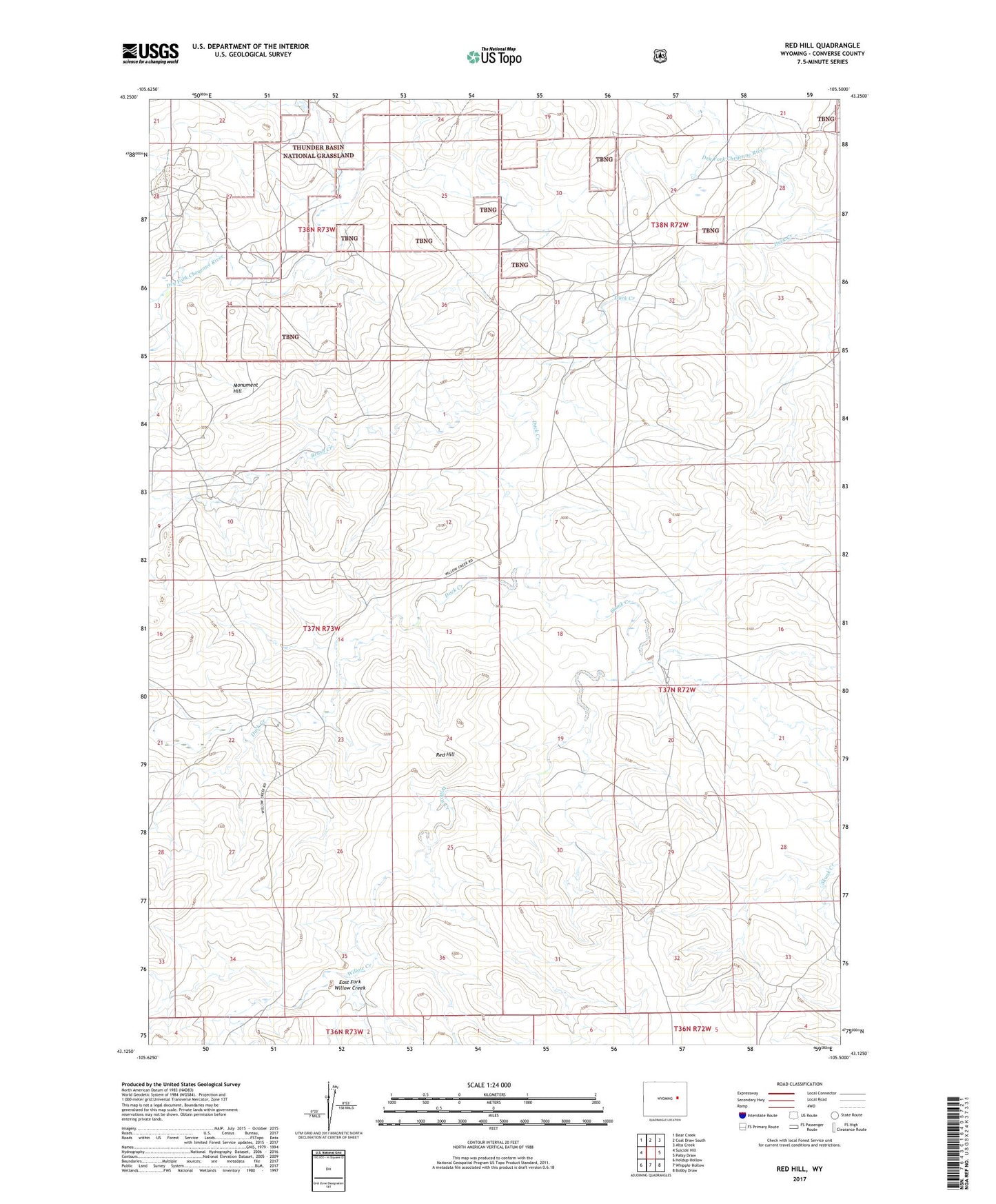
Red Hill Wyoming US Topo Map
Couldn't load pickup availability
Also explore the Red Hill Forest Service Topo of this same quad for updated USFS data
2021 topographic map quadrangle Red Hill in the state of Wyoming. Scale: 1:24000. Based on the newly updated USGS 7.5' US Topo map series, this map is in the following counties: Converse. The map contains contour data, water features, and other items you are used to seeing on USGS maps, but also has updated roads and other features. This is the next generation of topographic maps. Printed on high-quality waterproof paper with UV fade-resistant inks.
Quads adjacent to this one:
West: Suicide Hill
Northwest: Bear Creek
North: Coal Draw South
Northeast: Alta Creek
East: Patsy Draw
Southeast: Bobby Draw
South: Whipple Hollow
Southwest: Holdup Hollow
This map covers the same area as the classic USGS quad with code o43105b5.
Contains the following named places: 2-A Dam, 2-A Reservoir, Baker Ranch, Brush Creek, Duck Creek, East Fork Willow Creek, Genevieve Draw, Hardy Lease Mine, Hornbuckle Number 1 Dam, Hornbuckle Number 1 Reservoir, J Reynolds Ranch, Manning Ranch, Monument Hill, Nats Nugget Mine, Red Hill, Reynolds Ranch, Skunk Creek, Spook Mine, Tisket Group Mine, W Reynolds Ranch, Willow Creek