MyTopo
Powder Mountain Wyoming US Topo Map
Couldn't load pickup availability
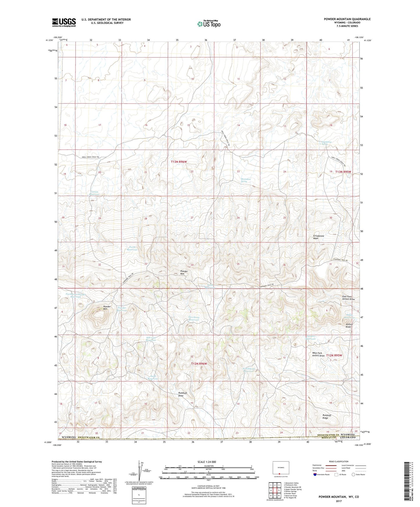
2021 topographic map quadrangle Powder Mountain in the state of Wyoming. Scale: 1:24000. Based on the newly updated USGS 7.5' US Topo map series, this map is in the following counties: Sweetwater, Moffat. The map contains contour data, water features, and other items you are used to seeing on USGS maps, but also has updated roads and other features. This is the next generation of topographic maps. Printed on high-quality waterproof paper with UV fade-resistant inks.
Quads adjacent to this one:
West: Upper Powder Spring
Northwest: Monument Valley
North: Prehistoric Rim
Northeast: Powder Mountain NE
East: Rotten Springs
Southeast: The Nipple NE
South: Reservoir Draw
Southwest: Powder Wash
Contains the following named places: Anthill Knob, Arrowhead Reservoir, Carson Reservoir, Grindstone Spring, Juniper Reservoir, Knob Reservoir, Moonshine Spring, North Reservoir, Northwest Powder Reservoir, Powder Mountain, Powder Reservoir, Powder Rim, Ruedloff Ridge, Salt Lick Reservoir, Sand Reservoir, Two Draw Reservoir, White Reservoir