MyTopo
Rozet NW Wyoming US Topo Map
Couldn't load pickup availability
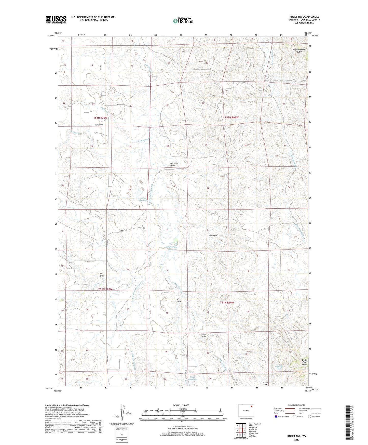
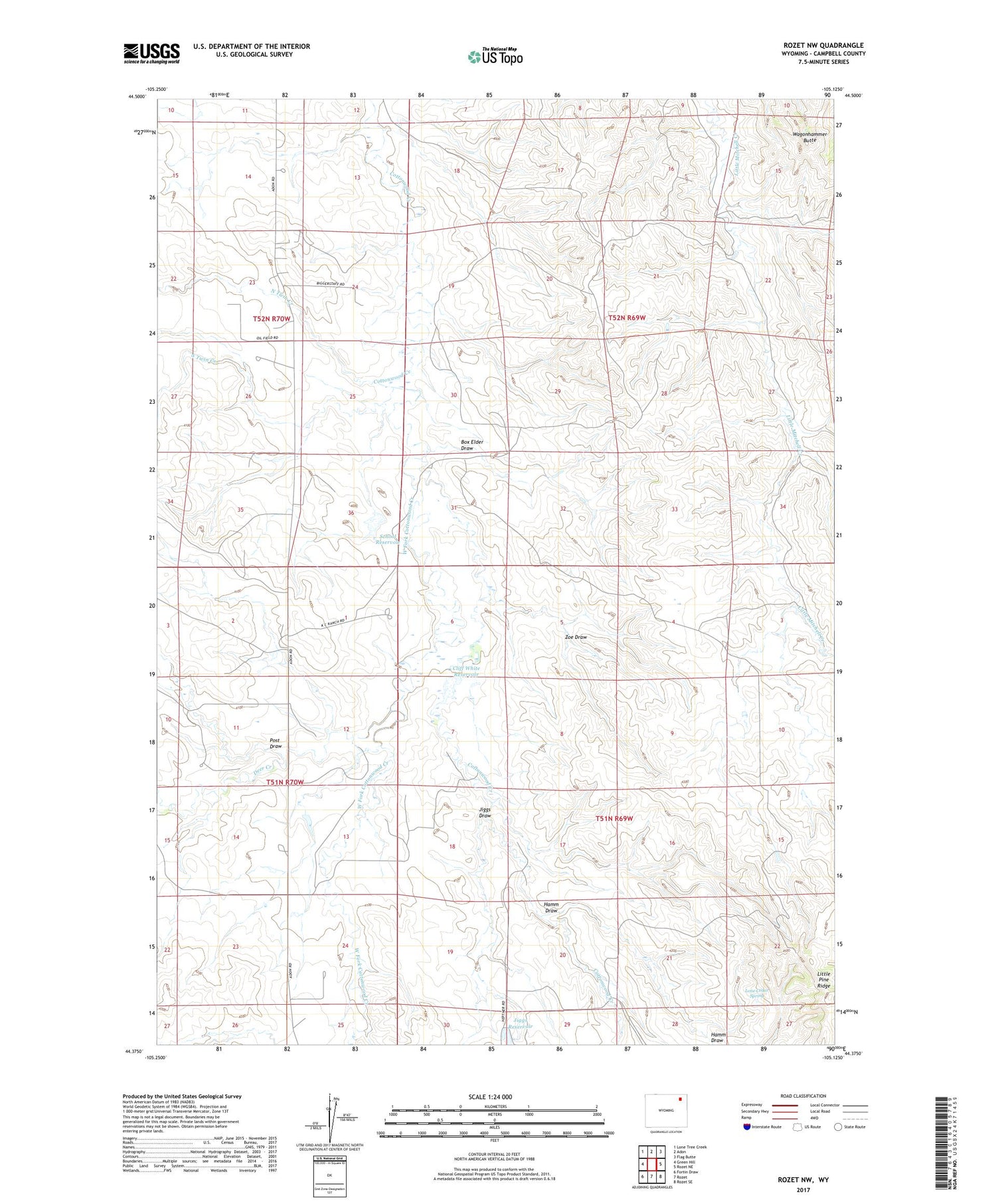
2021 topographic map quadrangle Rozet NW in the state of Wyoming. Scale: 1:24000. Based on the newly updated USGS 7.5' US Topo map series, this map is in the following counties: Campbell. The map contains contour data, water features, and other items you are used to seeing on USGS maps, but also has updated roads and other features. This is the next generation of topographic maps. Printed on high-quality waterproof paper with UV fade-resistant inks.
Quads adjacent to this one:
West: Green Hill
Northwest: Lone Tree Creek
North: Adon
Northeast: Flag Butte
East: Rozet NE
Southeast: Rozet SE
South: Rozet
Southwest: Fortin Draw
Contains the following named places: Box Elder Draw, C White Number 1 Dam, Cliff White Reservoir, Deer Creek, Hamm Draw, Jiggs Draw, Little Mitchell Creek Breaks, Lone Cedar Spring, North Twin Creek, North Twin Well, Post Draw, School Reservoir, South Twin Creek, Wagonhammer Butte, West Fork Cottonwood Creek, White Number 2 Dam, Zoe Draw