MyTopo
Rozet SE Wyoming US Topo Map
Couldn't load pickup availability
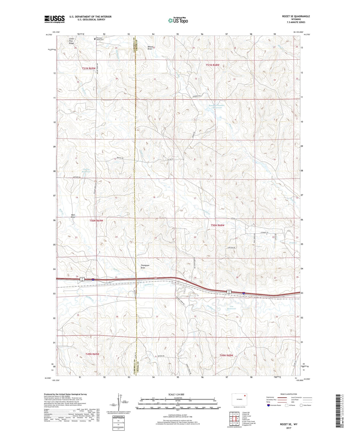
2021 topographic map quadrangle Rozet SE in the state of Wyoming. Scale: 1:24000. Based on the newly updated USGS 7.5' US Topo map series, this map is in the following counties: Crook, Campbell. The map contains contour data, water features, and other items you are used to seeing on USGS maps, but also has updated roads and other features. This is the next generation of topographic maps. Printed on high-quality waterproof paper with UV fade-resistant inks.
Quads adjacent to this one:
West: Rozet
Northwest: Rozet NW
North: Rozet NE
Northeast: Edith Creek
East: Moorcroft
Southeast: Spyglass Hill
South: Whitetail Creek NE
Southwest: Coon Track Creek
This map covers the same area as the classic USGS quad with code o44105c1.
Contains the following named places: Cherry Reservoir, Cox Dam, Cox Reservoir, Keuhne Dam, Keuhne Reservoir, Kummerfeld Oil Field, North Donkey Creek Oil Field, Phil Dam, Phil Reservoir, Pleasant Valley Cemetery, Raudsep Number 1 Dam, Raudsep Number 1 Reservoir, Stewart Ranch Oil Field, Thompson Creek, Thompson Draw, Well Creek, Well Draw, Wheat Draw