MyTopo
Rozet Wyoming US Topo Map
Couldn't load pickup availability
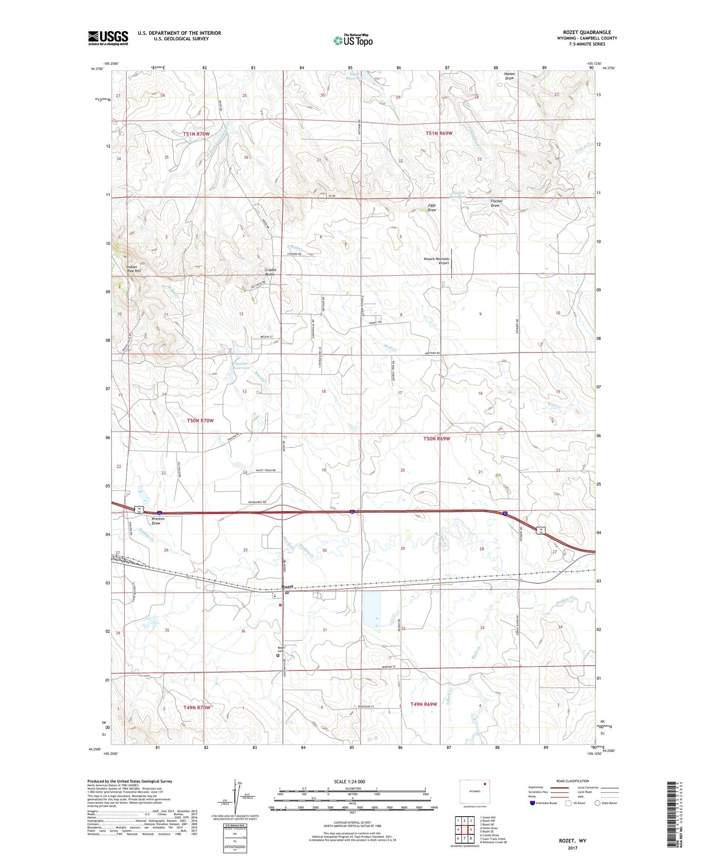
2021 topographic map quadrangle Rozet in the state of Wyoming. Scale: 1:24000. Based on the newly updated USGS 7.5' US Topo map series, this map is in the following counties: Campbell. The map contains contour data, water features, and other items you are used to seeing on USGS maps, but also has updated roads and other features. This is the next generation of topographic maps. Printed on high-quality waterproof paper with UV fade-resistant inks.
Quads adjacent to this one:
West: Fortin Draw
Northwest: Green Hill
North: Rozet NW
Northeast: Rozet NE
East: Rozet SE
Southeast: Whitetail Creek NE
South: Coon Track Creek
Southwest: Coyote Draw
Contains the following named places: Buck Creek, Campbell County Fire Department Station 12, Cradle Butte, Fischer Draw, Fischer Reservoir, Indian Tree Hill, Jiggs Dam, Jiggs Reservoir, Nelson Dam, Nelson Reservoir, Pleasant Valley Oil Field, Preston Draw, Rozet, Rozet Cemetery, Rozet Oil Field, Rozet Post Office, Rozet School, South Buck Creek, Ward Creek, ZIP Code: 82727