MyTopo
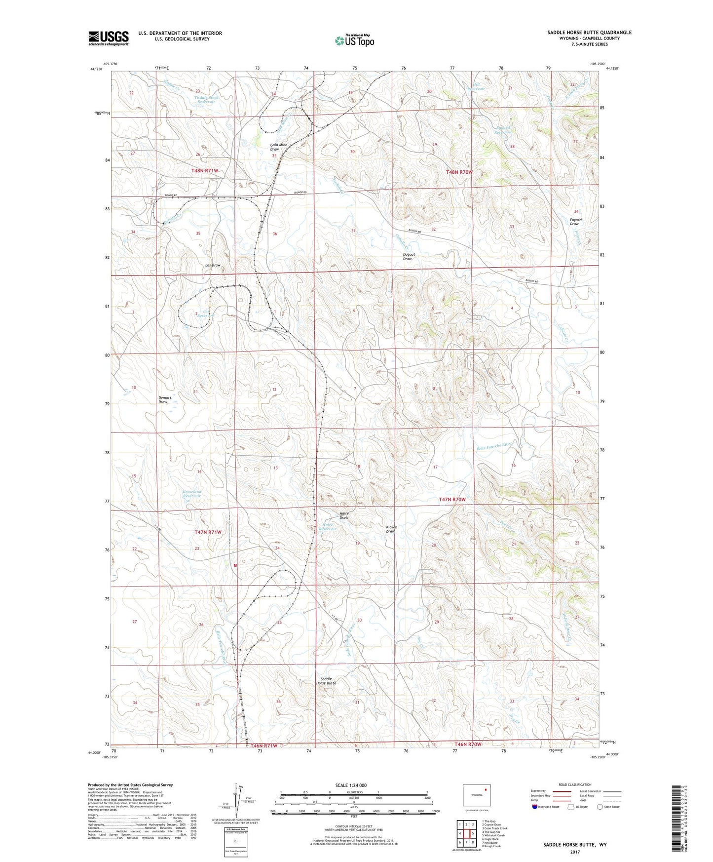
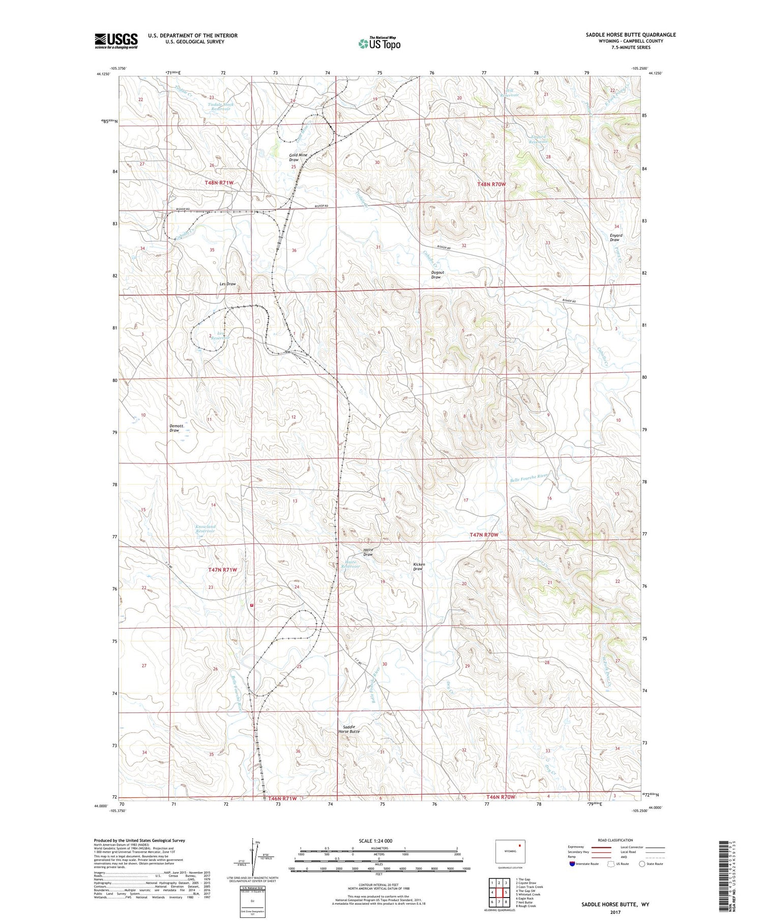
Saddle Horse Butte Wyoming US Topo Map
Couldn't load pickup availability
2021 topographic map quadrangle Saddle Horse Butte in the state of Wyoming. Scale: 1:24000. Based on the newly updated USGS 7.5' US Topo map series, this map is in the following counties: Campbell. The map contains contour data, water features, and other items you are used to seeing on USGS maps, but also has updated roads and other features. This is the next generation of topographic maps. Printed on high-quality waterproof paper with UV fade-resistant inks.
Quads adjacent to this one:
West: The Gap SW
Northwest: The Gap
North: Coyote Draw
Northeast: Coon Track Creek
East: Whitetail Creek
Southeast: Rough Creek
South: Neil Butte
Southwest: Eagle Rock
Contains the following named places: Basin Oil Field, Belle Fourche Mine, Big Hand Oil Field, Caballo Creek, Caballo Dam, Coal Creek, Cordero Rojo Mining Company Mine Emergency Response Team, Deer Creek, Deer Creek Dam, Dry Creek, Dugout Draw, East Fork Piney Creek, Enyard Draw, Enyard Reservoir, Gold Mine Creek, Gold Mine Draw, Haire Draw, Haire Reservoir, Hill Reservoir, Kicken Draw, Knowland Reservoir, Les Draw, Les Reservoir, Mary Reservoir, Saddle Horse Butte, Sylvester Dam, T 7 Ranch, Tisdale Creek, Tisdale Stock Reservoir, West Fork Deer Creek