MyTopo
Saddle Rock Wyoming US Topo Map
Couldn't load pickup availability
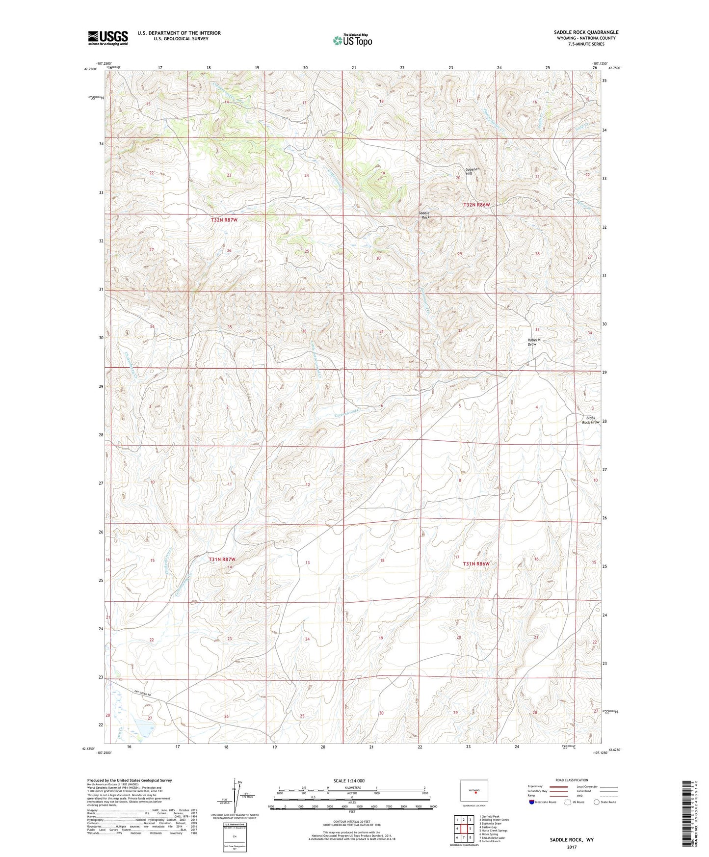
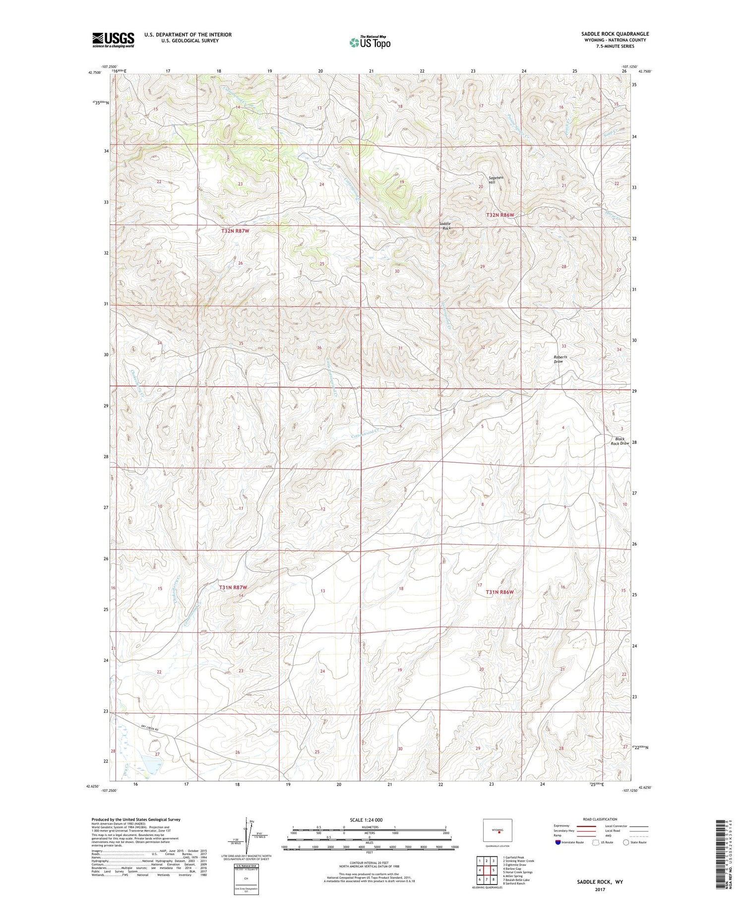
2021 topographic map quadrangle Saddle Rock in the state of Wyoming. Scale: 1:24000. Based on the newly updated USGS 7.5' US Topo map series, this map is in the following counties: Natrona. The map contains contour data, water features, and other items you are used to seeing on USGS maps, but also has updated roads and other features. This is the next generation of topographic maps. Printed on high-quality waterproof paper with UV fade-resistant inks.
Quads adjacent to this one:
West: Barlow Gap
Northwest: Garfield Peak
North: Stinking Water Creek
Northeast: Eightmile Draw
East: Horse Creek Springs
Southeast: Sanford Ranch
South: Beulah Belle Lake
Southwest: Miller Spring
Contains the following named places: Cabin Creek Dam, Chokecherry Creek, Cottonwood Creek, Cottonwood Ranch, Little Cottonwood Creek, Saddle Rock, Sagehen Hill