MyTopo
Simpson Draw NW Wyoming US Topo Map
Couldn't load pickup availability
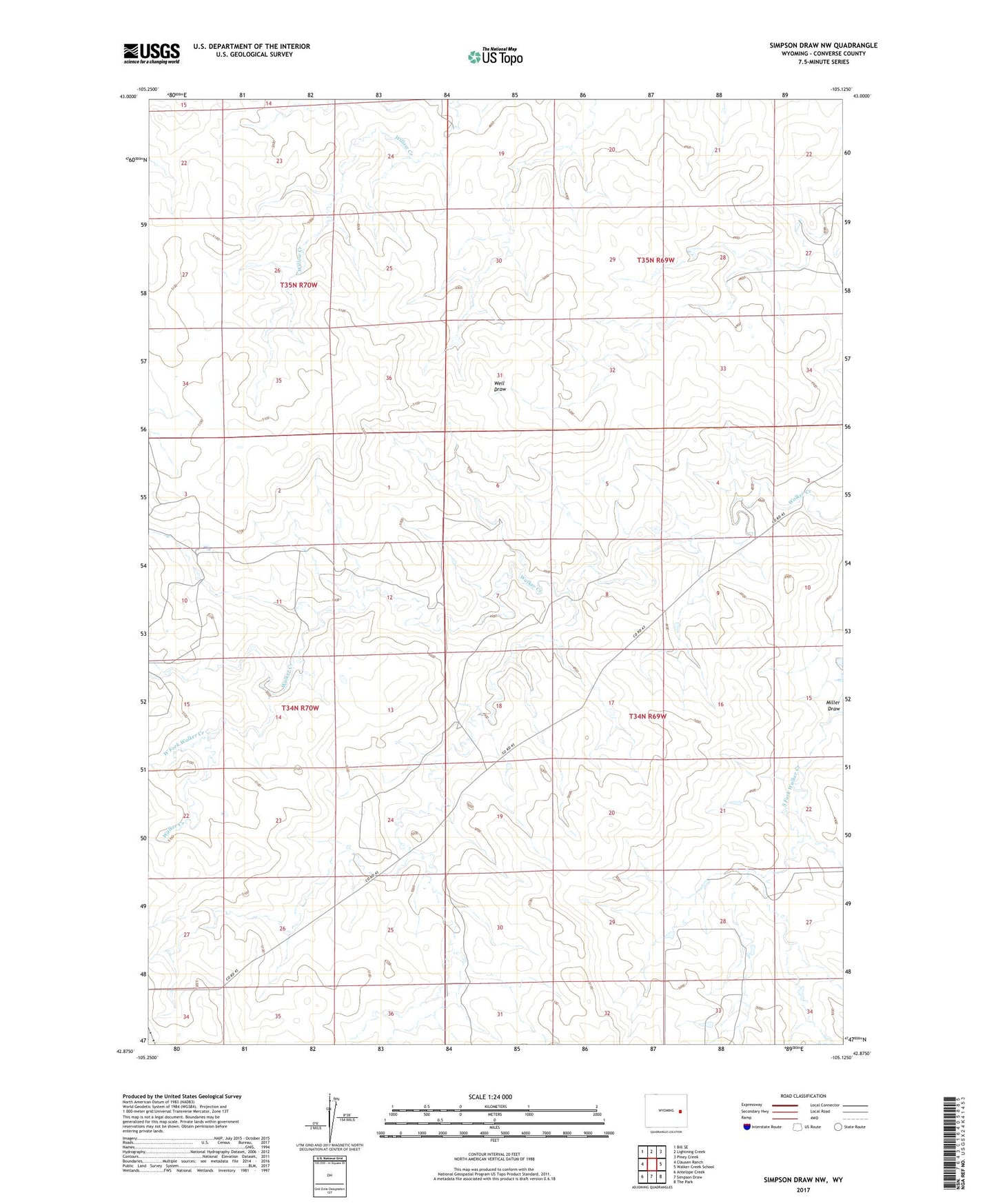
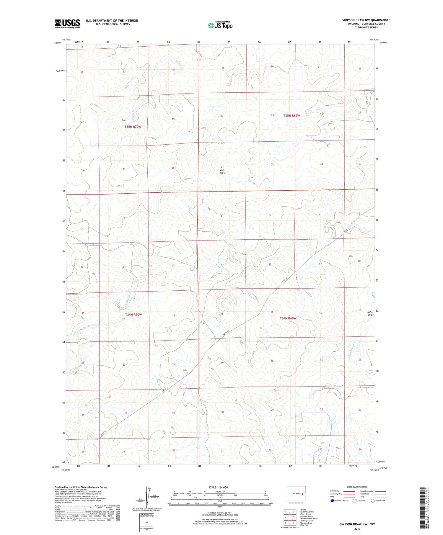
2021 topographic map quadrangle Simpson Draw NW in the state of Wyoming. Scale: 1:24000. Based on the newly updated USGS 7.5' US Topo map series, this map is in the following counties: Converse. The map contains contour data, water features, and other items you are used to seeing on USGS maps, but also has updated roads and other features. This is the next generation of topographic maps. Printed on high-quality waterproof paper with UV fade-resistant inks.
Quads adjacent to this one:
West: Clausen Ranch
Northwest: Bill SE
North: Lightning Creek
Northeast: Piney Creek
East: Walker Creek School
Southeast: The Park
South: Simpson Draw
Southwest: Antelope Creek
Contains the following named places: Buck Pasture Dam, Buck Pasture Reservoir, Lebar Ranch, Miller Draw, West Fork Walker Creek