MyTopo
The Park Wyoming US Topo Map
Couldn't load pickup availability
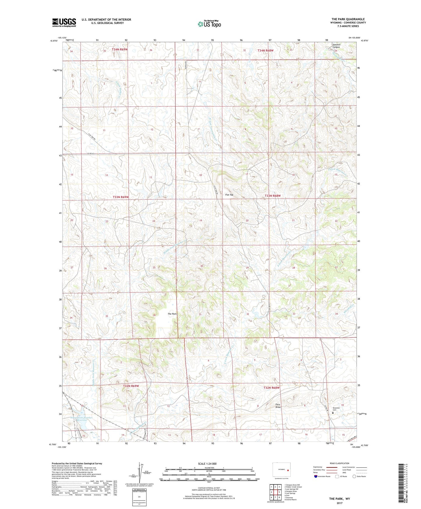
2021 topographic map quadrangle The Park in the state of Wyoming. Scale: 1:24000. Based on the newly updated USGS 7.5' US Topo map series, this map is in the following counties: Converse. The map contains contour data, water features, and other items you are used to seeing on USGS maps, but also has updated roads and other features. This is the next generation of topographic maps. Printed on high-quality waterproof paper with UV fade-resistant inks.
Quads adjacent to this one:
West: Simpson Draw
Northwest: Simpson Draw NW
North: Walker Creek School
Northeast: Lost Springs NW
East: Lost Springs
Southeast: Amend Ranch
South: Shawnee
Southwest: Orin
This map covers the same area as the classic USGS quad with code o42105g1.
Contains the following named places: Flat Top, Flat Top Oil and Gas Field, Hageman Number 2 Dam, Hageman Number 2 Reservoir, Henry Reese Fee Land Mine, Lost Springs Mine, Middle Fork Shawnee Creek, Sawmill Canyon, Shawnee Cemetery, The Park, Whackoff Creek, Wintermote Number 1 Dam, Wintermote Number 1 Reservoir