MyTopo
Spence Wyoming US Topo Map
Couldn't load pickup availability
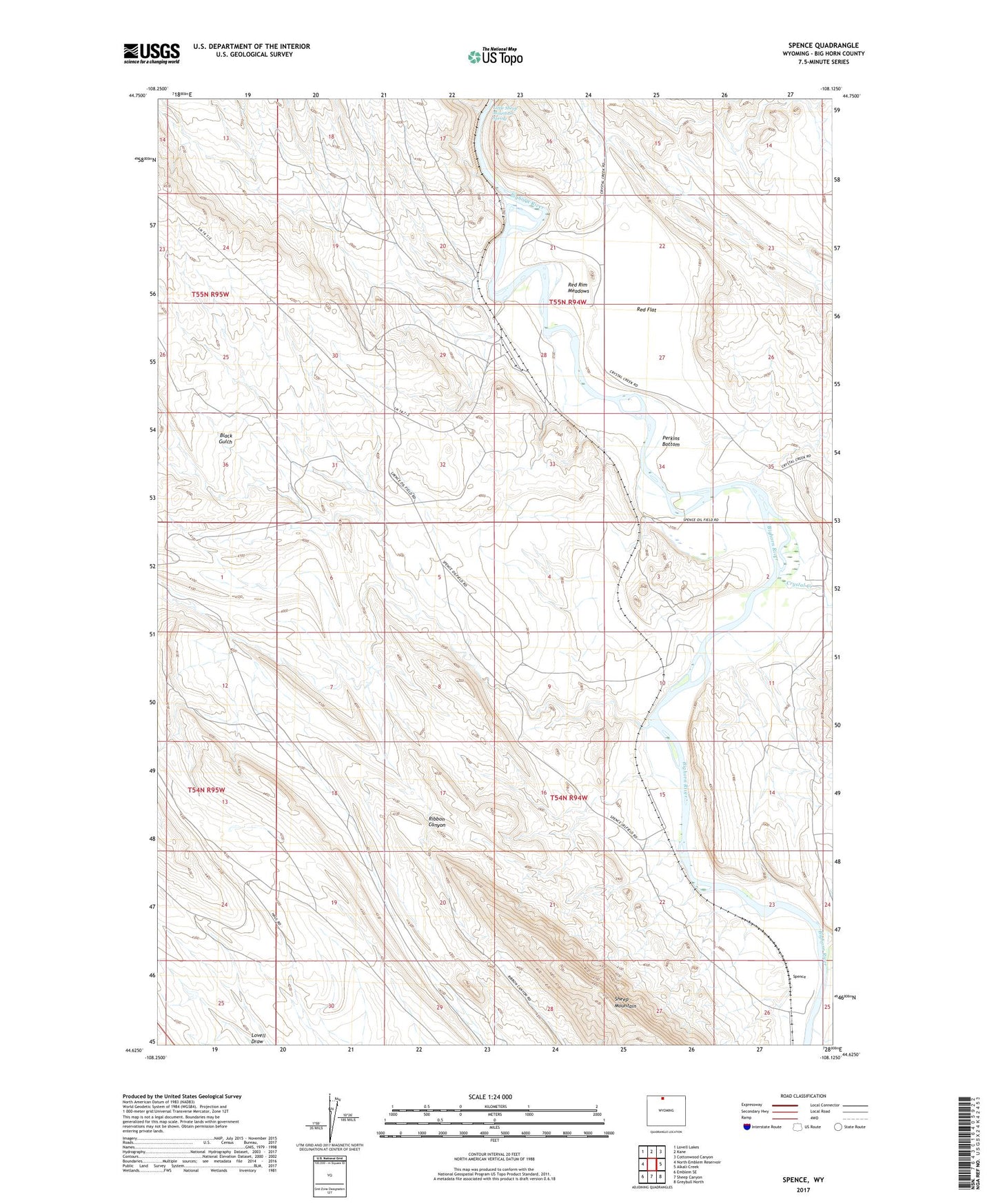
2021 topographic map quadrangle Spence in the state of Wyoming. Scale: 1:24000. Based on the newly updated USGS 7.5' US Topo map series, this map is in the following counties: Big Horn. The map contains contour data, water features, and other items you are used to seeing on USGS maps, but also has updated roads and other features. This is the next generation of topographic maps. Printed on high-quality waterproof paper with UV fade-resistant inks.
Quads adjacent to this one:
West: North Emblem Reservoir
Northwest: Lovell Lakes
North: Kane
Northeast: Cottonwood Canyon
East: Alkali Creek
Southeast: Greybull North
South: Sheep Canyon
Southwest: Emblem SE
Contains the following named places: Al Egbert Mine, Asay-Egbert Prospects Mine, Crystal Creek, Dry Creek Group Number One Mine, Dry Creek Group Number Three Mine, Eberhard Ranch, Himes, Little Sheep Mountain Anticline Number Eight Mine, Little Sheep Mountain Anticline Number Five Mine, Little Sheep Mountain Anticline Number Four Mine, Little Sheep Mountain Anticline Number Nine Mine, Little Sheep Mountain Anticline Number Seven Mine, Little Sheep Mountain Anticline Number Six Mine, Little Sheep Mountain Anticline Number Ten Mine, Little Sheep Mountain Anticline Number Three, Little Sheep Mountain Anticline Number Two Mine, Little Sheep Mountain Spring, Lovell Mine, Marvel Mine, North Emblem Mine, Perkins Bottom, Red Flat, Red Rim Meadows, Ribbon Canyon, Spence, Spence Dome Oil Field