MyTopo
Lovell Lakes Wyoming US Topo Map
Couldn't load pickup availability
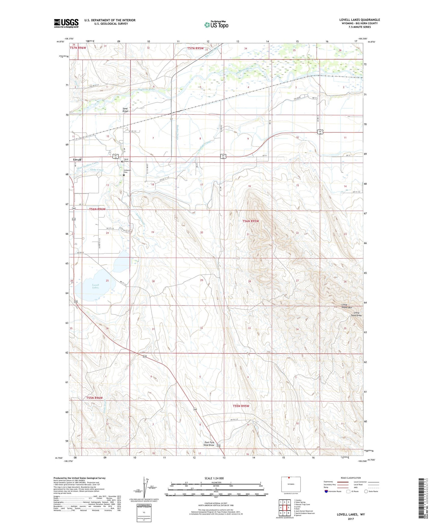
2021 topographic map quadrangle Lovell Lakes in the state of Wyoming. Scale: 1:24000. Based on the newly updated USGS 7.5' US Topo map series, this map is in the following counties: Big Horn. The map contains contour data, water features, and other items you are used to seeing on USGS maps, but also has updated roads and other features. This is the next generation of topographic maps. Printed on high-quality waterproof paper with UV fade-resistant inks.
Quads adjacent to this one:
West: Lovell
Northwest: Cowley
North: Sykes Spring
Northeast: Natural Trap Cave
East: Kane
Southeast: Spence
South: North Emblem Reservoir
Southwest: Jack Horner Reservoir
This map covers the same area as the classic USGS quad with code o44108g3.
Contains the following named places: Assay Pit Number One Mine, Assay Pit Number Three Mine, Dry Creek, East Fork Sand Draw, Government Pit Number One Mine, Hooker Drain, Little Dry Creek, Little Sheep Mine, Little Sheep Mountain, Little Sheep Mountain Anticline Number Eighteen Mine, Little Sheep Mountain Anticline Number Fifteen Mine, Little Sheep Mountain Anticline Number Nineteen Mine, Little Sheep Mountain Anticline Number One Mine, Little Sheep Mountain Anticline Number Twelve Mine, Little Sheep Mountain Mine, Lovell Canal, Lovell Deposit Number Three Mine, Lovell Lakes, Lovell Mine, Lutheran Cemetery, North Big Horn Division, Sand Draw, Sand Draw Cemetery, Sunlight Canal