MyTopo
Wagon Prong Wyoming US Topo Map
Couldn't load pickup availability
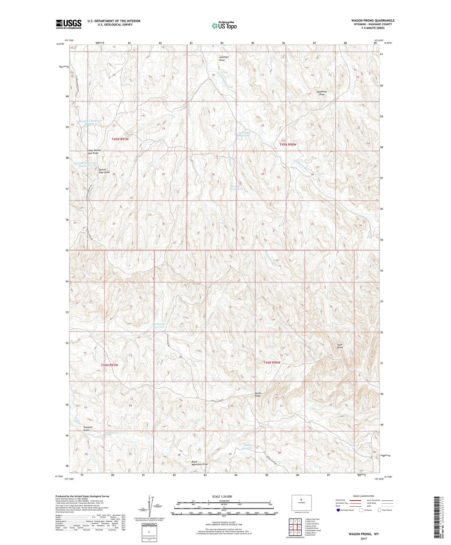
2021 topographic map quadrangle Wagon Prong in the state of Wyoming. Scale: 1:24000. Based on the newly updated USGS 7.5' US Topo map series, this map is in the following counties: Washakie. The map contains contour data, water features, and other items you are used to seeing on USGS maps, but also has updated roads and other features. This is the next generation of topographic maps. Printed on high-quality waterproof paper with UV fade-resistant inks.
Quads adjacent to this one:
West: Henry Draw
Northwest: Banjo Flats East
North: Cabin Fork
Northeast: Castle Gardens
East: Deadline Draw
Southeast: Sand Point
South: Bader Draw
Southwest: Packsaddle Creek
Contains the following named places: Antelope Draw, Black Mountain Draw, Coal Draw, Davis Reservoir Number 2, Devils Slide, Hampton Dam, Hampton Reservoir Number 12, Hampton Reservoir Number 5, Hampton Well Number 2, Hayes Cow Camp, Hayes Reservoir, Little Joe Dam, Little Joe Detention Dam, Little Joe Reservoir, Meleskie Camp, No Water Mine, Nugget Reservoir, Old Quaker Reservoir, Ray Dam, Ray Reservoir, Rays Detention Dam, Scorpion Draw, Shortys Reservoir, The Seeps, Two Wash Dam, Two Wash Detention Dam, Two Wash Reservoir, Wagon Prong, Wagon Prong Reservoir, West Reservoir