MyTopo
Henry Draw Wyoming US Topo Map
Couldn't load pickup availability
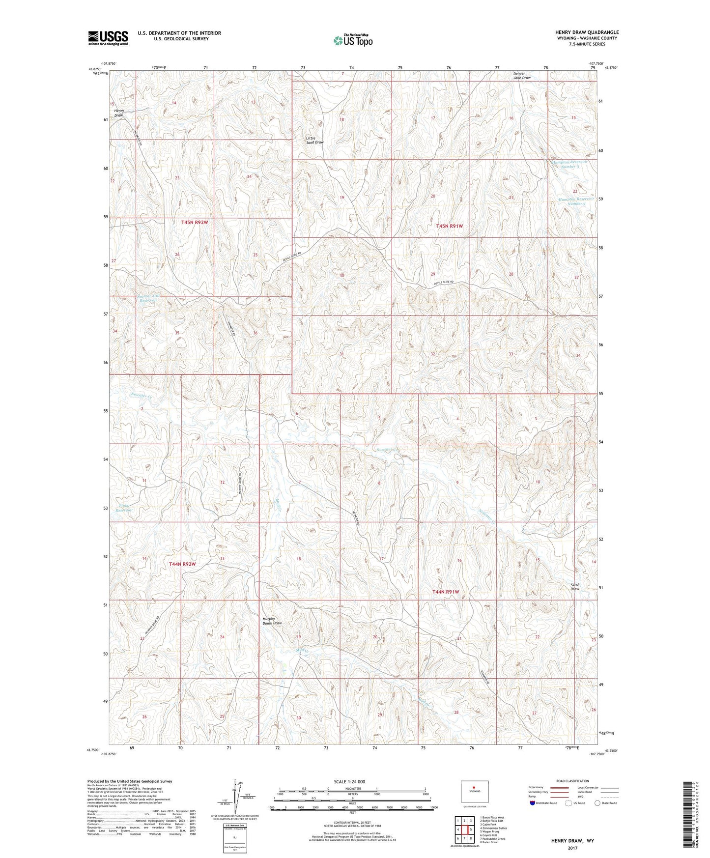
2021 topographic map quadrangle Henry Draw in the state of Wyoming. Scale: 1:24000. Based on the newly updated USGS 7.5' US Topo map series, this map is in the following counties: Washakie. The map contains contour data, water features, and other items you are used to seeing on USGS maps, but also has updated roads and other features. This is the next generation of topographic maps. Printed on high-quality waterproof paper with UV fade-resistant inks.
Quads adjacent to this one:
West: Zimmerman Buttes
Northwest: Banjo Flats West
North: Banjo Flats East
Northeast: Cabin Fork
East: Wagon Prong
Southeast: Bader Draw
South: Packsaddle Creek
Southwest: Coyote Hill
This map covers the same area as the classic USGS quad with code o43107g7.
Contains the following named places: Hampton Reservoir Number 3, Hampton Reservoir Number 4, Hampton Well, Henry Draw, McCarthy Well, Mud Creek, Mud Creek Mine, Murphy Dome Draw, Pinky Reservoir, Sand Draw, Seaman Hill Reservoir