MyTopo
West Thumb Wyoming US Topo Map
Couldn't load pickup availability
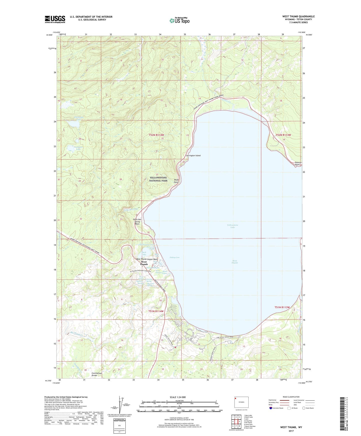
2021 topographic map quadrangle West Thumb in the state of Wyoming. Scale: 1:24000. Based on the newly updated USGS 7.5' US Topo map series, this map is in the following counties: Teton. The map contains contour data, water features, and other items you are used to seeing on USGS maps, but also has updated roads and other features. This is the next generation of topographic maps. Printed on high-quality waterproof paper with UV fade-resistant inks.
Quads adjacent to this one:
West: Craig Pass
Northwest: Mary Lake
North: Beach Lake
Northeast: Lake
East: Dot Island
Southeast: Heart Lake
South: Mount Sheridan
Southwest: Lewis Falls
Contains the following named places: Abyss Pool, Arnica Creek, Beach Geyser, Big Cone Spring, Big Thumb Creek, Black Pool, Bluff Point, Carrington Island, Chickadee Lake, Duck Lake, Ephedra Spring, Fishing Cone, Grant Village, Lakeside Spring, Little Thumb Creek, Nuthatch Lake, Occasional Geyser, Overhanging Geyser, Potts Hot Spring Basin, Pumice Point, Solution Creek, Thumb Paintpots, Twin Geyser, Twin Geysers, West Thumb, West Thumb Geyser Basin, Yellowstone National Park Fire Department Grant Village Station