MyTopo
Lake Wyoming US Topo Map
Couldn't load pickup availability
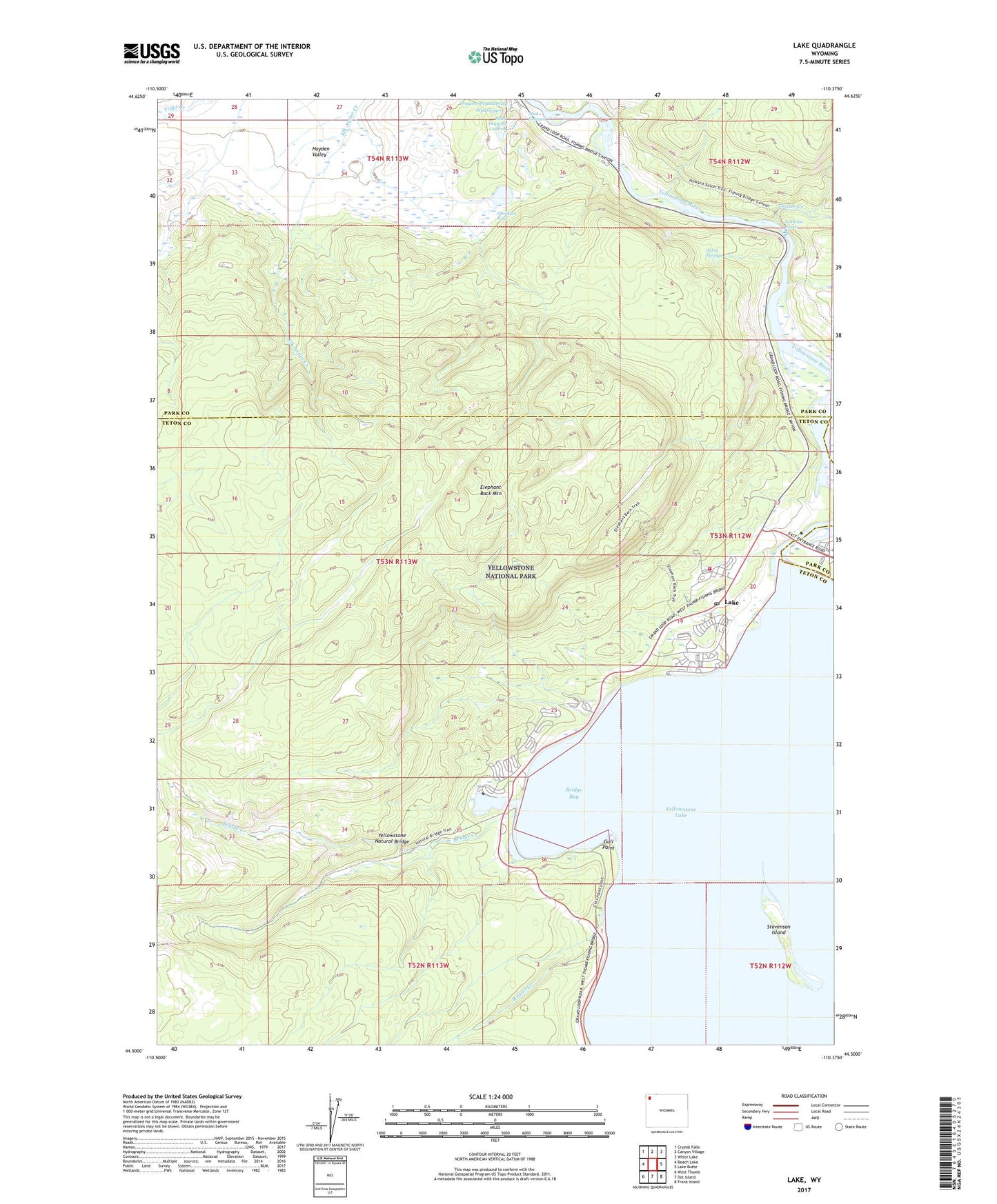
2021 topographic map quadrangle Lake in the state of Wyoming. Scale: 1:24000. Based on the newly updated USGS 7.5' US Topo map series, this map is in the following counties: Teton, Park. The map contains contour data, water features, and other items you are used to seeing on USGS maps, but also has updated roads and other features. This is the next generation of topographic maps. Printed on high-quality waterproof paper with UV fade-resistant inks.
Quads adjacent to this one:
West: Beach Lake
Northwest: Crystal Falls
North: Canyon Village
Northeast: White Lake
East: Lake Butte
Southeast: Frank Island
South: Dot Island
Southwest: West Thumb
This map covers the same area as the classic USGS quad with code o44110e4.
Contains the following named places: Black Dragons Caldron, Bridge Bay, Bridge Creek, Elephant Back Loop Trail, Elephant Back Mountain, Gull Point, Lake, Lake Hotel, Lake Junction, Lake Lodge, Lake Outlet Post Office, Lake Ranger Station, LeHardys Rapids, Mud Geyser, Mud Volcano, Nez Perce Ford, Obsidian Pool, Ochre Springs, Stevenson Island, Thistle Creek, Weasel Creek, Yellowstone National Park Fire Department Lake Station, Yellowstone Natural Bridge