MyTopo
Whitetail Creek NE Wyoming US Topo Map
Couldn't load pickup availability
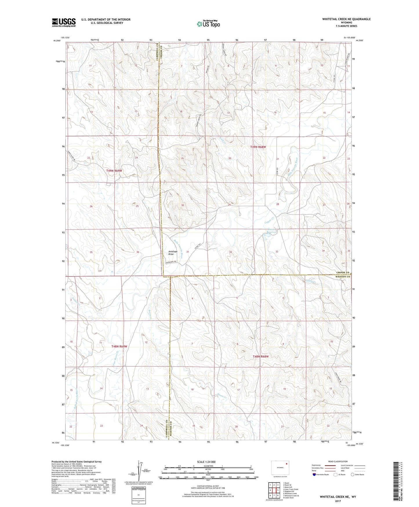
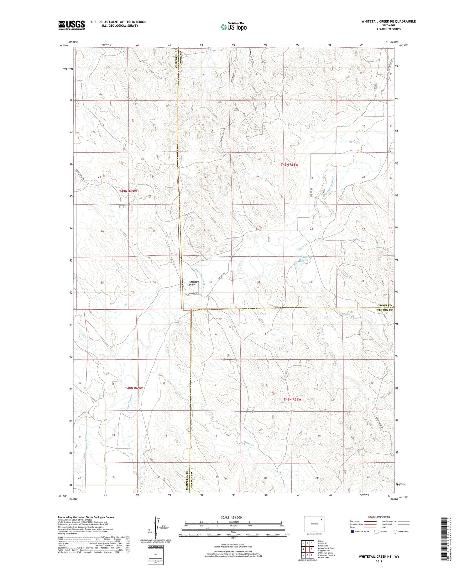
2021 topographic map quadrangle Whitetail Creek NE in the state of Wyoming. Scale: 1:24000. Based on the newly updated USGS 7.5' US Topo map series, this map is in the following counties: Crook, Campbell, Weston. The map contains contour data, water features, and other items you are used to seeing on USGS maps, but also has updated roads and other features. This is the next generation of topographic maps. Printed on high-quality waterproof paper with UV fade-resistant inks.
Quads adjacent to this one:
West: Coon Track Creek
Northwest: Rozet
North: Rozet SE
Northeast: Moorcroft
East: Spyglass Hill
Southeast: Cedar Draw
South: Whitetail Creek SE
Southwest: Whitetail Creek
Contains the following named places: Antelope Draw, Buzzer Dam, Buzzer Reservoir, Coyote Creek, Coyote Creek Oil Field, Donkey Creek Oil Field, Duvall Ranch Oil Field, Four Horse Creek, Koch Creek, Raven Creek, Raven Creek Oil Field, Riveburgh Dam, Rivenburgh Reservoir, Slattery Oil Field, Timber Creek