MyTopo
Windy Point Wyoming US Topo Map
Couldn't load pickup availability
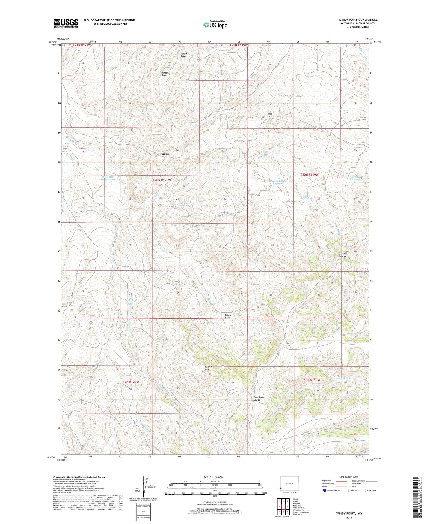
2021 topographic map quadrangle Windy Point in the state of Wyoming. Scale: 1:24000. Based on the newly updated USGS 7.5' US Topo map series, this map is in the following counties: Lincoln. The map contains contour data, water features, and other items you are used to seeing on USGS maps, but also has updated roads and other features. This is the next generation of topographic maps. Printed on high-quality waterproof paper with UV fade-resistant inks.
Quads adjacent to this one:
West: Rex Peak
Northwest: Leefe
North: Sage
Northeast: Nugget
East: Bell Butte NE
Southeast: Bell Butte
South: Sawtooth Mountain
Southwest: Woodruff Narrows
Contains the following named places: Bridger Basin, Bridger Hill, Cercocapia Reservoir, High Top, Lag Reservoir, North Bridger Creek, Pocket Reservoir, Question Mark Reservoir, Sand Knoll, White Rock Pit Reservoir, Windy Point