MyTopo
Leefe Wyoming US Topo Map
Couldn't load pickup availability
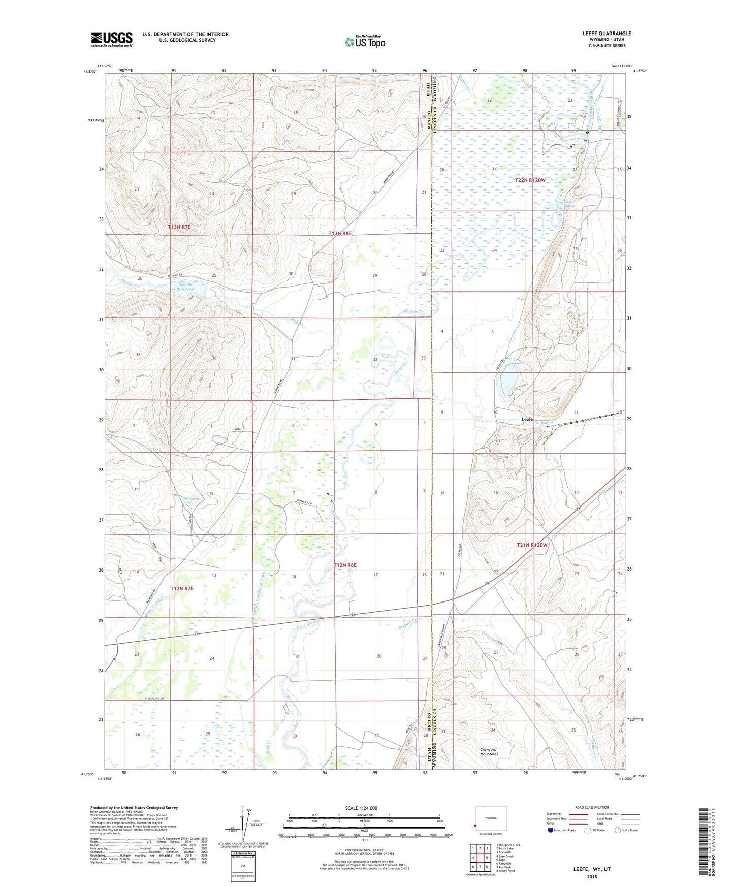
2021 topographic map quadrangle Leefe in the states of Utah, Wyoming. Scale: 1:24000. Based on the newly updated USGS 7.5' US Topo map series, this map is in the following counties: Lincoln, Rich. The map contains contour data, water features, and other items you are used to seeing on USGS maps, but also has updated roads and other features. This is the next generation of topographic maps. Printed on high-quality waterproof paper with UV fade-resistant inks.
Quads adjacent to this one:
West: Sage Creek
Northwest: Sheeppen Creek
North: South Lake
Northeast: Beckwith
East: Sage
Southeast: Windy Point
South: Rex Peak
Southwest: Randolph
This map covers the same area as the classic USGS quad with code o41111g1.
Contains the following named places: Beckwith and Quinn Canal, B-Q Dam, Bridger Creek, Duck Creek, Leefe, McFarland Ditch, McKinnon Spring, North Forty Pit, Otter Creek, Rabbit Creek, Sage Creek, Sage Creek Junction, San Francisco Chemical Company Number Five Mine, San Francisco Chemical Company Number One Mine, San Francisco Chemical Company Number Three Mine, San Francisco Chemical Company Number Two Mine, Sixmile Creek, Sixmile Reservoir, South Fork Sixmile Creek, State Line Pit, Sucker Spring, Twin Creek, West Side Ditch