
MyTopo
Y B O Canyon Wyoming US Topo Map
Couldn't load pickup availability
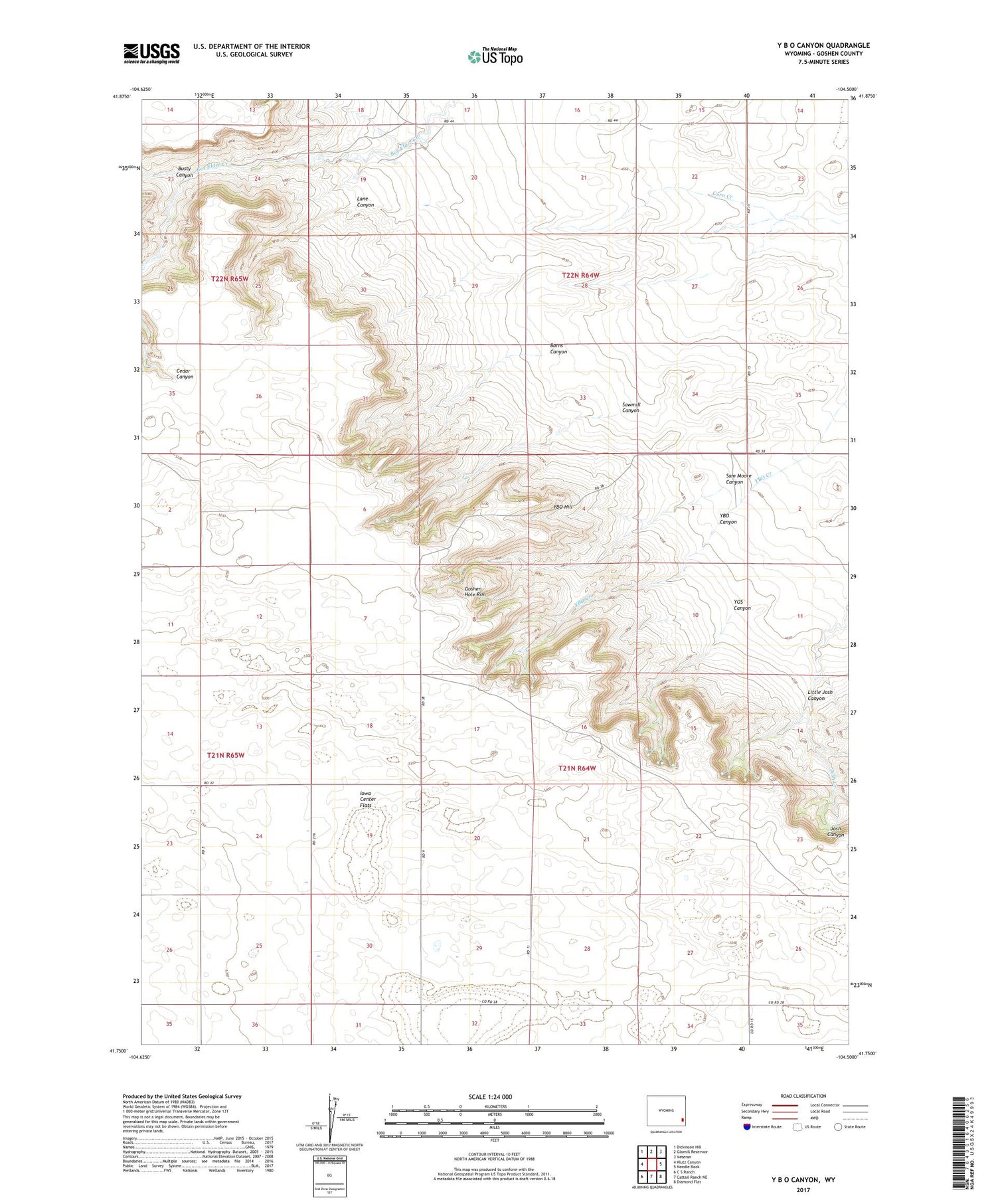
2021 topographic map quadrangle Y B O Canyon in the state of Wyoming. Scale: 1:24000. Based on the newly updated USGS 7.5' US Topo map series, this map is in the following counties: Goshen. The map contains contour data, water features, and other items you are used to seeing on USGS maps, but also has updated roads and other features. This is the next generation of topographic maps. Printed on high-quality waterproof paper with UV fade-resistant inks.
Quads adjacent to this one:
West: Klutz Canyon
Northwest: Dickinson Hill
North: Glomill Reservoir
Northeast: Veteran
East: Needle Rock
Southeast: Diamond Flat
South: Cattail Ranch NE
Southwest: C S Ranch
Contains the following named places: Barns Canyon, Bogville Ranch, Busty Canyon, Canyon View Ranch Airport, Lane Canyon, Little Josh Canyon, Sam Moore Canyon, Sawmill Canyon, Smith Ranch, Werner Ranch, YBO Canyon, YBO Hill, YOS Canyon


