MyTopo
Klutz Canyon Wyoming US Topo Map
Couldn't load pickup availability
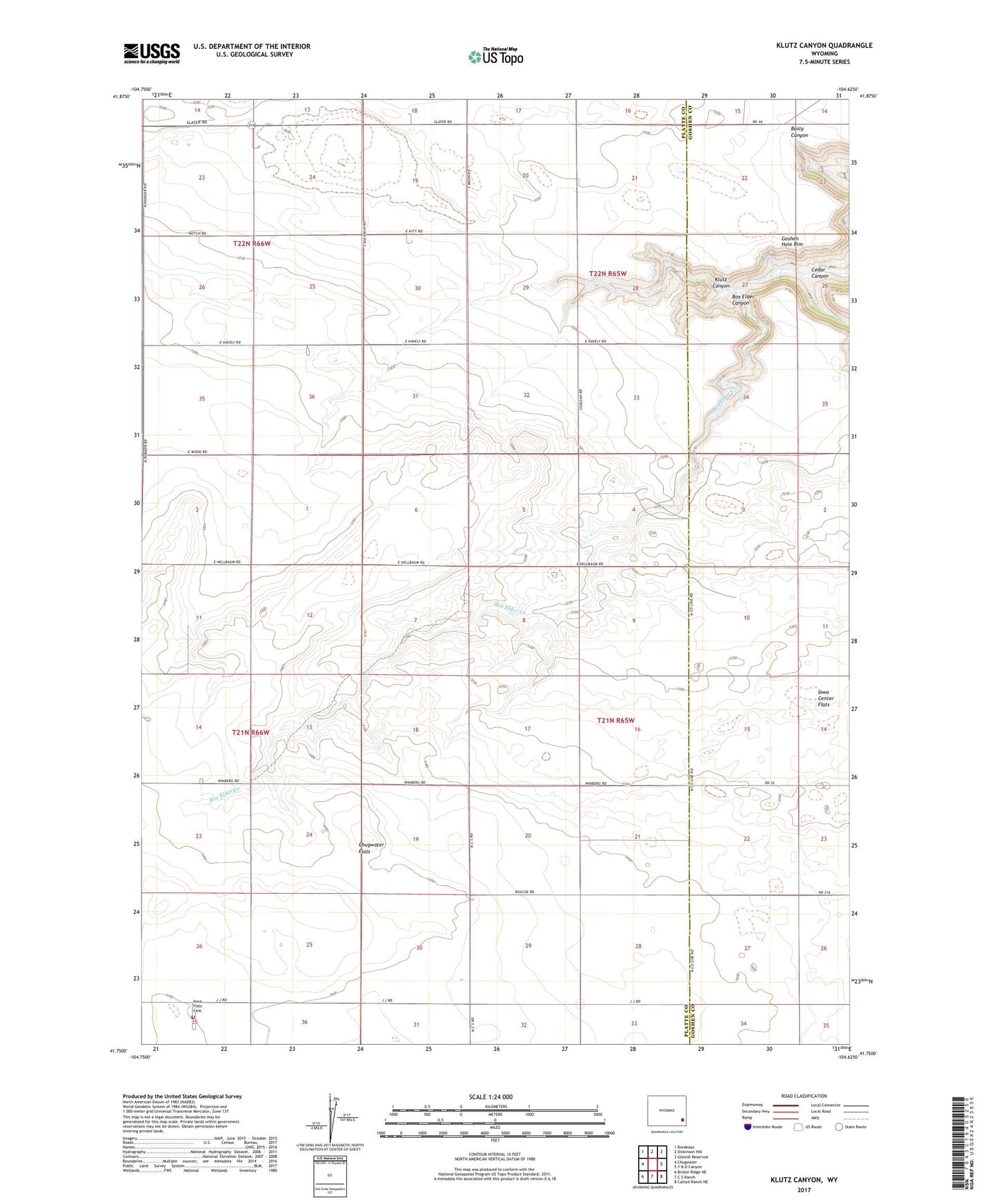
2021 topographic map quadrangle Klutz Canyon in the state of Wyoming. Scale: 1:24000. Based on the newly updated USGS 7.5' US Topo map series, this map is in the following counties: Platte, Goshen. The map contains contour data, water features, and other items you are used to seeing on USGS maps, but also has updated roads and other features. This is the next generation of topographic maps. Printed on high-quality waterproof paper with UV fade-resistant inks.
Quads adjacent to this one:
West: Chugwater
Northwest: Bordeaux
North: Dickinson Hill
Northeast: Glomill Reservoir
East: Y B O Canyon
Southeast: Cattail Ranch NE
South: C S Ranch
Southwest: Bristol Ridge NE
This map covers the same area as the classic USGS quad with code o41104g6.
Contains the following named places: Box Elder Canyon, Cedar Canyon, Chugwater Flats, Iowa Center Flats Church, Iowa Flats Cemetery, Klutz Canyon