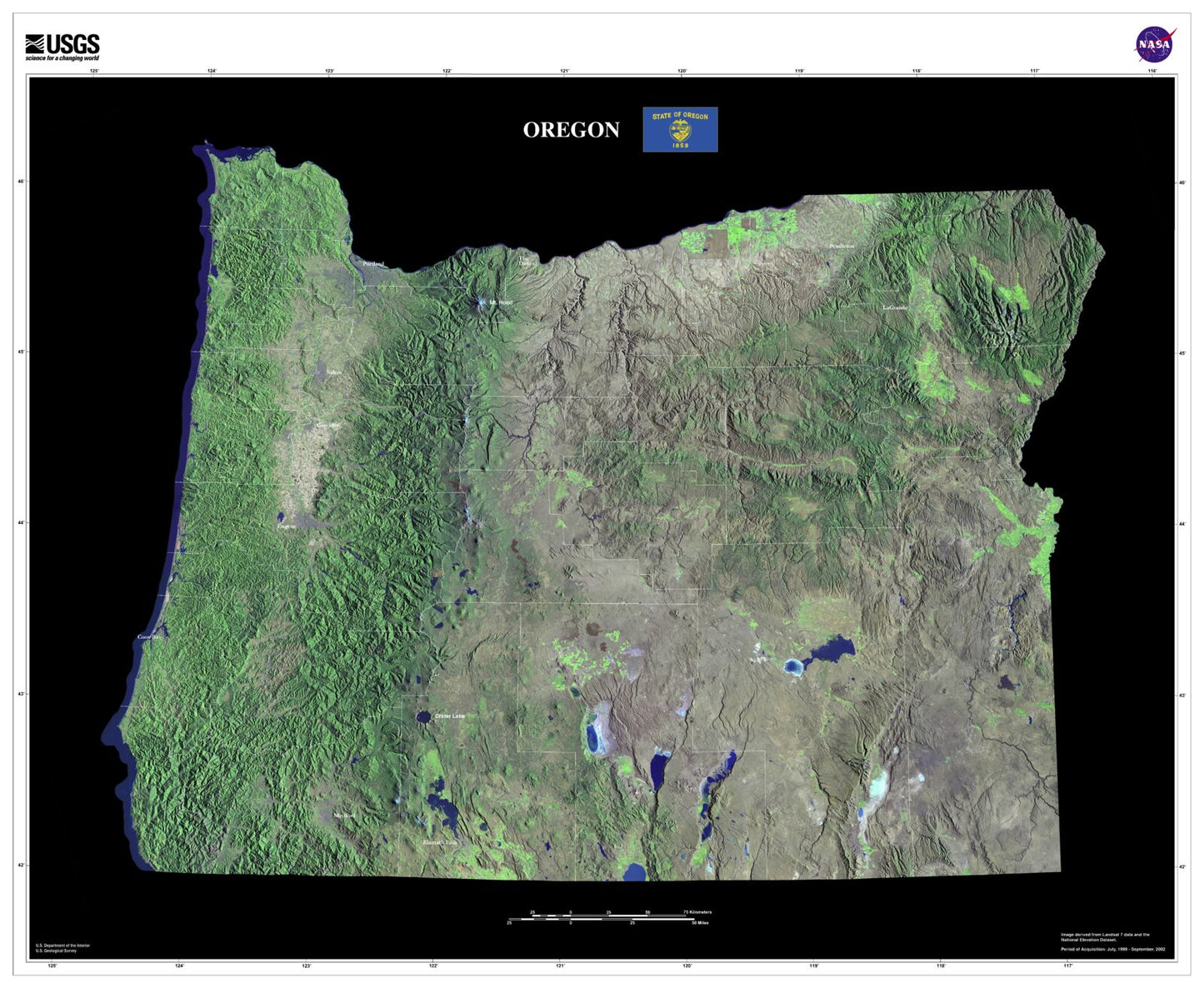
Part of the U.S. Geological Survey (USGS)'s state map series, this stunning print shows a satellite view of the state of Oregon. From arid plains to Cascade volcanoes to the rugged coast, it shows the Beaver State in high detail. Oregon is a state of diverse geography, including High Desert areas, the Willamette Valley, and Columbia River gorge. This map is especially suited for showing it.