MyTopo
Backpacker Topographic map for Map (Great Basin NP, Nevada)
Couldn't load pickup availability
A special Backpacker Magazine topo map printed on waterproof, tearproof paper. Includes topographic map data from the USGS and detailed trip information
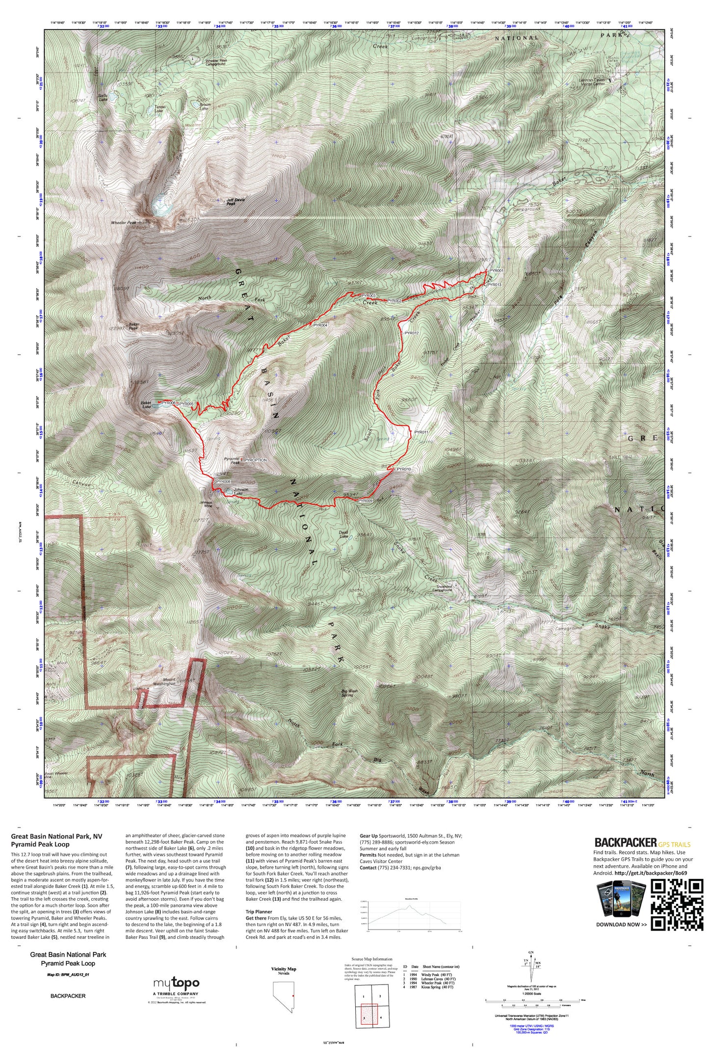
No mirage: Great Basin’s peaks rise more than a mile above the sagebrush plains, offering a summer escape to lakes and meadows with staggering desert views. This 12.7-mile overnight loop hits the best of the park. Map includes turn-by-turn hiking directions and in-depth trip planning essentials to help you experience this BACKPACKER PRO adventure.
Contains the following named locations: Baker Creek Forest Service Recreation Site,Baker Lake,Baker Peak,Baker Shoshone Trail,Bald Mountain,Big Wash Spring,Blue Ridge,Bristlecone Pine Interpretive Trail,Brown Lake,Dead Lake,Doso Doyabi,Granite Basin,Great Basin National Park,Great Basin National Park Visitor Center,Johnson Lake,Johnson Mine,Lehman Caves National Monument,Lehman Creek Campground and Trailhead,Lehmans,Lower Lehman Creek Campground,Mount Washington,Mount Wheeler Mine,North Fork Baker Creek,Pole Canyon,Pole Creek,Pyramid Peak,Saint Lawrence Mine,Shoshone Campground,Snake Creek Forest Service Recreation Site,Snake Mining District,Solace Loop,South Fork Baker Creek,Stella Lake,Teresa Lake,Timber Creek,Treasure Lake,Upper Lehman Creek Campground,Wheeler Peak,Wheeler Peak Campground,Wheeler Peak Scenic Area