MyTopo
Citico Creek Loop Map (Cherokee and Nantahala NF, Tennessee)
Couldn't load pickup availability
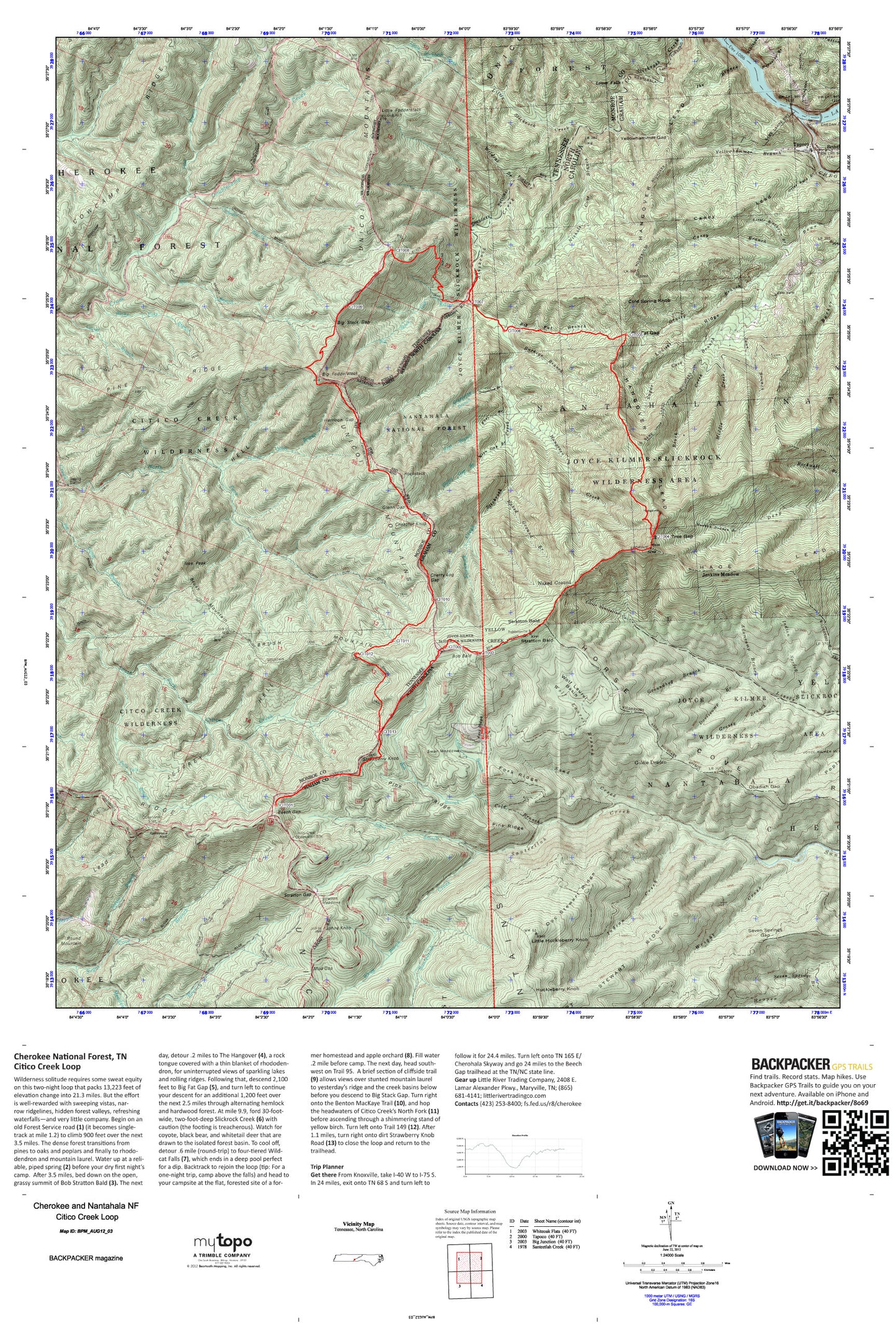
A special Backpacker Magazine topo map printed on waterproof, tearproof paper. Includes topographic map data from the USGS and detailed trip information
Wilderness solitude requires some sweat equity on this two-night loop that packs 13,223 feet of elevation change into 21.3 miles. But the effort is well-rewarded with sweeping vistas, narrow ridgelines, hidden forest valleys, refreshing waterfalls—and very little company. Map includes turn-by-turn hiking directions and in-depth trip planning essentials to help you experience this BACKPACKER PRO adventure.
Contains the following named locations: Adamcamp Branch,Art Stewart Ridge,Beach Creek,Bear Creek Hunter Camp,Beech Gap,Bethel Church,Big Fat Branch,Big Fat Gap,Big Fodderstack,Big Indian Branch Trail,Big Stack Gap,Big Stack Gap Branch,Big Stack Gap Branch Trail,Big Stock Gap Branch,Bob Bald,Bob Branch,Brush Mountain,Brush Mountain Trail,Buckeye Branch,Caney Branch,Caney Lead,Chedah Dam,Cheoah Dam,Cheoah Lake,Cheoah River,Cherry Log Gap,Chestnut Knob,Citico Creek Wilderness,Cold Branch,Cold Spring Knob,Cold Spring Lookout Tower,Cowcamp Ridge,Crowder Branch,Crowder Branch Trail,Daviscamp Branch,Doc Stewart Ridge,Dogfall Branch,Fall Branch Scenic Area,Falls Branch,Falls Branch Trail,Farr Gap,Flint Branch,Fodderstack Trail,Fork Ridge,Glen Gap Branch,Glenn Gap,Goldie Deaden,Grapevine Branch,Grassy Branch,Groundhog Branch,Hangover Creek,Hangover Lead,Haoe Lead,Harrison Gap,Horse Cove Ridge,Huckleberry Knob,Hudson Deaden Branch,Ike Branch,Ikes Peak,Indian Branch,Indian Creek,Indian Spring Branch,Indian Valley Branch,Jane Branch,Jeffrey Hell,Jeffrey Trail,Jenkins Meadow,Johns Branch,Johns Knob,Joyce Kilmer Memorial,Joyce Kilmer-Slickrock Wilderness,Laurel Branch,Little Blackgum Branch,Little Fodderstack,Little Huckleberry Knob,Little Slickrock Creek,Locust Ridge,Lowdown Branch,Lower Falls,Magazine Branch,McIntyre Lead,Meadow Branch,Middle Creek,Mill Branch,Mill Branch Trail,Mud Gap,Naked Ground,Naked Ground Branch,Nichols Cove Branch,North Fork Citico Creek,North Fork Citico Trail,Obadiah Gap,Orr Cemetery,Otter Rack Branch,Pine Ridge,Pine Ridge Trail,Rattlesnake Rock,Roaring Branch,Rockstack,Rockwall Branch,Rocky Flats Branch,Rocky Flats Trail,Round Mountain,Rowe Lake,Rowe Lake Dam,Rust Branch,Saddle Tree Gap,Salt Spring Mountain,Sand Creek,Santeetlah Creek,Sassafras Ridge,Seven Springs Branch,Seven Springs Gap,Slickrock Creek,South Fork Citico Creek,South Fork Citico Trail,State Line Branch,Stewart Cabin,Stiffknee Top,Stiffknee Trail,Stillhouse Branch,Stratton Bald,Stratton Gap,Stratton Meadows,Strawberry Knob,Sugar Cove Branch,Sugar Cove Trail,Swan Meadows,Tapoco,Whigg Branch,Wildcat Branch,Wolf Laurel Basin,Wolf Laurel Branch,Wright Creek,Yellowhammer Branch,Yellowhammer Gap


