MyTopo
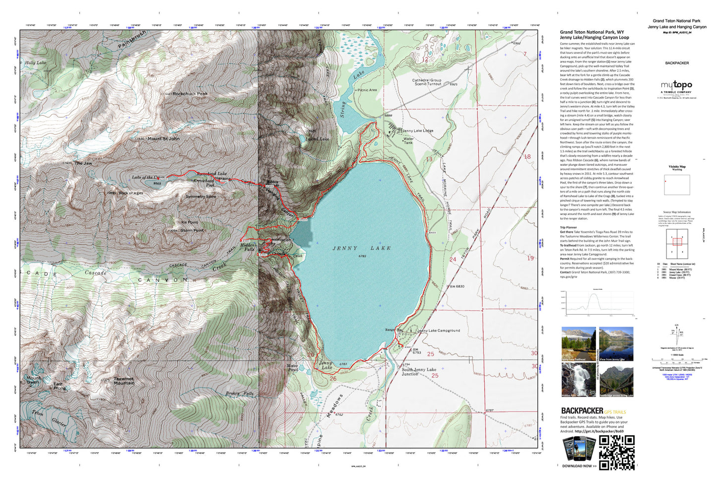
Jenny Lake and Hanging Canyon Loop Map (Grand Teton NP, Wyoming)
Couldn't load pickup availability
A special Backpacker Magazine topo map printed on waterproof, tearproof paper. Includes topographic map data from the USGS and detailed trip information
Circle a glacial lake, see a waterfall, and explore a forgotten trail on this 12.4-mile loop in Grand Teton National Park. Come summer, the established trails near Jenny Lake can be hiker magnets. Your solution: This circuit tours several of the park’s must-see sights before ducking onto an unofficial trail that doesn’t appear on area maps. Map includes turn-by-turn hiking directions and in-depth trip planning essentials to help you experience this BACKPACKER PRO adventure.
Contains the following named locations: 83012,Amphitheater Lake,Arrowhead Pool,Boulder Island,Broken Falls,Cascade Canyon,Cascade Canyon Trail,Cascade Creek,Cathedral Group Scenic Turnout,Delta Lake,Disappointment Peak,East Prong,Grand Teton,Hanging Canyon,Hidden Falls,Hidden Falls Horse Trail,Holly Lake,Ice Point,Inspiration Point,Jenny Lake,Jenny Lake Campground,Jenny Lake Lodge,Jenny Lake Moraine Horse Trail,Jenny Lake Post Office,Jenny Lake Trail,Lake of the Crags,Laurel Lake,Lupine Meadows,Moose Pond,Mount Owen,Mount Saint John,Mount Woodring,Paintbrush Canyon Trail,Ramshead Lake,Ramshield Lake,Ribbon Cascade,Rock of Ages,Rockchuck Peak,South Jenny Lake Junction,Storm Point,String Lake,String Lake Trail,Symmetry Spire,Teepe Glacier,Teepe Pillar,Teewinot Mountain,Teton Glacier,The Jaw,Valhalla Canyon