MyTopo
Mount Shasta Map (Shasta NP, California)
Couldn't load pickup availability
A special Backpacker Magazine topo map printed on waterproof, tearproof paper. Includes topographic map data from the USGS and detailed trip information
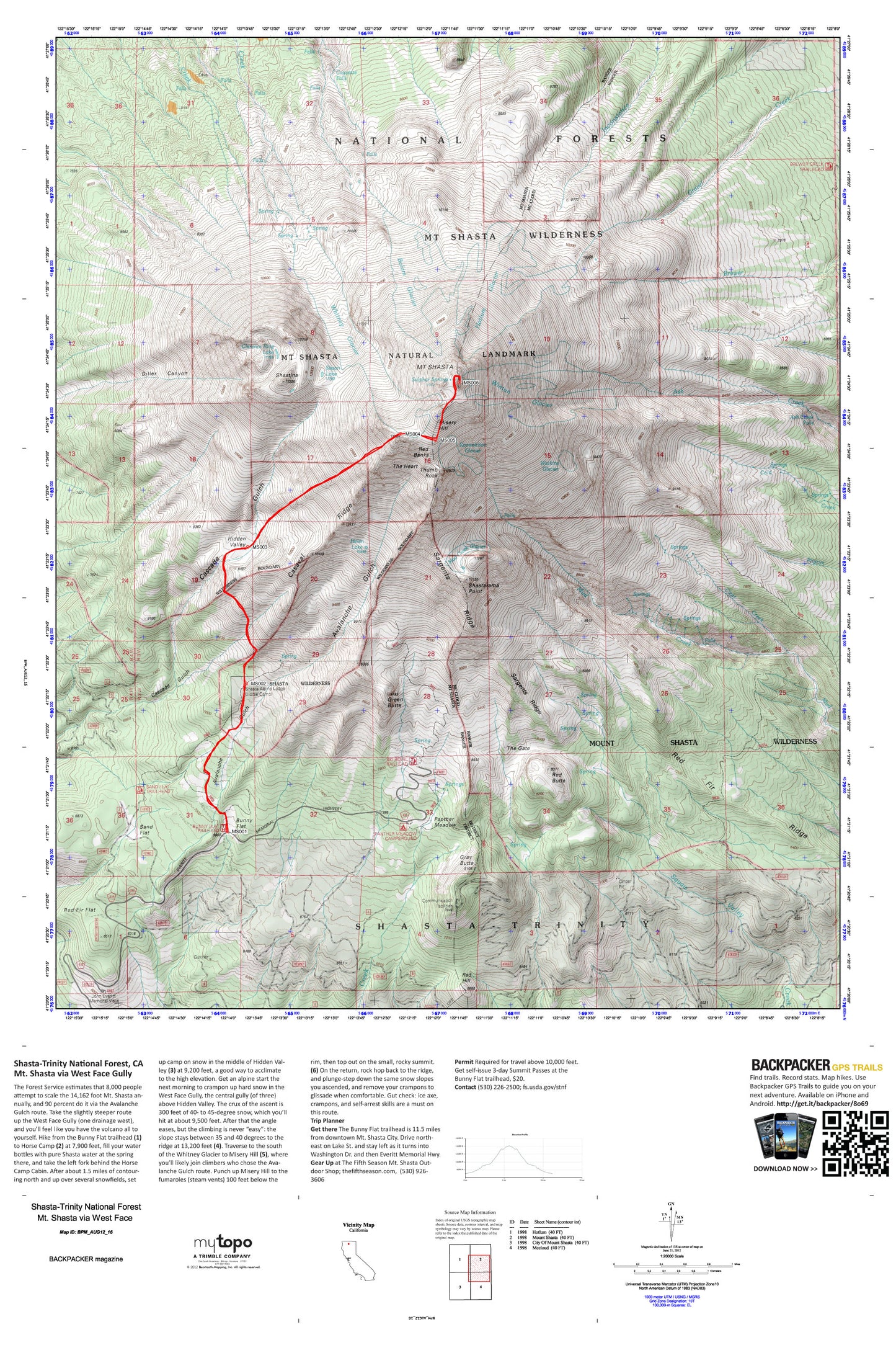
The Forest Service estimates that 8,000 people attempt to scale the 14,162 foot Mt. Shasta annually, and 90 percent do it via the Avalanche Gulch route. Take the slightly steeper route up the West Face Gully (one drainage west), and you’ll feel like you have the volcano all to yourself. Map includes turn-by-turn hiking directions and in-depth trip planning essentials to help you experience this BACKPACKER PRO adventure.
Contains the following named locations: Ash Creek Falls,Avalanche Gulch,Bolam Glacier,Bunny Flat,Casaval Ridge,Clarence King Lake,Clear Creek,Coquette Falls,Gray Butte,Green Butte,Helen Lake,Hidden Valley,Hotlum Glacier,Konwakiton Glacier,KWHO-FM (Weed),McGinnis Springs,Misery Hill,Mount Shasta,Mount Shasta Natural Landmark,Mount Shasta Wilderness,Mud Creek Glacier,Panther Meadow,Panther Meadows Campground,Red Banks,Red Butte,Red Fir Ridge,Red Hill,Sand Flat,Sargents Ridge,Shasta Alpine Lodge,Shastarama Point,Shastina,Sisson Lake,Sulphur Springs,The Gate,The Heart,Thumb Rock,Watkins Glacier,Whitney Glacier,Wintun Glacier