MyTopo
Mount Washington Map (White Mountain NF, New Hampshire)
Couldn't load pickup availability
A special Backpacker Magazine topo map printed on waterproof, tearproof paper. Includes topographic map data from the USGS and detailed trip information
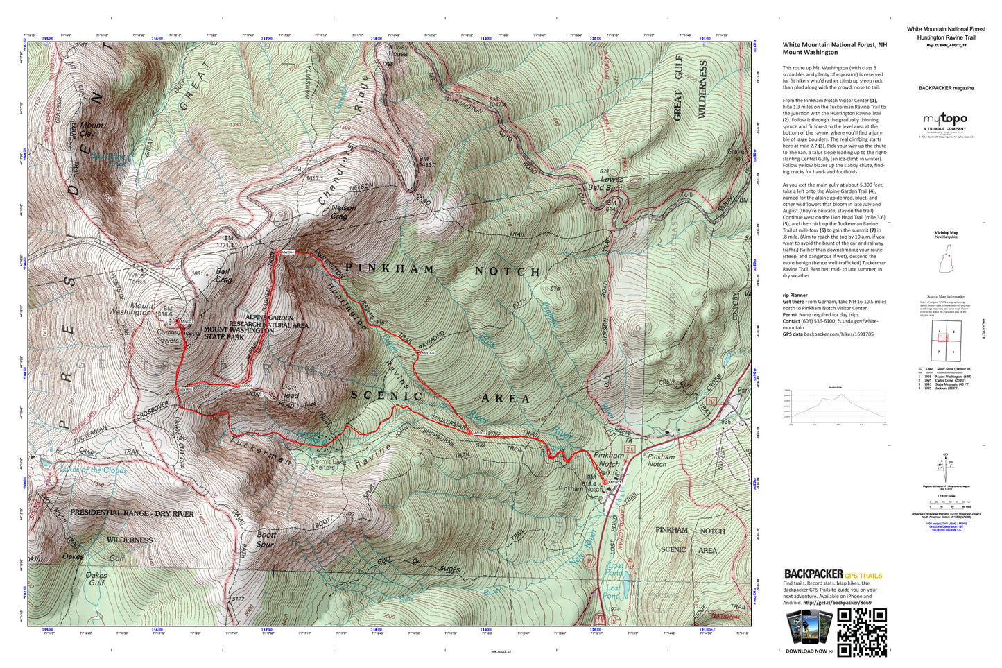
This route up Mt. Washington (with class 3 scrambles and plenty of exposure) is reserved for fit hikers who’d rather climb up steep rock than plod along with the crowd, nose to tail. Map includes turn-by-turn hiking directions and in-depth trip planning essentials to help you experience this BACKPACKER PRO adventure.
Contains the following named locations: Agiocochook Crag,Alpine Garden Trail,Alpine Gardens,Ball Crag,Bigelow Lawn,Boott Spur,Boott Spur Trail,Chandler Ridge,Crew Cut Trail,Cutler River,Davis Path,Emerald Pool,Glen Boulder Trail,Glen Ellis Falls,Glen Ellis Falls Picnic Area,Glen Ellis Falls Scenic Area,Great Gulf Shelter,Gulf of Slides,Hermit Lake,Huntington Ravine,Lakes of the Clouds,Lion Head,Lost Pond,Lows Bald Spot,Mount Clay,Mount Franklin,Mount Monroe,Mount Washington,Nelson Crag,Nelson Crag Trail,New River,Oakes Gulf,Oakes Gulf Trail,Old Jackson Road,Pinkham Notch,Pinkham Notch Camp,Pinkham Notch Scenic Area,Pinkham Notch Visitor Center,Pinkhams Grant,Raymond Path,Spaulding Lake,Sphinx Trail,Summit House,Thompson Brook,Tip-Top House,Tuckerman Ravine,Vals Ledge,Wamsutta Trail,Washburn Point,Westside Trail,White Mountains,WHOM-FM (Mount Washington),Wildcat Mountain Ski Area,WZPK-FM (Berlin)