MyTopo
Mount Katahdin Map (Baxter State Park, Maine)
Couldn't load pickup availability
A special Backpacker Magazine topo map printed on waterproof, tearproof paper. Includes topographic map data from the USGS and detailed trip information
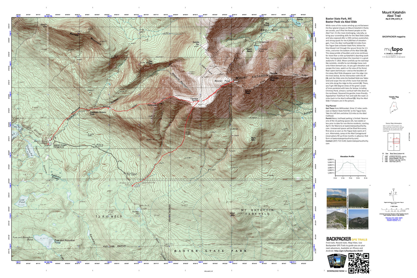
While none of the routes winding up and between the four glacial cirques on Mount Katahdin’s flanks are secrets, you’ll find the fewest people on the Abol Trail. It’s the most challenging, naturally, so bring your scrambling skills for the Abol Slide (slabs and talus exposed after a 19th century avalanche), and strong quads for the 4,000 feet of elevation gain. Map includes turn-by-turn hiking directions and in-depth trip planning essentials to help you experience this BACKPACKER PRO adventure.
Contains the following named locations: Abol Mountain,Abol Trail,Abot Trail,Barren Mountain,Baxter Peak,Caribou Spring,Cathedral Trail,Chimney Peak,Chimney Pond,Chimney Pond Campground,Depot Pond,Dry Pond,Dudley Trail,Elbow Pond,Foss and Knowlton Pond,Grassy Pond,Great Basin,Hamlin Peak,Hamlin Ridge,Hunts Peak,Katahdin Falls,Katahdin Stream Campground,Katahdin Stream Falls,Keep Ridge,Klondike Pond,Knife Edge,Lost Pond,Mount Katahdin,Mount Katahdin Township,Mount O-J-I,North Basin,Pamola,Pamola Pond,Rum Mountain,Saddle Spring,Saddle Trail,South Basin,South Peak,T3 R10 WELS,Table Land,The Owl,Thoreau Spring,Tracy Pond,Witherle Ravine,York Valley