MyTopo
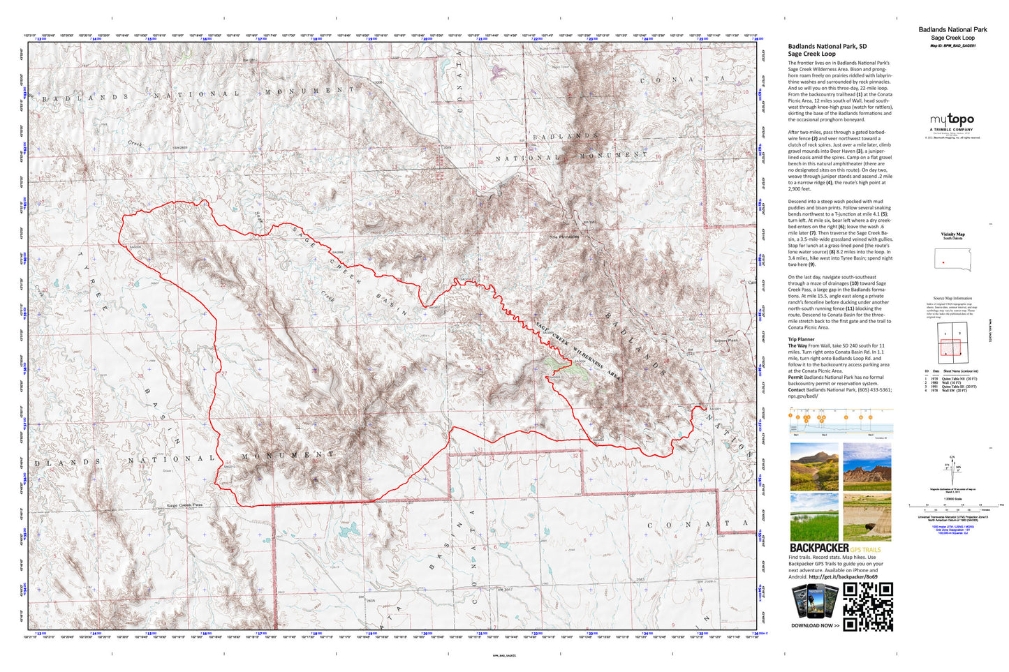
Sage Creek Loop Map (Badlands National Park, South Dakota)
Couldn't load pickup availability
A special Backpacker Magazine topo map printed on waterproof, tearproof paper. Includes topographic map data from the USGS and detailed trip information
The Old West lives on in Badlands National Park's remote Sage Creek Wilderness Area. Home to herds of roaming bison and pronghorn—and surrounded by pinnacled rock formations, endless prairie, and labyrinthine washes—the trailless expanse in the park's North Unit is the setting for this 3-day, 22-mile loop. Map includes turn-by-turn hiking directions and in-depth trip planning essentials to help you experience this BACKPACKER PRO adventure.
Contains the following named locations: Badlands Wilderness,Conata Picnic Ground,Dillon Campground,Dillon Pass,Pinnacles Ranger Station,Sage Creek Basin,Sage Creek Pass,Sage Creek Wilderness Area,The Pinnacles,Township of Conata,Tyree Basin,Unorganized Territory of Badlands