
MyTopo
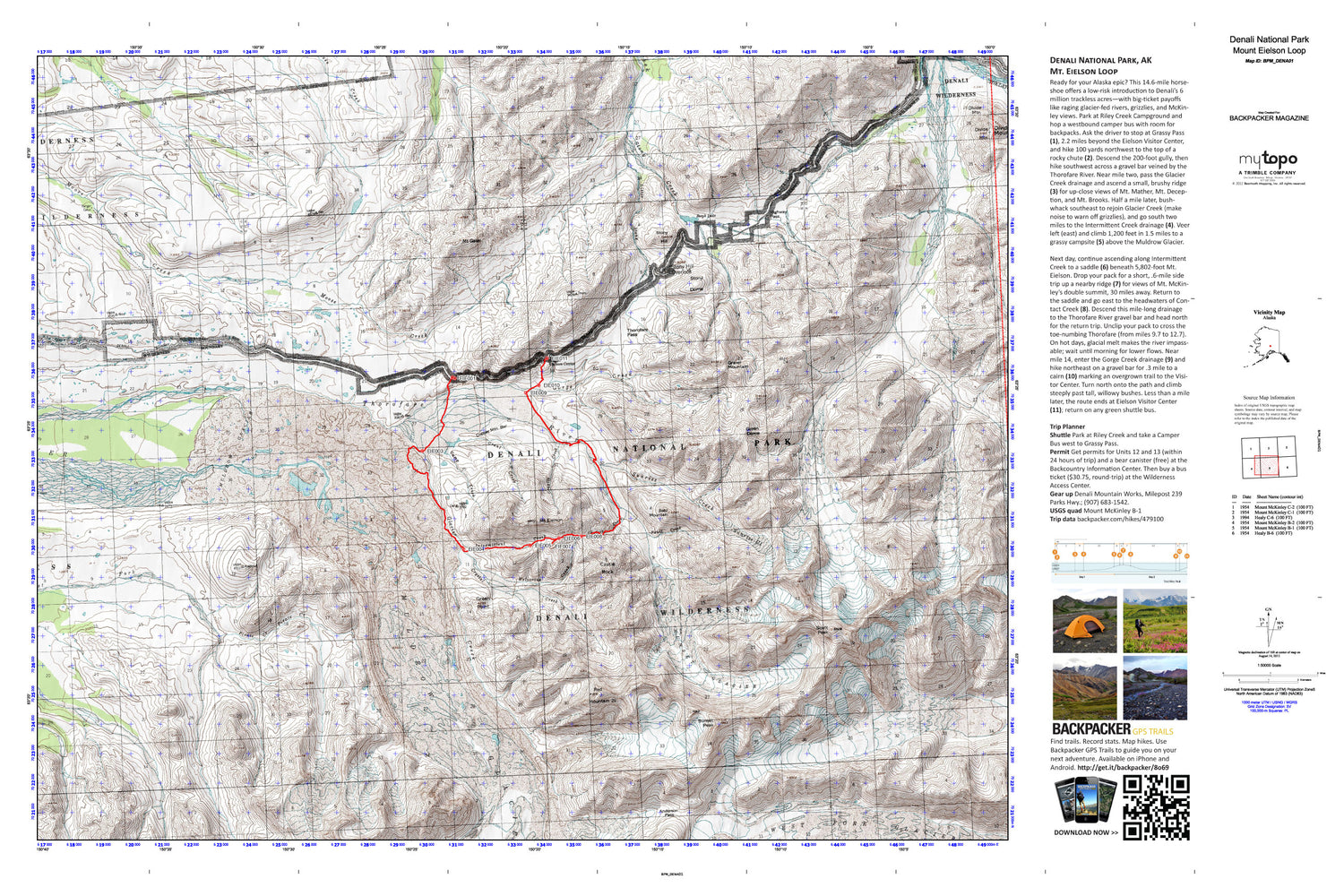
Mount Eilson Loop Map (Denali NP, Alaska)
Couldn't load pickup availability
A special Backpacker Magazine topo map printed on waterproof, tearproof paper. Includes topographic map data from the USGS and detailed trip information
Ready for your Alaska epic? This 14.6-mile horseshoe offers a low-risk introduction to Denali’s 6 million trackless acres—with big-ticket payoffs like raging glacier-fed rivers, grizzlies, and McKinley views. Map includes turn-by-turn hiking directions and in-depth trip planning essentials to help you experience this BACKPACKER PRO adventure.
Contains the following named locations: Bald Mountain,Bergh Lake,Camp Creek,Castle Rock,Contact Creek,Copper Mountain Bar,Crystal Creek,Denali Wilderness,Eielson Visitor Center,Fault Creek,Glacier Creek,Gorge Creek,Granite Creek,Grant Creek,Gravel Mountain,Green Dome,Green Point,Highway Pass,Intermittent Creek,Little Stony Creek,Mount Eielson,Mount Galen,Pirate Creek,Red Mountain,Scott Peak,Stony Dome,Stony Hill,Stony Hill Overlook,Sunrise Creek,Sunrise Glacier,Sunset Glacier,The Notch,Thorofare Pass,Thorofare River Patrol Cabin,Whistler Creek,Wolverine Creek


