MyTopo
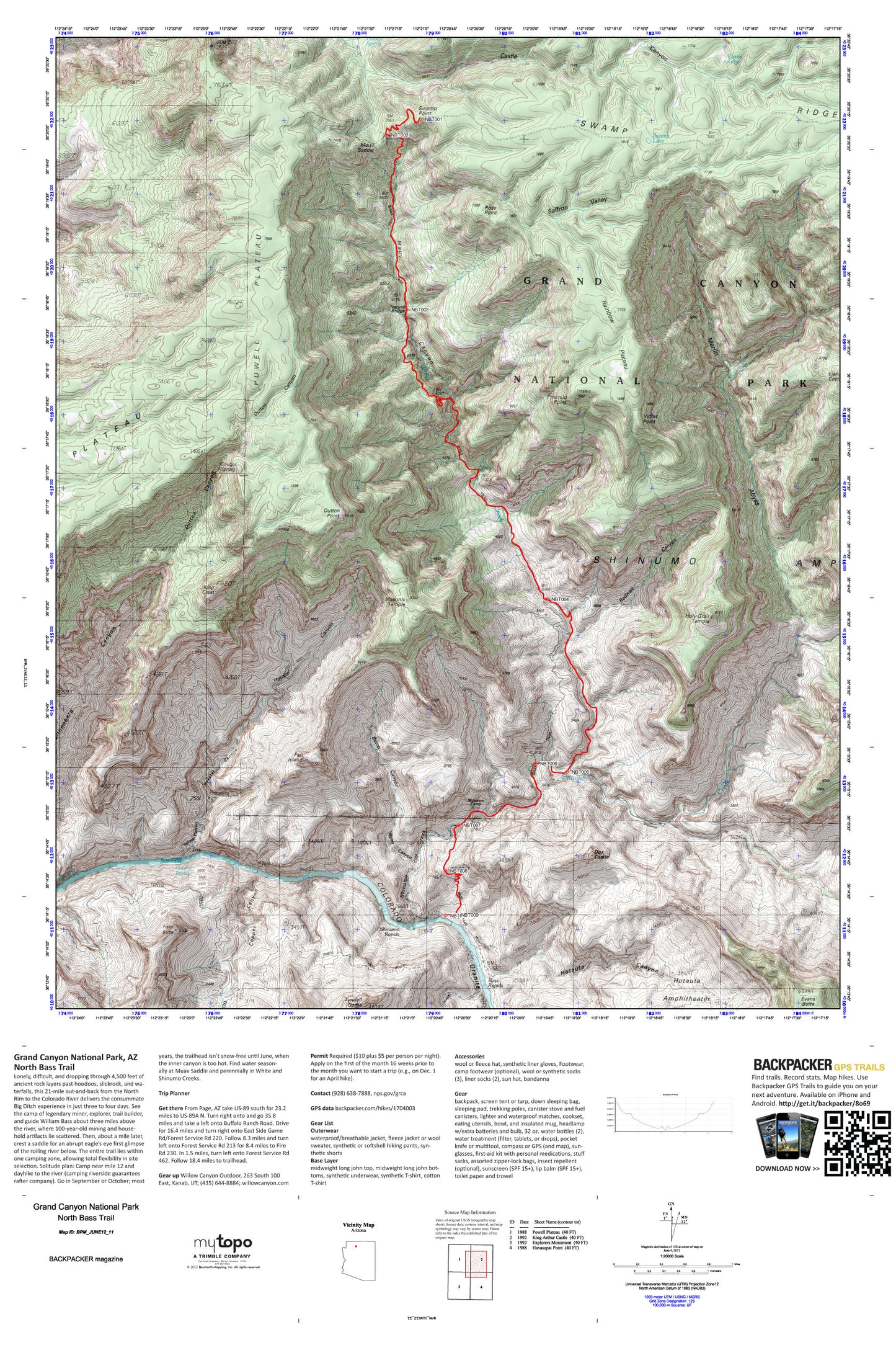
North Bass Trail Map (Grand Canyon NP, Arizona)
Couldn't load pickup availability
A special Backpacker Magazine topo map printed on waterproof, tearproof paper. Includes topographic map data from the USGS and detailed trip information
Lonely, difficult, and dropping through 4,500 feet of ancient rock layers past hoodoos, slickrock, and waterfalls, this 21-mile out-and-back from the North Rim to the Colorado River delivers the consummate Big Ditch experience in just three to four days. Map includes turn-by-turn hiking directions and in-depth trip planning essentials to help you experience this BACKPACKER PRO adventure.
Contains the following named locations: Bass Canyon,Bass Rapids,Bass Trail,Beaman Point,Burro Canyon,Castle Canyon,Castle Lake,Copper Canyon,Cougar Spring,Dox Castle,Dutton Canyon,Dutton Point,Elaine Castle,Emerald Point,Evans Butte,Fan Island,Fiske Butte,Flint Creek,Grass Canyon,Hakatai Canyon,Hakatai Rapids,Holy Grail Temple,Hotauta Amphitheater,Hotauta Canyon,King Crest,Masonic Temple,Merlin Abyss,Modred Abyss,Muav Canyon,Muav Saddle,Natural Bridge,Powell Plateau,Powell Spring,Rainbow Plateau,Redwall Canyon,Rose Point,Saffron Valley,Sagittarius Ridge,Shinumo Camp,Shinumo Creek,Shinumo Rapids,Swamp Lake,Swamp Point,Tyndall Dome,Violet Point,Wallace Butte,Walthenberg Canyon,Walthenberg Rapids,White Creek