MyTopo
Ecola State Park to Arch Cape Map (Oregon Coast Trail, Oregon)
Couldn't load pickup availability
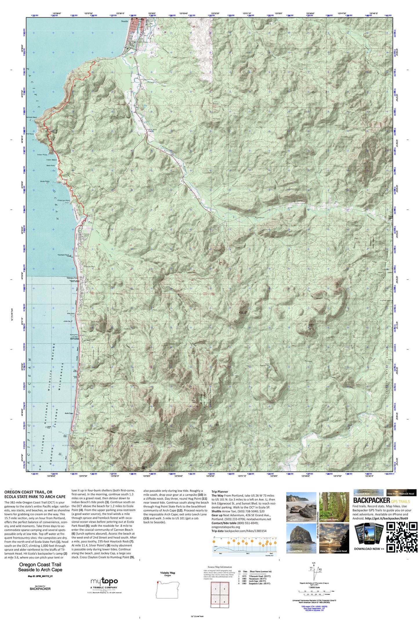
A special Backpacker Magazine topo map printed on waterproof, tearproof paper. Includes topographic map data from the USGS and detailed trip information
The 382-mile Oregon Coast Trail (OCT) is your gateway to the state’s entire Pacific edge: rainforests, sea stacks, and beaches, as well as shoreline towns for grabbing ice cream on the way. This 15.7-mile section, only an hour from Portland, offers the perfect balance of convenience, scenery, and wild moments. Take three days to accommodate sparse camping and several spots passable only at low tide. Map includes turn-by-turn hiking directions and in-depth trip planning essentials to help you experience this BACKPACKER PRO adventure.
Contains the following named locations: 97102,97110,97145,Adair Point,Alder Creek,Angora Peak,Arcadia Beach,Arcadia Beach State Park,Arch Cape,Arch Cape Creek,Arch Cape Post Office,Arch Cape Tunnel 2247,Arch Cape Water and Sanitary District,Asbury Creek,Austin Creek,Austin Point,Bailey Point,Bald Mountain,Bald Point,Barbra Post Office,Beerman Creek,Ben Holladay Post Office,Bird Rocks,Black Butte,Brandis Creek,Buchanan Creek,C Z Picnic Ground,Cannon Beach,Cannon Beach City Hall,Cannon Beach Elementary,Cannon Beach History Center and Museum,Cannon Beach Junction,Cannon Beach Library,Cannon Beach Municipal Court,Cannon Beach Police Department,Cannon Beach Post Office,Cannon Beach Public Works,Cannon Beach Rural Fire Protection District,Cannon Beach Rural Fire Protection District Arch Cape Station,Cannon Beach Sewage Treatment Plant,Cannon Beach Trail,Cannon Beach Water Treatment Plant,Canyon Creek,Cartwright Park Boat Ramp,Castle Rock,Cedar Creek,Chapman Beach,Chapman Point,Chapman Ponds,Charlie Creek,Chisana Creek,Church of Jesus Christ of Latter Day Saints,Circle Creek,City of Cannon Beach,Clark's Mountain,Clatsop Fire Tower,Clayton Creek,Coaster Theatre,Cougar Creek,Cove Beach,Crescent Beach,Crescent Creek,Davis Point,Double Peak,Ecola Creek,Ecola Point,Ecola State Park,Eden Post Office,Elmer Feldenheimer Forest Reserve,Evergreen Cemetery,Fall Creek,Grassy Lake,Grassy Lake Creek,Griffin Creek,Gull Rock,Hamlet Volunteer Fire Department Necanicum Station,Haystack Hill State Park,Haystack Rock,Holladay,Hoover Spring,Hug Creek,Hug Point,Hug Point State Park,Humbug Point,Indian Beach,Indian Creek,Indian Point,Jack Horner Creek,Jockey Cap,John Yeon State Park,Johnson Creek,Kidders Butte,Klootchie Creek,Klootchy Creek County Campground,Klootchy Creek County Park Boat Ramp,Kramer Point,KSWB - AM,Les Shirley Park,Lewis and Clark Salt Cairn Historic Monument,Lindsley Creek,Lion Rock,Little Humbug Creek,Little Muddy Creek,Little South Fork Lewis and Clark River,Logan Creek,MacLaren Forestry Camp,Mail Creek,Mantel Lake,Mason Creek,Meyer Creek,Necanicum,Necanicum Guard Station,Necanicum Picnic Area,Necanicum Post Office,Nehalem Fish Hatchery Boat Ramp,Nehalem Harwood Square,North Fork Ecola Creek,North Fork Necanicum River,North Fork Nehalem County Park,Onion Peak,Peris Post Office,Point Meriwether,Red Rock Creek,Rippet Mountain,Riverside Lake,Salmon Creek,Sea Lion Rock,Sea Lion Rock Arch,Seaside Dam,Seaside Division,Seaside Golf Course,Seaside Heights Elementary School,Seaside House Post Office,Seaside Police Department,Seaside Public Works,Seaside Reservoir,Seaside Water Treatment Plant,Shangrila Creek,Shark Creek,Silver Point,Skibbereen Bridge,Soapstone Creek,South Fork Necanicum River,South Sugarloaf,Submarine Rock,Sugarloaf Mountain,Sunset Beach,The Needles,Tillangora Creek,Tolovana Beach State Park,Tolovana Park,Tolovana Park Post Office,Trail Creek,Twin Peaks,Volmer Creek,Warner Creek,Waterfall Creek,West Fork Ecola Creek,West Point,Williamson Creek,Wolf Creek


