MyTopo
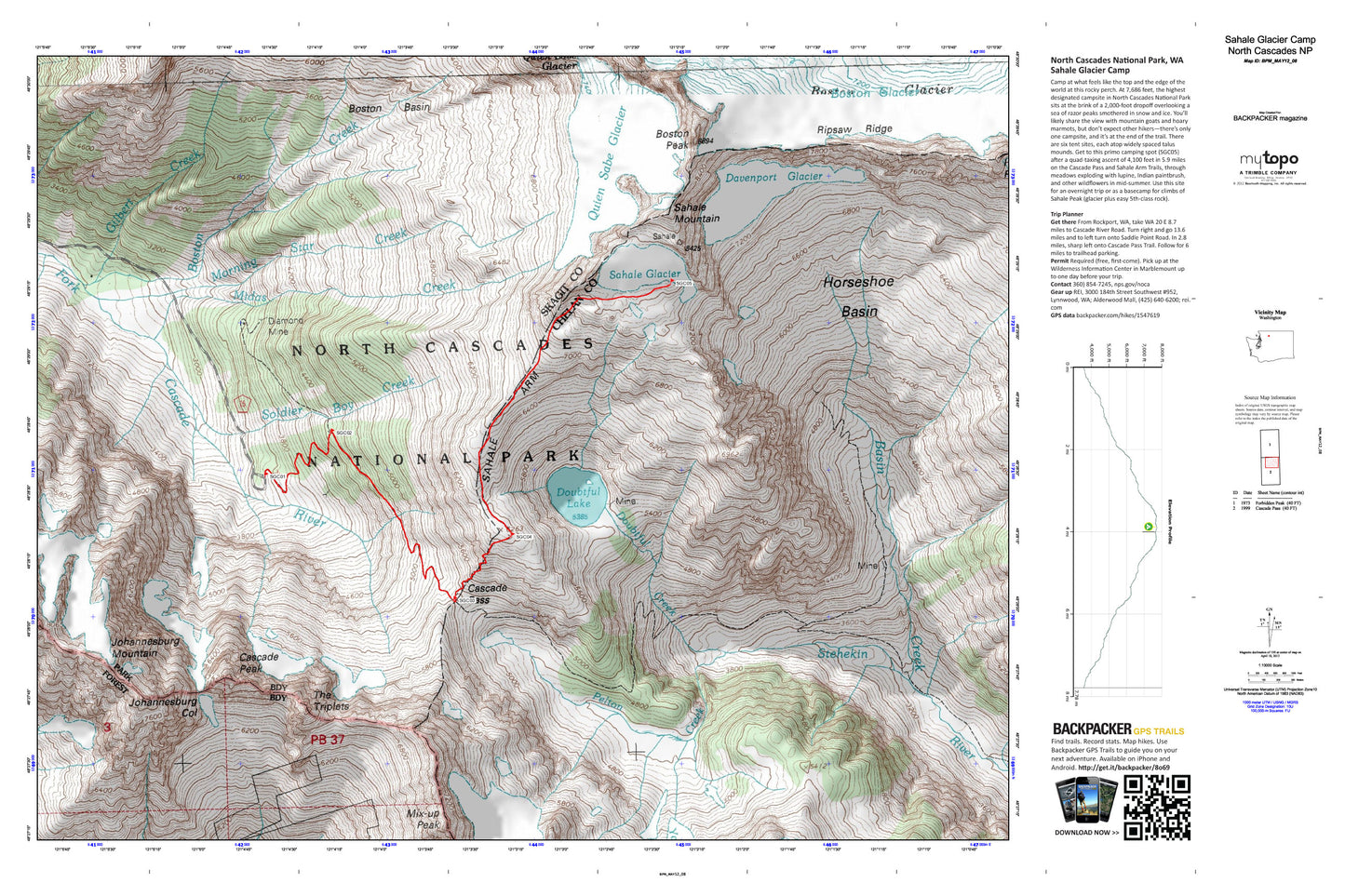
Sahale Glacier Map (North Cascades National Park, Washington)
Couldn't load pickup availability
A special Backpacker Magazine topo map printed on waterproof, tearproof paper. Includes topographic map data from the USGS and detailed trip information
Camp at what feels like the top and the edge of the world. At 7,686 feet, Sahale Camp is the park’s highest designated site, and your tent will sit at the brink of a 2,000-foot dropoff overlooking a sea of razor peaks smothered in snow and ice. In mid summer, you'll passed through meadows exploding with lupine and Indian paintbrush. Map includes turn-by-turn hiking directions and in-depth trip planning essentials to help you experience this BACKPACKER PRO adventure.
Contains the following named locations: Basin Creek,Boston Basin,Boston Creek,Boston Glacier,Boston Glacier Research Natural Area,Boston Peak,Cache Col,Cascade Pass,Cascade Peak,Davenport Glacier,Diamond Mine,Doubtful Creek,Doubtful Lake,Gilbert Creek,Horseshoe Basin,Horseshoe Peak,Johannesburg Col,Johannesburg Mountain,Midas Creek,Mix-up Peak,Morning Star Creek,Pelton Creek,Pelton Lake,Pelton Peak,Quien Sabe Glacier,Ripsaw Ridge,Sahale Arm,Sahale Glacier,Sahale Mountain,Soldier Boy Creek,The Triplets,Yawning Glacier