MyTopo
Blue Lakes Map (Mt. Sneffels Wilderness, Colorado)
Couldn't load pickup availability
A special Backpacker Magazine topo map printed on waterproof, tearproof paper. Includes topographic map data from the USGS and detailed trip information
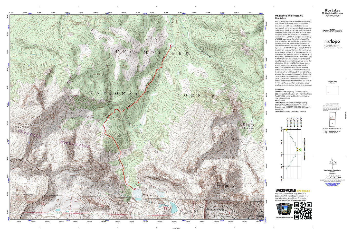
But this spot lies tucked away in one of Colorado's most secluded mountain ranges, five miles west of Ouray. From this perch above the lowest of the three Blue Lakes, at over 11,000 feet, you gaze out on a ring of 13,000-footers and the neighborhood’s big boy, 14,150-foot Mt. Sneffels. Spend two nights, and on your middle day visit the higher lakes and 12,980-foot Blue Lakes Pass for views of endless rows of spires and fields of wildflowers (best mid-July to mid-August). Map includes turn-by-turn hiking directions and in-depth trip planning essentials to help you experience this BACKPACKER PRO adventure.
Contains the following named locations: Blaine Basin,Blaine Mine,Blue Lake Pass,Blue Lakes,Blue Lakes Trail,Box Factory Park,Cirque Mountain,Cocan Flats,Mears Peak,Mount Sneffels,Ruby Trust Mine,Wilson Creek,Wolcott Mountain,Yankee Boy Basin