MyTopo
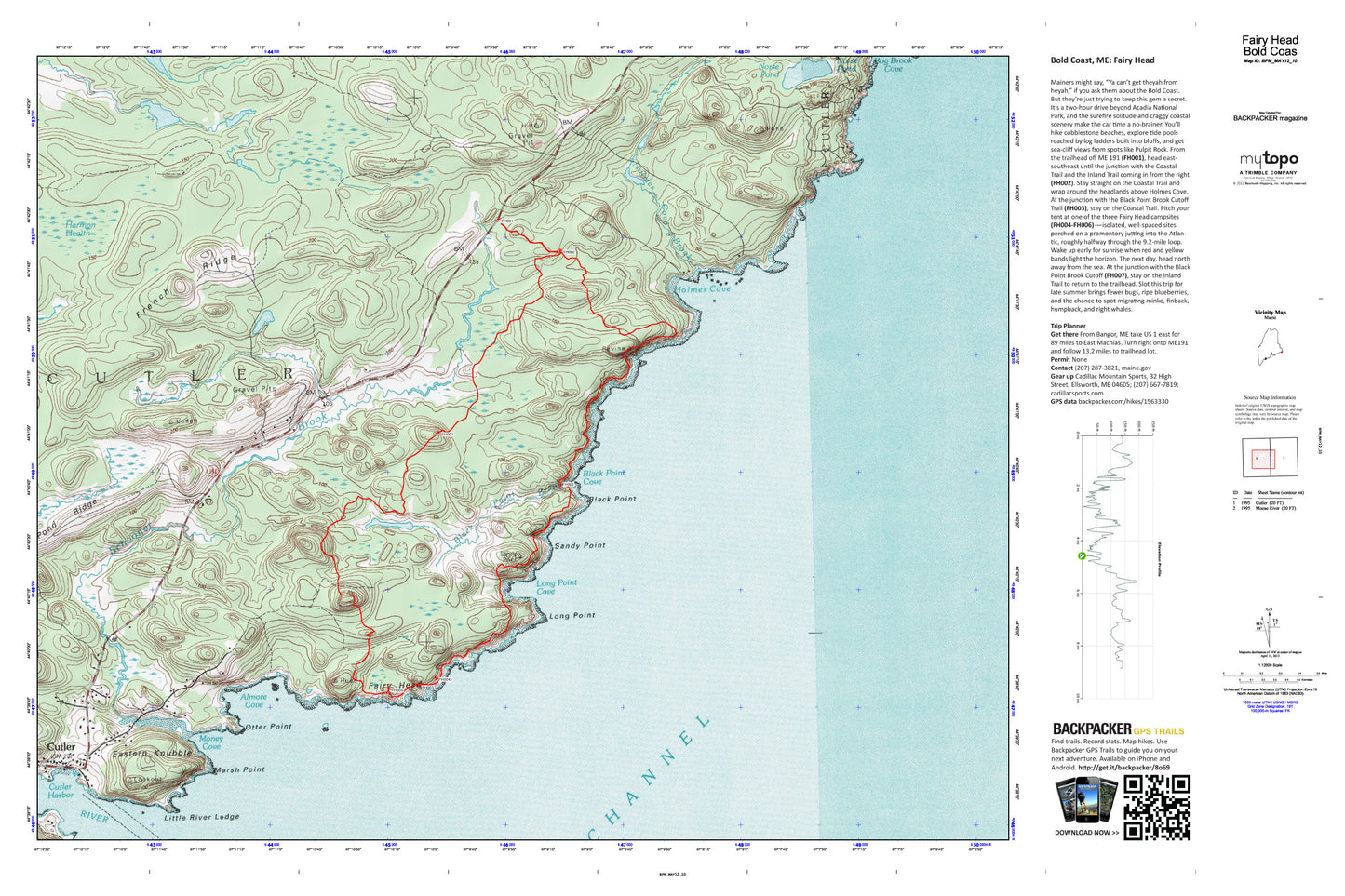
Fairy Head Map (Bold Coast, Maine)
Couldn't load pickup availability
A special Backpacker Magazine topo map printed on waterproof, tearproof paper. Includes topographic map data from the USGS and detailed trip information
Find solitude and sea-side camping on this local's only 9.2-mile route. You’ll hike cobblestone beaches, explore tide pools reached by log ladders built into bluffs, and get sea-cliff views. Slot this trip for late summer brings fewer bugs, ripe blueberries, and the chance to spot migrating minke, finback, humpback, and right whales. Map includes turn-by-turn hiking directions and in-depth trip planning essentials to help you experience this BACKPACKER PRO adventure.
Contains the following named locations: Almore Cove,Black Point,Black Point Brook,Black Point Cove,Bog Brook,Bog Brook Cove,Cutler,Cutler Harbor,Cutler Post Office,Cutler Volunteer Fire Department,Eastern Knubble,Fairy Head,French Ridge,Grand Manan Channel,Harmon Heath,Holmes Cove,Holmes Cove Brook,Little River,Little River Island,Little River Ledge,Little River Lighthouse,Long Point,Long Point Cove,Louise Clements Memorial Library,Marsh Point,Money Cove,Norse Pond,Otter Point,Pond Ridge,Sandy Point,Schooner Brook,Stone Hill