MyTopo
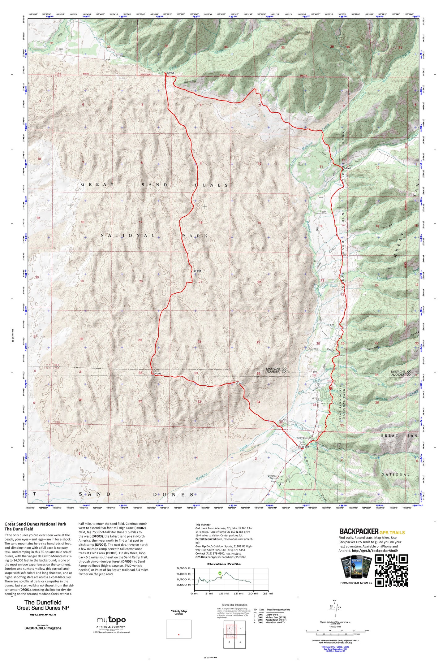
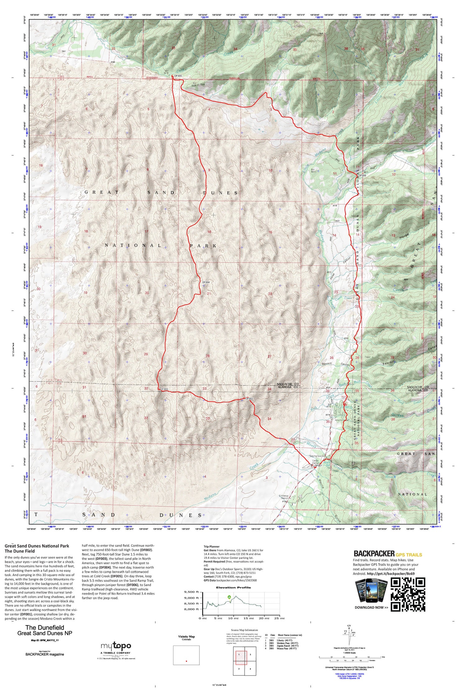
The Dune Field Camp Map (Great Sand Dunes N.P., Colorado)
Couldn't load pickup availability
A special Backpacker Magazine topo map printed on waterproof, tearproof paper. Includes topographic map data from the USGS and detailed trip information
Camping in this 30-square-mile sea of sand, with the Sangre de Cristo Mountains rising to 14,000 feet in the background, is one of the most unique experiences on the continent. Sunrises and sunsets mellow this surreal landscape with soft colors and long shadows, and at night, shooting stars arc across a coal-black sky. This 19.1-mile trips spends two nights out in the dunes and travels cross-country through pinyon and juniper forests. Map includes turn-by-turn hiking directions and in-depth trip planning essentials to help you experience this BACKPACKER PRO adventure.
Contains the following named locations: Buck Creek,Castle Creek,Cold Creek,Evans Gulch,Garden Creek,Great Sand Dunes National Preserve,Great Sand Dunes Wilderness,Horse Canyon,Little Medano Creek,Medano Creek,Morris Gulch,Mosca Creek,Mosca Spring,Pinon Flats Campground,Sawmill Canyon