MyTopo
Powell Point & Colorado River via North Bass Trail Map (Grand Canyon National Park, Arizona)
Couldn't load pickup availability
A special Backpacker Magazine topo map printed on waterproof, tearproof paper. Includes topographic map data from the USGS and detailed trip information
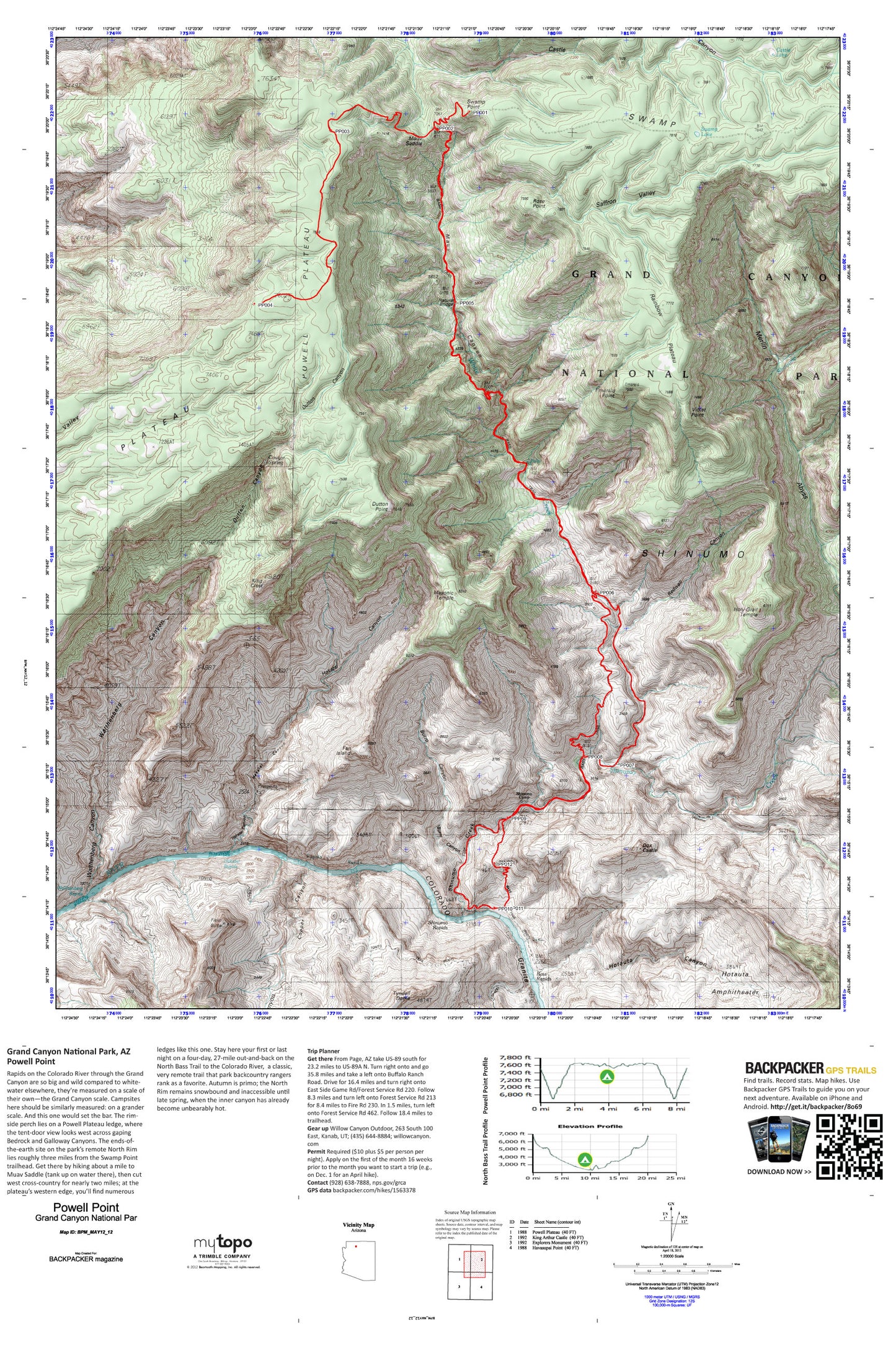
The rim-side perch lies on a Powell Plateau ledge, where the tent-door view looks west across gaping Bedrock and Galloway Canyons. The ends-of-the-earth site on the park’s remote North Rim lies roughly three miles from the Swamp Point trailhead. Get there by hiking to Muav Saddle then cut west cross-country to the plateau’s western edge, where you’ll find numerous ledges to spend the night. Stay here your first or last night on a four-day, 27-mile out-and-back on the North Bass Trail to the Colorado River, a classic, very remote trail that park backcountry rangers rank as a favorite and also begins at Swamp Point. Map includes turn-by-turn hiking directions and in-depth trip planning essentials to help you experience this BACKPACKER PRO adventure.
Contains the following named locations: Bass Canyon,Bass Rapids,Bass Trail,Beaman Point,Burro Canyon,Castle Canyon,Castle Lake,Copper Canyon,Cougar Spring,Dox Castle,Dutton Canyon,Dutton Point,Emerald Point,Evans Butte,Fan Island,Feroz Terrace,Fiske Butte,Flint Creek,Grass Canyon,Hakatai Canyon,Hakatai Rapids,Holy Grail Temple,Hotauta Amphitheater,Hotauta Canyon,King Crest,Masonic Temple,Merlin Abyss,Modred Abyss,Muav Canyon,Muav Saddle,Natural Bridge,Newberry Point,Powell Plateau,Powell Spring,Rainbow Plateau,Redwall Canyon,Rose Point,Saffron Valley,Sagittarius Ridge,Shinumo Camp,Shinumo Creek,Shinumo Rapids,Swamp Lake,Swamp Point,Tyndall Dome,Violet Point,Wallace Butte,Walthenberg Canyon,Walthenberg Rapids,White Creek