MyTopo
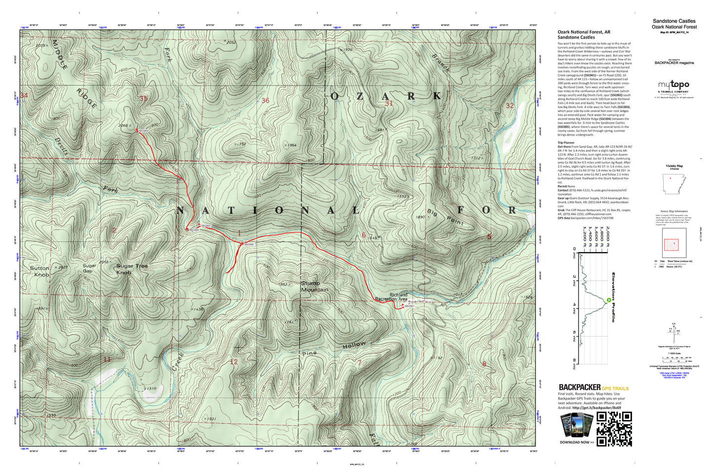
Sandstone Castles Map (Ozark National Forest, Arkansas)
Couldn't load pickup availability
A special Backpacker Magazine topo map printed on waterproof, tearproof paper. Includes topographic map data from the USGS and detailed trip information
You won’t be the first person to hole up in the maze of tunnels and grottos riddling these sandstone bluffs in the Richland Creek Wilderness—outlaws and Civil War deserters did the same in centuries past. But you won’t have to worry about sharing it with a crowd: Few of today’s hikers even know the castles exist. Reaching them involves routefinding puzzles on rough, unmaintained use trails. Map includes turn-by-turn hiking directions and in-depth trip planning essentials to help you experience this BACKPACKER PRO adventure.
Contains the following named locations: Big Devils Fork,Big Point,Bobtail Creek,Cherry Flat,Drury Hollow,Falling Water Creek,Long Branch,Long Devils Fork,Meeks Hollow,Pine Hollow,Richland Creek Wild and Scenic River,Richland Creek Wilderness,Richland Recreation Area,Rose Hollow,Stump Mountain,Sugar Gap,Sugar Tree Knob,Sutton Knob