MyTopo
Castleton Tower Map (Castle Valley, Utah)
Couldn't load pickup availability
A special Backpacker Magazine topo map printed on waterproof, tearproof paper. Includes topographic map data from the USGS and detailed trip information
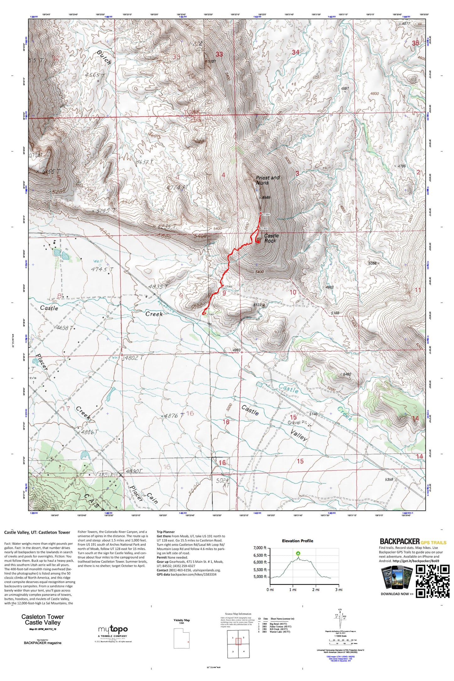
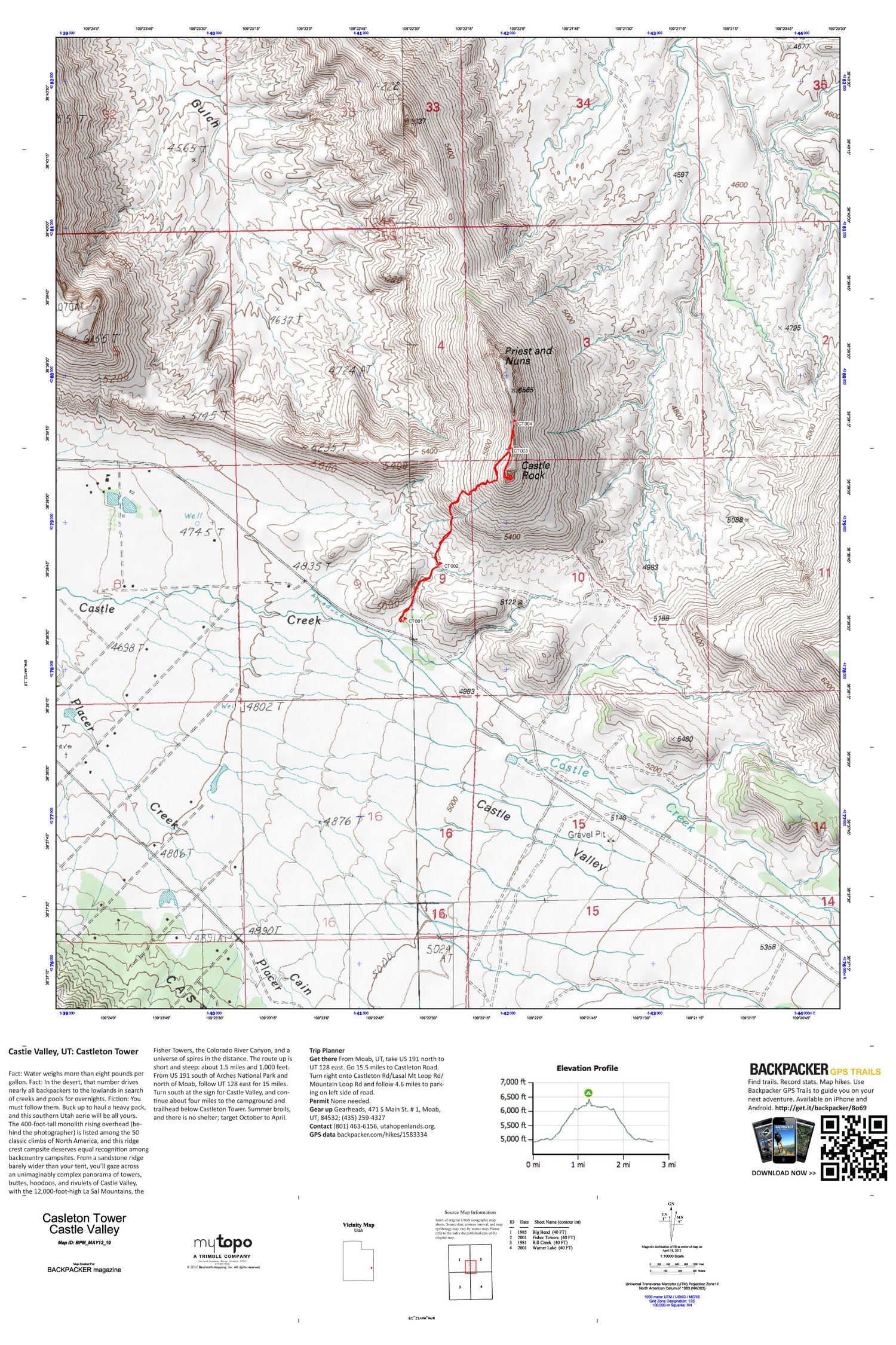
From a sandstone ridge barely wider than your tent, you’ll gaze across an unimaginably complex panorama of towers, buttes, hoodoos, and rivulets of Castle Valley, with the 12,000-foot-high La Sal Mountains, the Fisher Towers, the Colorado River Canyon, and a universe of spires in the distance. The route up is short and steep: about 1.5 miles and 1,000 feet. Map includes turn-by-turn hiking directions and in-depth trip planning essentials to help you experience this BACKPACKER PRO adventure.
Contains the following named locations: Cain Hollow,Castle Rock,Castle Rock/Priest and Nuns Point of Interest,Castle Valley Cemetery,Castle Valley Fire Department Station 1,Parriott Mesa,Placer Creek,Priest and Nuns,Round Mountain,Spring Creek,The Church of Jesus Christ of Latter Day Saints,Town of Castle Valley