MyTopo
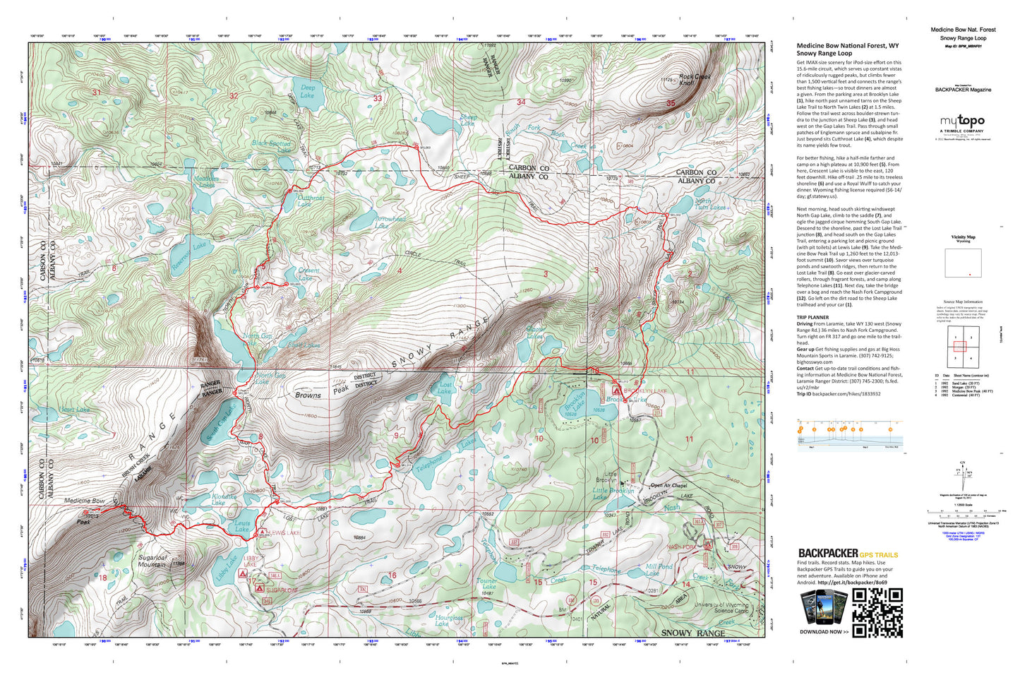
Snowy Range Loop Map (Medicine Bow NF, Wyoming)
Couldn't load pickup availability
A special Backpacker Magazine topo map printed on waterproof, tearproof paper. Includes topographic map data from the USGS and detailed trip information
Put in only minimal effort (1,500 feet of climbing) for maximum gain on this 15.6 mile circuit. This overnight trip wil lhave you camping on a high plateau at 10,900 feet and takes you to past Wyoming's best fishing lakes. A short side trip lets you bag Medicine Bow Peak, at 12,013 feet. Map includes turn-by-turn hiking directions and in-depth trip planning essentials to help you experience this BACKPACKER PRO adventure.
Contains the following named locations: Arrowhead Lake,Bellamy Lake,Black Jack Lake,Black Spotted Lake,Brady Lake,Brooklyn Lake,Brooklyn Lake Campground,Brooklyn Lake Guard Station,Browns Peak,Circle Trail,Class Lake,Crescent Lake,Cutthoat Lake,Deep Lake,Drillers Lake,Fishhook Lake,Glacier Lakes,Hatchet Lake,Heart Lake,Highway 130 Lake,Hourglass Lake,Jeep Lake,Klondike Lake,Lakes Trail,Lewis Lake,Lewis Lake Campground,Libby Lake,Little Brooklyn Lake,Little Brooklyn Lake Dam,Little Long Lake,Lookout Lake,Lost Lake,Meadows Lakes,Medicine Bow Peak,Medicine Bow Trail,Middle Long Lake,Mill Pond Lake,Mutt Lake,North Gap Lake,North Twin Lakes,Open Air Chapel,Pinchot Lake,Reservoir Lake,Rock Creek Knoll,Round Lake,Sally Creek,Sandy Lake,Scott Lake,Sheep Lake,Shelf Lakes,Snow Bank Lake,Snowy Range,Snowy Range Natural Area,Snowy Range Pass,South Gap Lake,Sugarloaf Mountain,Sugarloaf Recreation Area,Swastika Lake,Telephone Creek,Telephone Lakes,Towner Lake,University of Wyoming Science Camp,Upper Nash Fork Campground,Vagner Lake,Vosseller Lake