MyTopo
Chimney Tops Map (Great Smoky Mountains National Park, Tennessee)
Couldn't load pickup availability
A special Backpacker Magazine topo map printed on waterproof, tearproof paper. Includes topographic map data from the USGS and detailed trip information
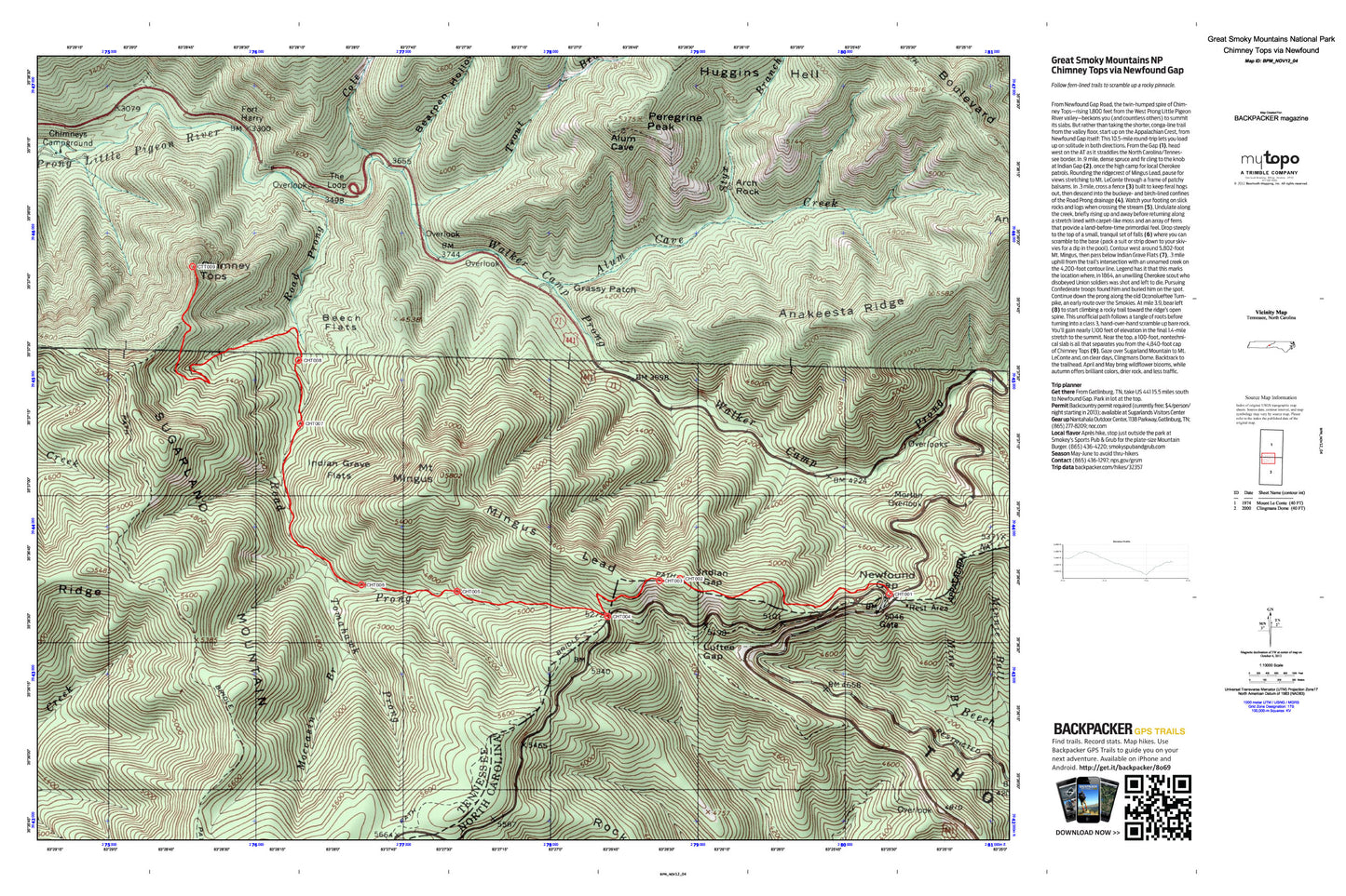
Follow fern-lined trails to scramble up a rocky pinnacle. From Newfound Gap Road, the twin-humped spire of Chimney Tops—rising 1,800 feet from the West Prong Little Pigeon River valley—beckons you (and countless others) to summit its slabs. But rather than taking the shorter, conga-line trail from the valley floor, start up on the Appalachian Crest, from Newfound Gap itself: This 10.5-mile round-trip lets you load up on solitude in both directions. Map includes turn-by-turn hiking directions and in-depth trip planning essentials to help you experience this BACKPACKER PRO adventure.
Contains the following named locations: Alum Cave Creek,Alum Gap,Anakeesta Knob,Anakeesta Ridge,Arch Rock,Bearpen Hollow,Beech Flats,Chimney Tops,Chimneys Campground,Cole Creek,Fort Harry,Grass Patch Branch,Grassy Patch,Huggins Hell,Indian Gap,Indian Grave Flats,Luftee Gap,Mine Branch,Mingus Lead,Minnie Ball Branch,Moccasin Branch,Morton Overlook,Mount Collins Shelter,Mount Mingus,Mount Weaver,Newfound Gap,Peregrine Peak,Road Prong,Rocky Fork Ridge,Shot Beech Ridge,Styx Branch,Sugarland Mountain,Sweet Ridge,The Loop,Thomas Ridge,Tomahawk Prong,Trout Branch,Walker Camp Prong