MyTopo
Horseshoe Canyon Map (Canyonlands NP, Utah)
Couldn't load pickup availability
A special Backpacker Magazine topo map printed on waterproof, tearproof paper. Includes topographic map data from the USGS and detailed trip information
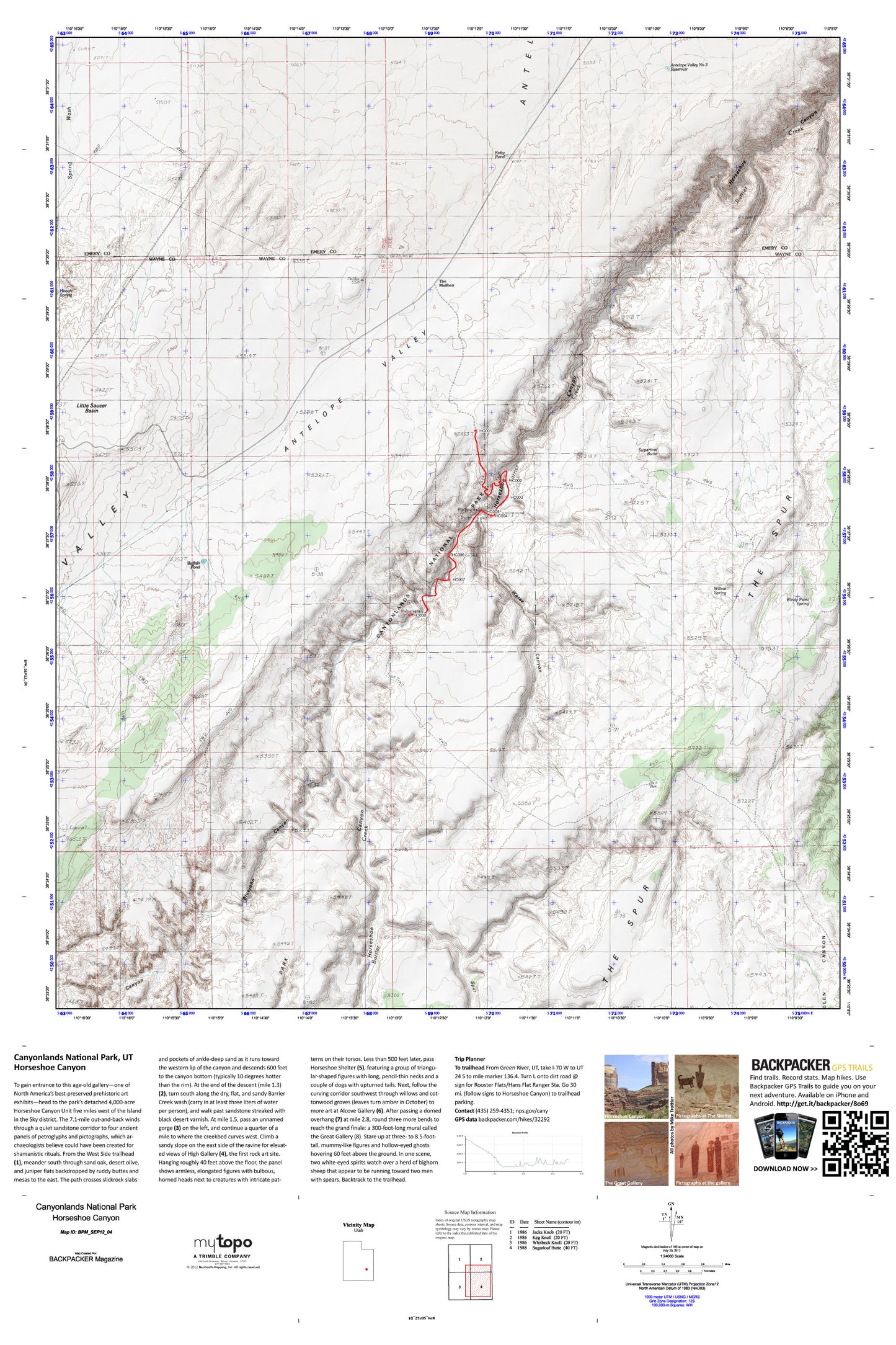
To gain entrance to this age-old gallery—one of North America’s best-preserved prehistoric art exhibits—head to the park’s detached 4,000-acre Horseshoe Canyon Unit five miles west of the Island in the Sky district. The 7.1-mile out-and-back winds through a quiet sandstone corridor to four ancient panels of petroglyphs and pictographs, which archaeologists believe could have been created for shamanistic rituals. Map includes turn-by-turn hiking directions and in-depth trip planning essentials to help you experience this BACKPACKER PRO adventure.
Contains the following named locations: Antelope Valley Corral,Antelope Valley Number Three Reservoir,Big Pond,Big Spring,Bluejohn Canyon,Buffalo Pond,Great Gallery Pictographs,Hooch Spring,Horseshoe Canyon Unit- Canyonlands National Park,Kirby Pond,Little Saucer Basin,Middle Canyon,Red Nubs,Spur Fork,Sugarloaf Butte,The Mailbox,Tidwell Ranch,Water Canyon,Willow Spring,Windy Point Spring