MyTopo
Mathews Arm Loop Map (Shenandoah NP, Virginia)
Couldn't load pickup availability
A special Backpacker Magazine topo map printed on waterproof, tearproof paper. Includes topographic map data from the USGS and detailed trip information
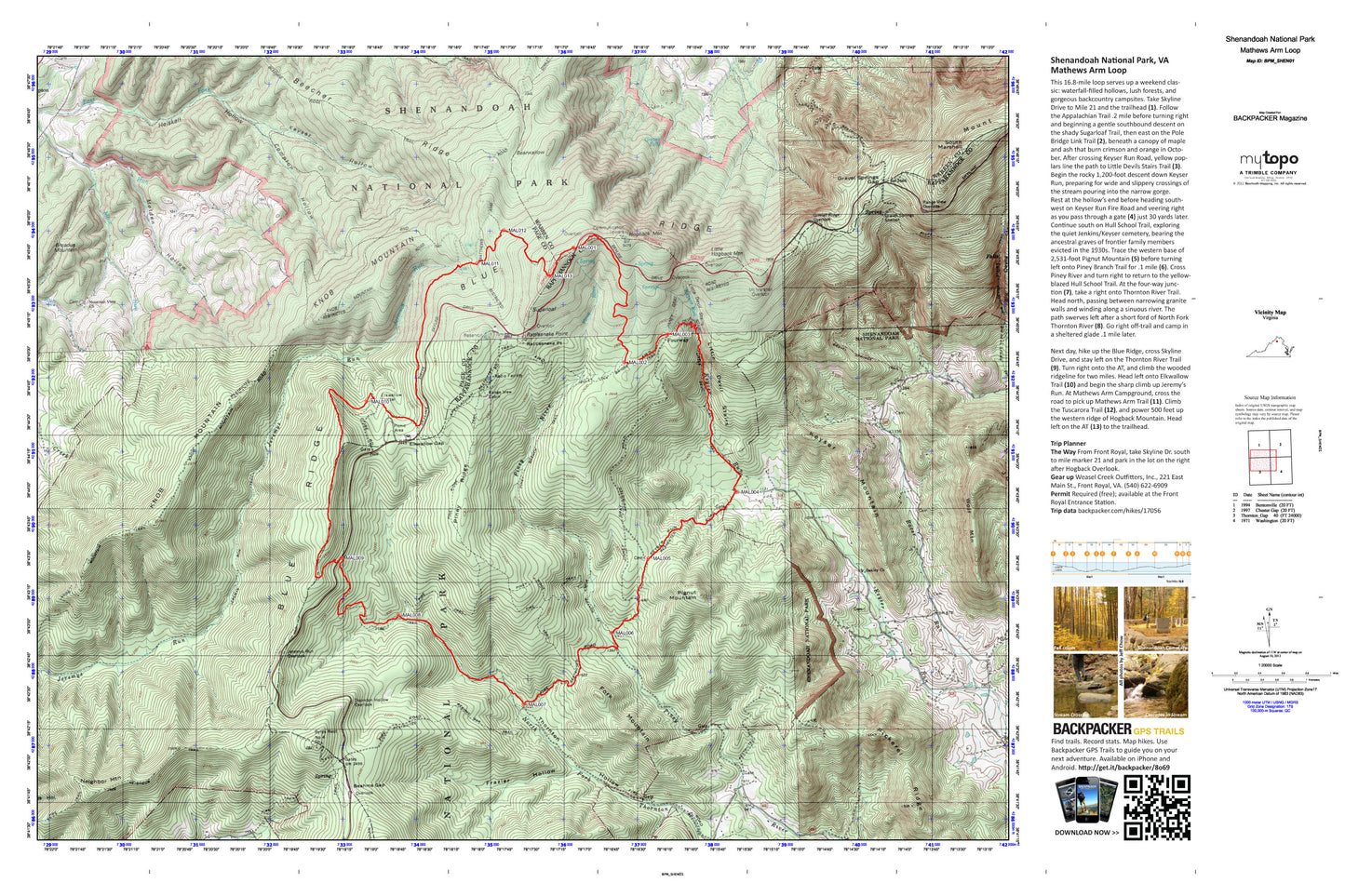
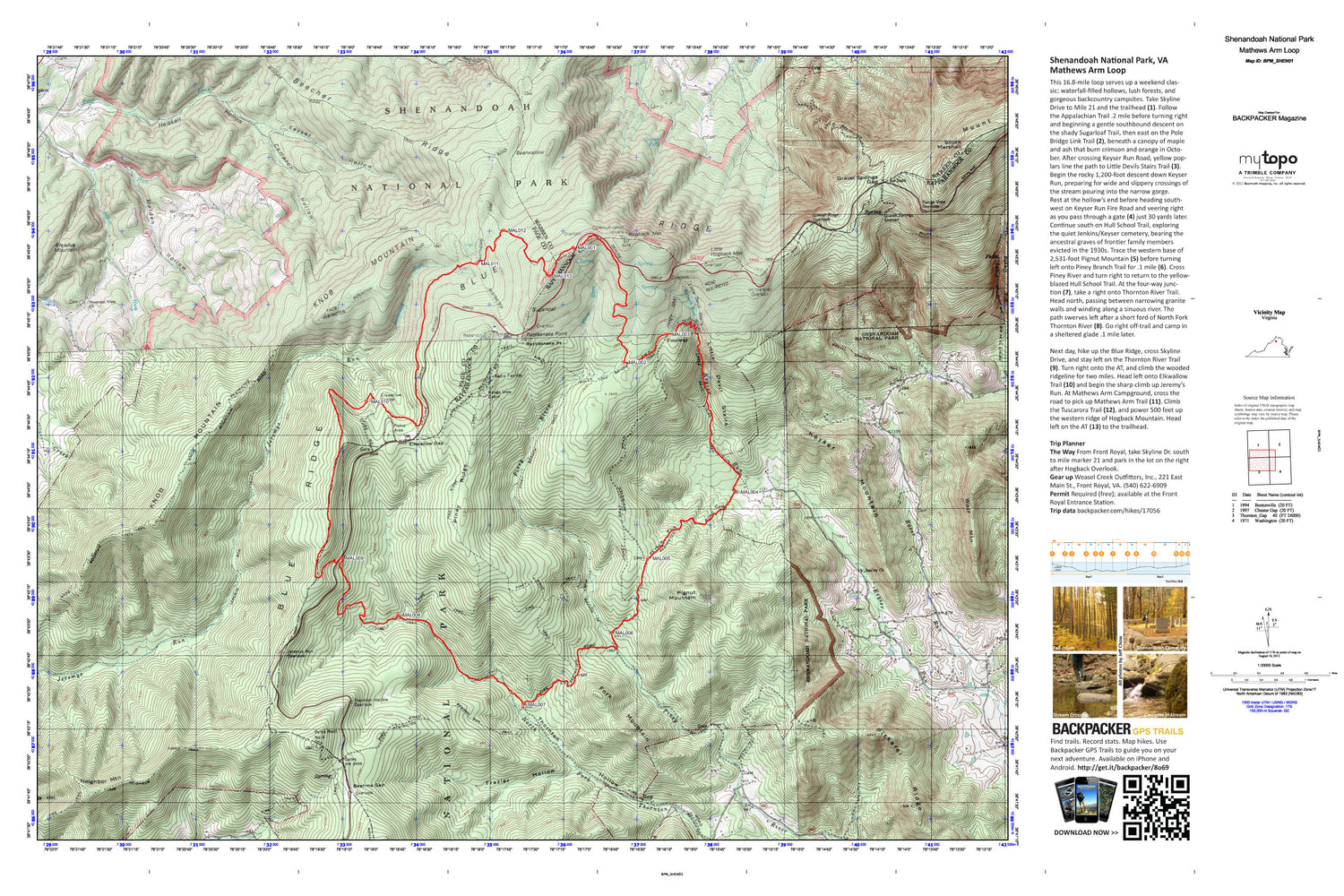
This 16.8-mile loop serves up a weekend classic: waterfall-filled hollows, lush forests, and gorgeous backcountry campsites. Rolling hills along a series of trails lead you to stream crossings, Skyline Drive and views from the Blue Ridge.
Contains the following named locations: 22650,Beahms Gap,Beahms Gap Trail,Bearwallow,Beecher Ridge,Beecher Ridge Trail,Big Devils Stairs Trail,Broadus Mountain,Butterwood Branch,Byrds Nest Number 4,Compton,Compton Hollow,Cool Spring Church,East Fork Dry Run,Elkwallow Gap,Elkwallow Shelter,Fork Mountain,Fourway,Fox Store,Frazier Hollow,Gimlet Ridge Overlook,Gimlet Ridge Trail,Gravel Springs Gap,Gravel Springs Shelter,Gravel Springs Trail,Greasy Falls,Heiskell Hollow,Hogback Mountain,Hull School,Jeremys Run Overlook,Jeremys Run Trail,Kemp Hollow,Keyser Hollow,Keyser Mountain,Keyser Run,Knob Mountain,Knob Mountain Trail,Little Devils Stairs,Little Devils Stairs Trail,Little Hogback Mountain,Long Arm,Mine Run,Molden Hollow,Moody Creek,Mount Marshall Overlook,Mountain View Church,Neighbor Mountain,Neighbor Trail,Oakley Church,Overall Run Trail,Pass Mountain,Pass Mountain Trail,Pickerel Ridge,Pignut Mountain,Piney Branch Trail,Piney Ridge,Piney Ridge Trail,Pole Link Bridge Trail,Promise Land Baptist Church,Racer Run,Range View Cabin,Range View Overlook,Rattlesnake Point,Rocky Branch Church,Rocky Branch School,Smedley,South Marshall,Sugarloaf,Sundown,Sycamore School,Thornton Hollow,Thornton Hollow Overlook,Wolf Mountain


