MyTopo
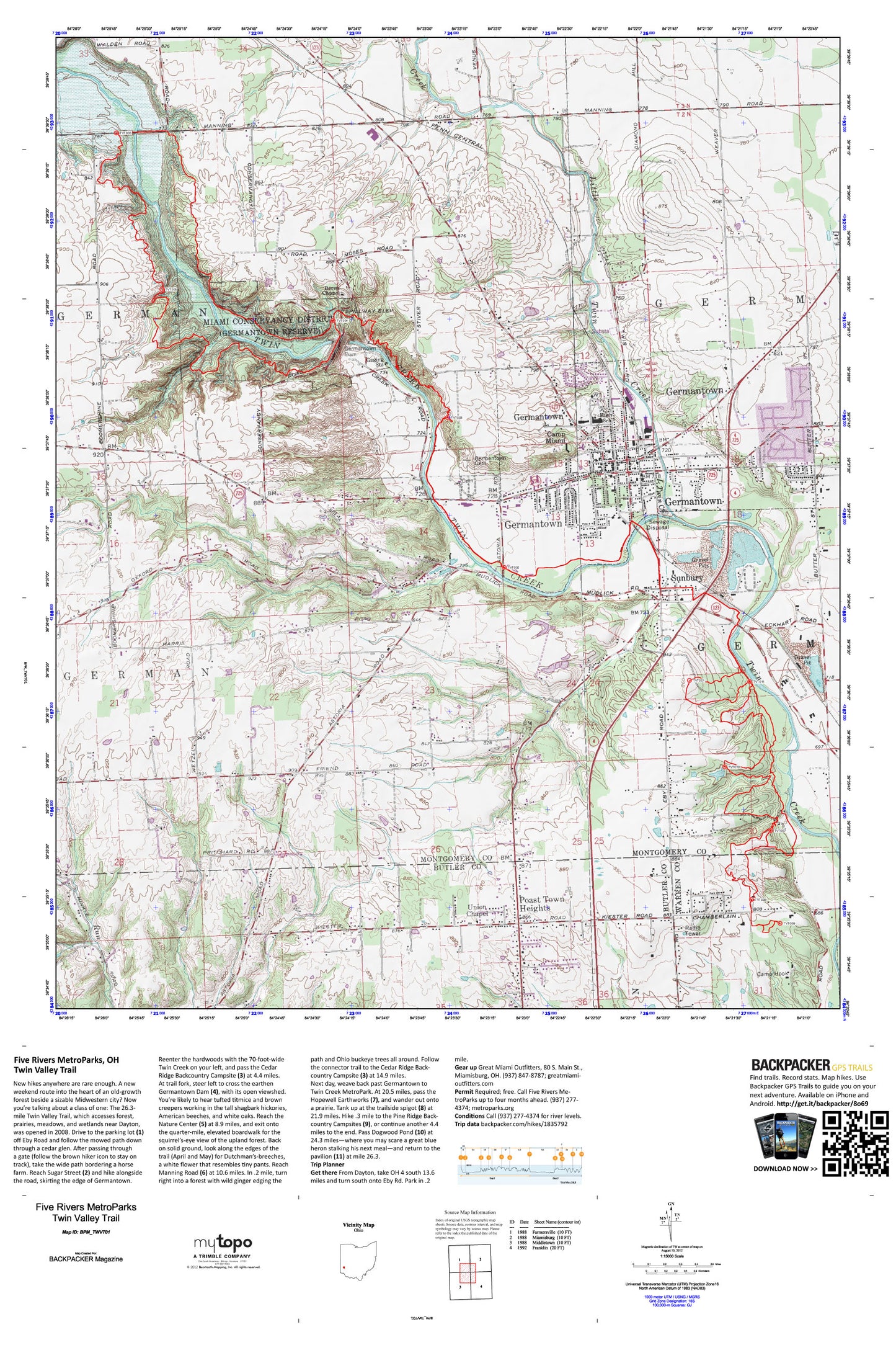
Twin Valley Trail Map (Five Rivers MetroParks, Ohio)
Couldn't load pickup availability
A special Backpacker Magazine topo map printed on waterproof, tearproof paper. Includes topographic map data from the USGS and detailed trip information
This weekend route cuts into the heart of an old-growth forest only minutes from Dayton, OH. The 26.3-mile Twin Valley Trail travels through forest, prairies, meadows, and wetlands and was opened in 2008. Map includes turn-by-turn hiking directions and in-depth trip planning essentials to help you experience this BACKPACKER PRO adventure.
Contains the following named locations: 45327,Barker Field,Berea Chapel,Bob Siebenthaler Natural Area,Camp Hook,Camp Miami,City of Germantown,Emmanuel Lutheran Church,First Baptist Church,German Township Police Department,Germantown,Germantown Cemetery,Germantown Covered Bridge,Germantown Dam,Germantown Elementary School,Germantown Fire Department Station 63,Germantown MetroPark,Germantown Police Department,Germantown Post Office,Germantown Public Library,Germantown Rescue Squad,Germantown Reservoir,Good Shepherd United Methodist Church,Guffey Lake,Guffey Lake Dam,Gunckels Town Plan Historic District,Hummel Airport,Jims Airport,Kercher Park,Little Twin Creek,Mudlick,Mudlick Mill,Old Lutheran Cemetery,Poast Town Heights,Saint Augustine Church,Saint Johns United Church of Christ,School Number 1,School Number 2,Sunbury,Sunfish Pond,Toms Run,Township of German,Twin Creek Park,Union Chapel United Methodist Church,Valley View High School,Valley View Middle School,Veterans Memorial Playground,Wesley United Methodist Church