
MyTopo
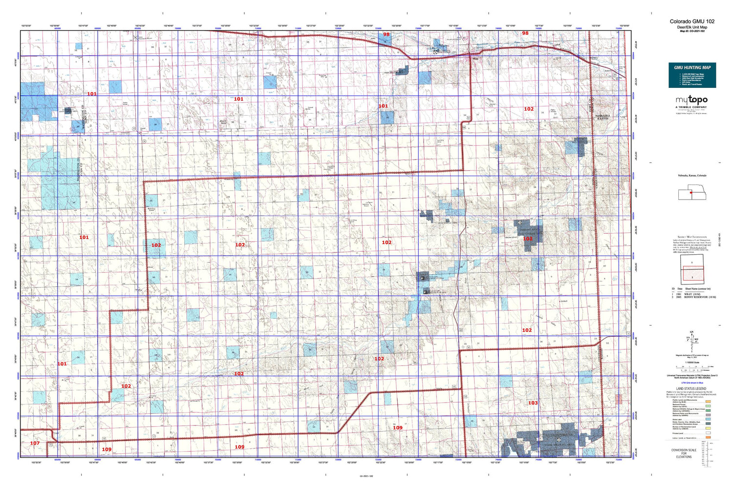
Colorado GMU 102 Map
Couldn't load pickup availability
Hunting unit map of Colorado Game Management Unit 102 with topographic lines and unit boundaries. This topo map features UTM / MGRS and Latitude/Longitude grids, plus public land ownership. It comes folded on waterproof paper. Be fully prepared for your hunt with a MyTopo GMU map!.
This map contains the following named places: 80735,80755,80822,Abarr,Adler Creek,Anderson Ranch,Armel Church,Beecher Island,Beecher Island Battlefield Monument,Bethel Community Hall,Beverly Grove,Black Wolf Creek,Bowman Ranch,Burr Ranch,Cope Census Designated Place,Cope Fire Department,Copperkettle Creek,Dickson Landing Strip,Donald Ranch,Downey Cemetery,Duck Dam,Duck Reservoir,Dunning Ranch,Glendale Cemetery,Grave of Buffalo Hunter,Hay Gulch,Heartstrong,Heartstrong Community Hall,Hillside Ranch,Hines Ranch,Idalia,Idalia Ambulance Service,Idalia Census Designated Place,Idalia Post Office,Idalia Volunteer Fire Department,Idalia-Joes Division,Idler Brother's Airport,Idler Family Cemetery,Jacks Gulch,KJCO-FM (Yuma),Lansing Valley Cemetery,Long Family Cemetery,Lucas Memorial Cemetery,Lundvall Brothers Landing Field,M A and K A Dickson Airport,M K Ranch,McCoy Ranch,Mildred Cemetery,Mount Yuma,Mullin Ranch,Noble Ranch,North Fork Black Wolf Creek,North Fork Dry Willow Creek,North Fork Spring Canyon,Olivet Cemetery,Peate Hill,Price Ranch,R L S Ranch,Saint John Church,Saint Johns Evangelical Cemetery,Sand Creek,Sharp Ranch,South Fork Black Wolf Creek,South Fork Dry Willow Creek,South Fork Spring Canyon,Spring Canyon,Squaw Hill,Stultz Landing Field,Thompson Ranch,Triple R Farms,Vernon,Vernon Census Designated Place,Vernon Post Office,Vernon Volunteer Fire Department,Whomble Airport,Whombles Meadow,Wildcat Canyon,Winger Ranch,Wingfield Ranch,Yuma County


