MyTopo
Colorado GMU 11 Map
Couldn't load pickup availability
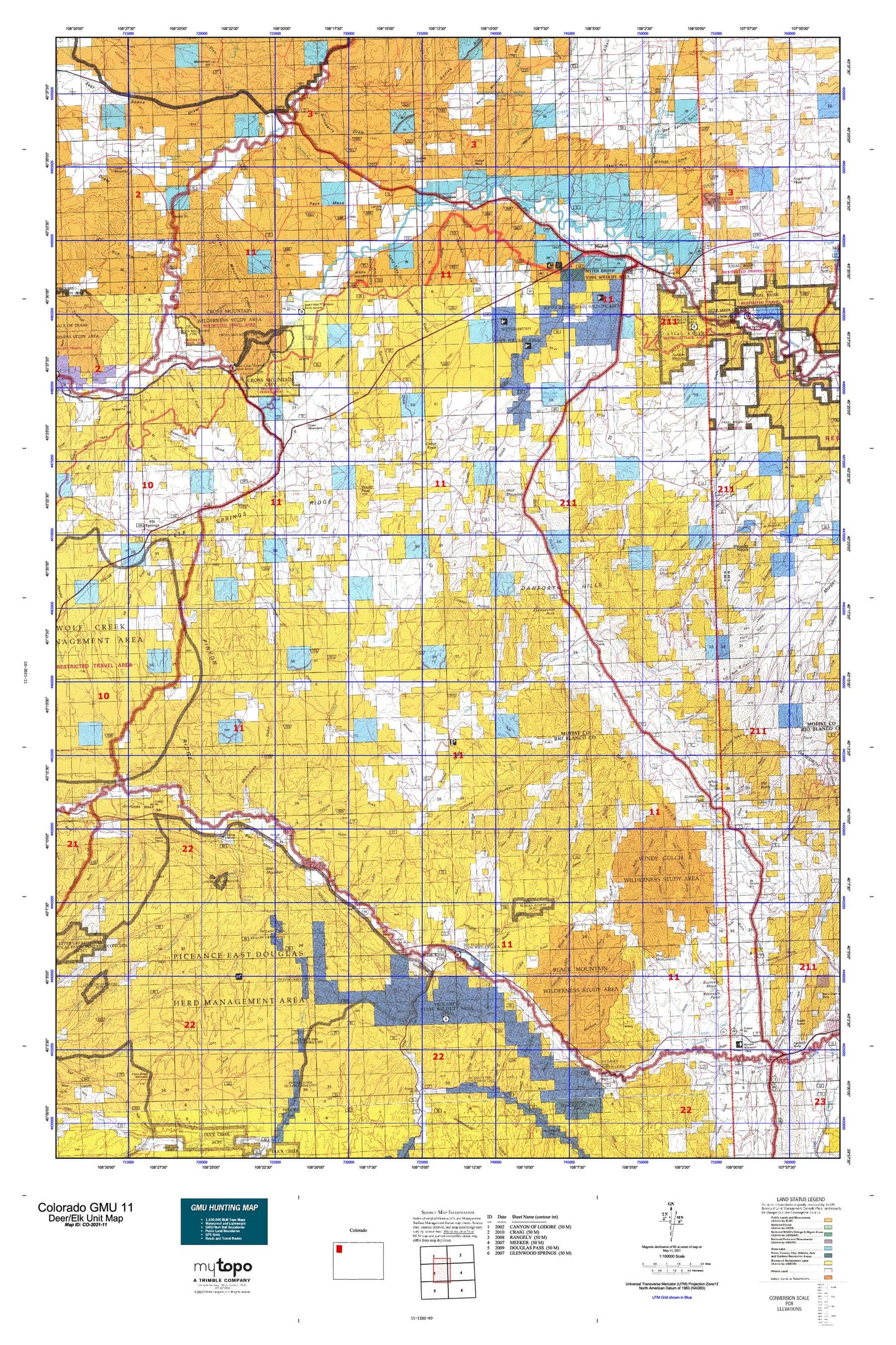
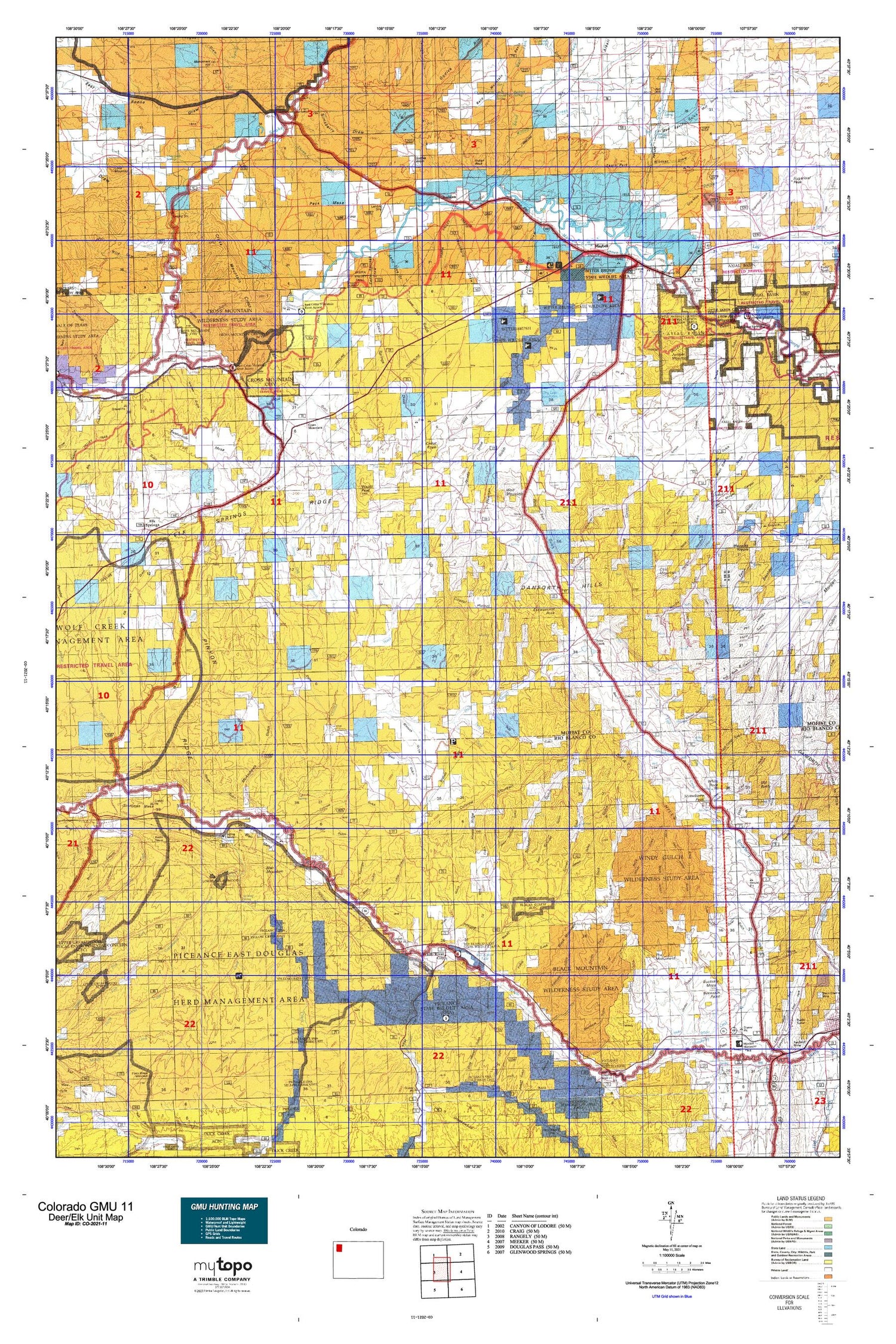
Hunting unit map of Colorado Game Management Unit 11 with topographic lines and unit boundaries. This topo map features UTM / MGRS and Latitude/Longitude grids, plus public land ownership. It comes folded on waterproof paper. Be fully prepared for your hunt with a MyTopo GMU map!.
This map contains the following named places: 81633,Airborne Anomaly B17-101 Mine,Airborne Anomaly B17-95 Mine,Airborne Anomaly B17-96 Mine,Alkali Draw,Alkali Flat,Barber Spring,Barcus Creek,Ben Morgan Canyon,Bitter Spring,Bitter Spring Gulch,Black Mountain,Blacks Gulch,Blair Ditch,Blair Mesa,Blair Mountain,Bob Hughes Creek,Boston Flat,Boston Hill,Boxelder Spring,Brouse Spring,Brush Draw,Buckskin Mesa,Buckskin Point,Buffalo Gulch,Buffalo Head Mining Company Claim Number Six,Cabin Gulch,Carlson Ranch,Cave Gulch,Cedar Knob,Cedar Springs,Cedar Springs Draw,Cedars Mining Company Claim Number One,Chase Spring,Citadel Plateau,Clinker Knob,Coal Creek,Coal Mountain,Coal Spring,Colorow Gulch,Colorow Mountain,Coyote Basin,Crooked Wash,Cross Mountain,Cross Mountain Canyon,Danforth Hills,Deception Creek,Deep Channel Creek,Deer Canyon,Devils Hole Gulch,Dick Ridge,Dickman Draw,Dry Lake Reservoir,Eagle Park,Eagle Rock,East Boone Draw,East Fork Greasewood Creek,East Fork Morgan Gulch,East Fork Strawberry Creek,East Jordan Gulch,East Tschuddi Gulch,Easton Gulch,Elk Springs,Elk Springs Draw,Elk Springs Ridge,Escarpment Arch,Escarpment Peak,Fairview Cemetery,Freeman Gulch,Gertrude Mine,Goff Camp Gulch,Gower Gulch,Graham Gulch,Grassy Gulch,Gray Hills,Greasewood Creek,Hale Gulch,Hat Hill,Hay Canyon,Hidden Valley,Horse Gulch,Horse Ridge,Hudson Claim Group Mine,Hurst Gulch,Indian Rock,Indian Springs Draw,Indian Valley,Jacobs Draw,Jesse Flats,Johnnie Johnson Dam,Johnson M.C.S. Mine,Johnson MCS Mine,Jordan Draw,Jordan Gulch,Juniper Canyon,Juniper Hot Springs,Juniper Mountain,Kellog Gulch,Keystone Ranch,Kissinger Gulch,Lambert Spring,Lay Creek,Lily Park,Little Juniper Mountain,Little Snake River,Lone Mountain,Lone Mountain Canyon,Lone Tree Gulch,Lucky Claim,Maggies Nipple,Marge Group Mine,Maudlin Gulch Oil Field,Maybell,Maybell Census Designated Place,Maybell Ditch,Maybell Pit,Maybell Post Office,Maybell Volunteer Fire Department,McAndrews Gulch,Michaels Draw,Middle Barcus Creek,Middle Fork Greasewood Creek,Middle Tschuddi Gulch,Moffat County,Moonshine Spring,Mud Spring,Mud Spring Gulch,Mud Springs Gulch,Niblock Ditch,North Barcus Creek,North Fork Greasewood Creek,North Fork Sagebrush Creek,Oil Well Gulch,Old Baldy,Omstead Spring,Open Gulch,Overholt Draw,Oyler Gulch,Peck Mesa,Piceance Creek,Pine Tree Gulch,Pinon Ridge,Pinto Gulch,Powell Park Ditch,Price Creek,Rattlesnake Gulch,Red Rock Canyon,Redrock Spring,Rimrock Gulch,Rinker Ranch,Rio Blanco Lake,Rough Gulch,Sagebrush Draw,Sage-Buella Mine,Sand Creek,Sand Wash,Sand Wash Ranch,Scenery Gulch,September Morn Claims,Sevens Ranch,Shell Group Claim Number One,Shelton Ranch,Sheridan Ranch,Short Canyon,Short Gulch,Simsberry Draw,Smith Gulch,Smizer Gulch,Spring Creek,Stadtman Mesa,Steamboat Rock,Stinking Spring,Stone Ranch,Straight Gulch,Strawberry Creek Cemetery,Strawberry Peak,Sugarloaf Basin,Sunbeam,Suttles Basin,Swan Draw,Sweeney Ranch,Teds Gulch,Temple Canyon,Temple Gulch,The Monument,Thompson Draw,Thompson Springs,Thornburg Draw,Thornburg Trail,Three C Wash,Threemile Gulch,Tisdell Ranch,Tom Little Draw,Tom Stith Gulch,Trevenen Claims,Tschuddi Gulch,Tuttle Ranch,Twelve Mile Gulch,Twelvemile Mesa,Twin Wash,Two Bar Ranch,U.S.B.M. Number One Shaft,USBM Number One Shaft,Wapiti Peak,Weaver Ranch,West Jordan Gulch,West Tschuddi Gulch,White Bear Ranch,White River City,White Rock,Wild Cow Draw,Wild Horse Ridge,Wildcat Draw,Willow Creek,Willow Gulch,Windy Gulch,Winter Valley,Winter Valley Gulch,Wolf Creek,Wolf Mountain,Wray Gulch,Yellow Creek


