MyTopo
Colorado GMU 114 Map
Couldn't load pickup availability
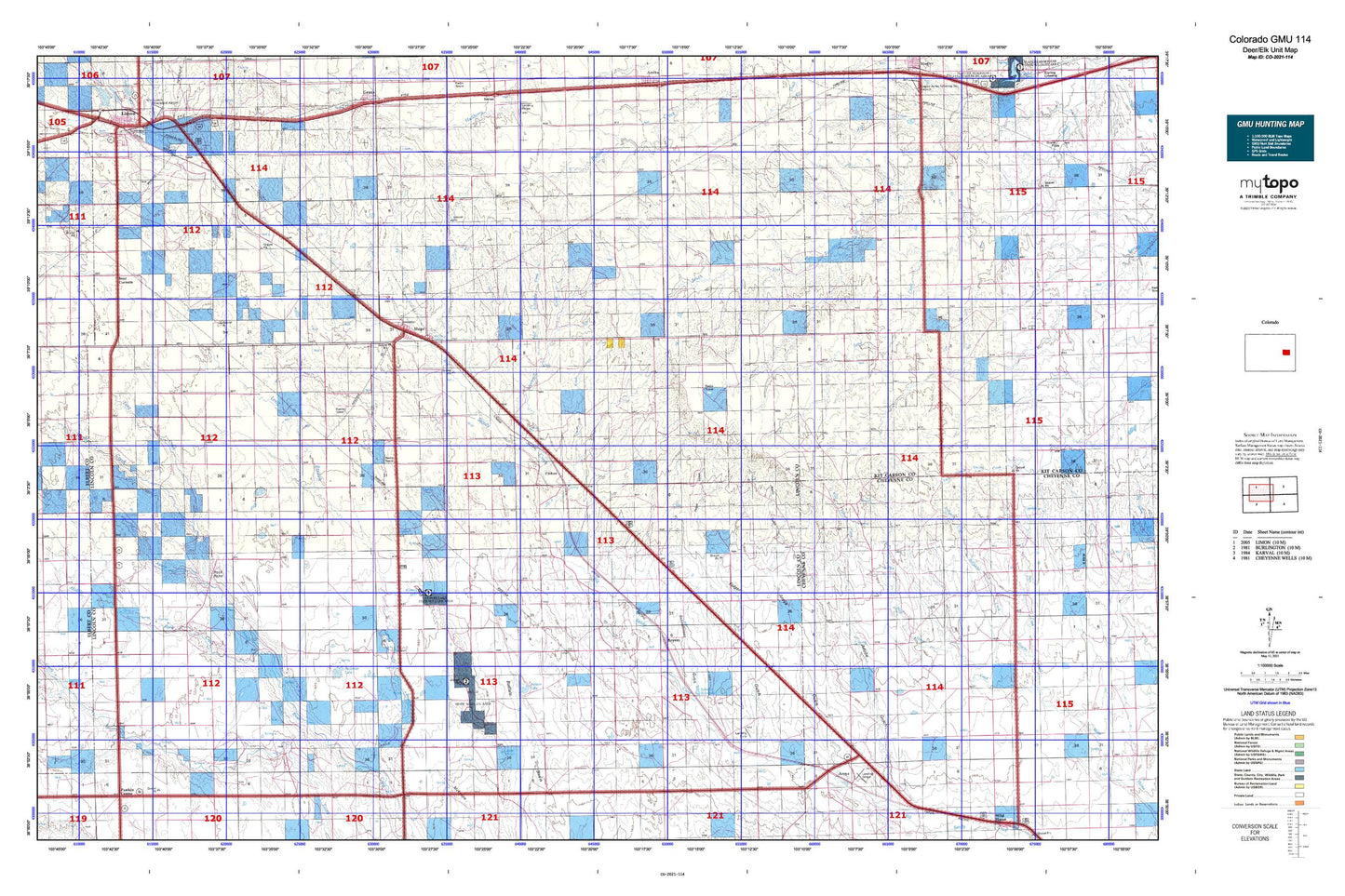
Hunting unit map of Colorado Game Management Unit 114 with topographic lines and unit boundaries. This topo map features UTM / MGRS and Latitude/Longitude grids, plus public land ownership. It comes folded on waterproof paper. Be fully prepared for your hunt with a MyTopo GMU map!.
This map contains the following named places: 80821,80862,Antelope Creek,Apache Creek,Aroya Cemetery,Aroya Gulch,Barron Creek,Beckman Lake,Bledsoe Ranch,Boyero,Boyero Cemetery,C H Mallon Ditch,Clifford,Clifford Cemetery,Clingingsmith Number 2 Dam,Clingingsmith Number 2 Reservoir,Coon Creek,Doctor A H Coulson Grave,Folger Gulch,Four Corners,Fred Pauls Detention Number 1 Dam,Fred Pauls Detention Reservoir Number 1,Hugo,Hugo Division,Hugo Evergreen Cemetery,Hugo Municipal Airport,Hugo Old Cemetery,Hugo Post Office,Hugo Volunteer Fire Department,Kinney Lake,L G Kinney Dam,Laddie Ditch,Lake,Lake Creek,Liberty Cemetery,Limon Correctional Facility,Limon Country Club,Limon Mennonite Cemetery,Lincoln Community Hospital,Lincoln Community Hospital Heliport,Lincoln Community Hospital Transport,Lincoln County,Lincoln County Fairgrounds,Lincoln County Sheriff's Office,Lofdahl Springs,Long Branch,Long Creek,Middle Rush Creek,Mount Calvary Cemetery,Mustang Creek,Nelson Lake,Parker Cemetery,Rock Point,Sanders Ranch,Schafer Reservoir,Schoolhouse Gulch,Sevenmile Creek,Sevenmile Ranch,Smoky Hill Trail,T-Cross Ranch,Town of Hugo,Wareland,West Sevenmile Creek,Willow Spring