
MyTopo
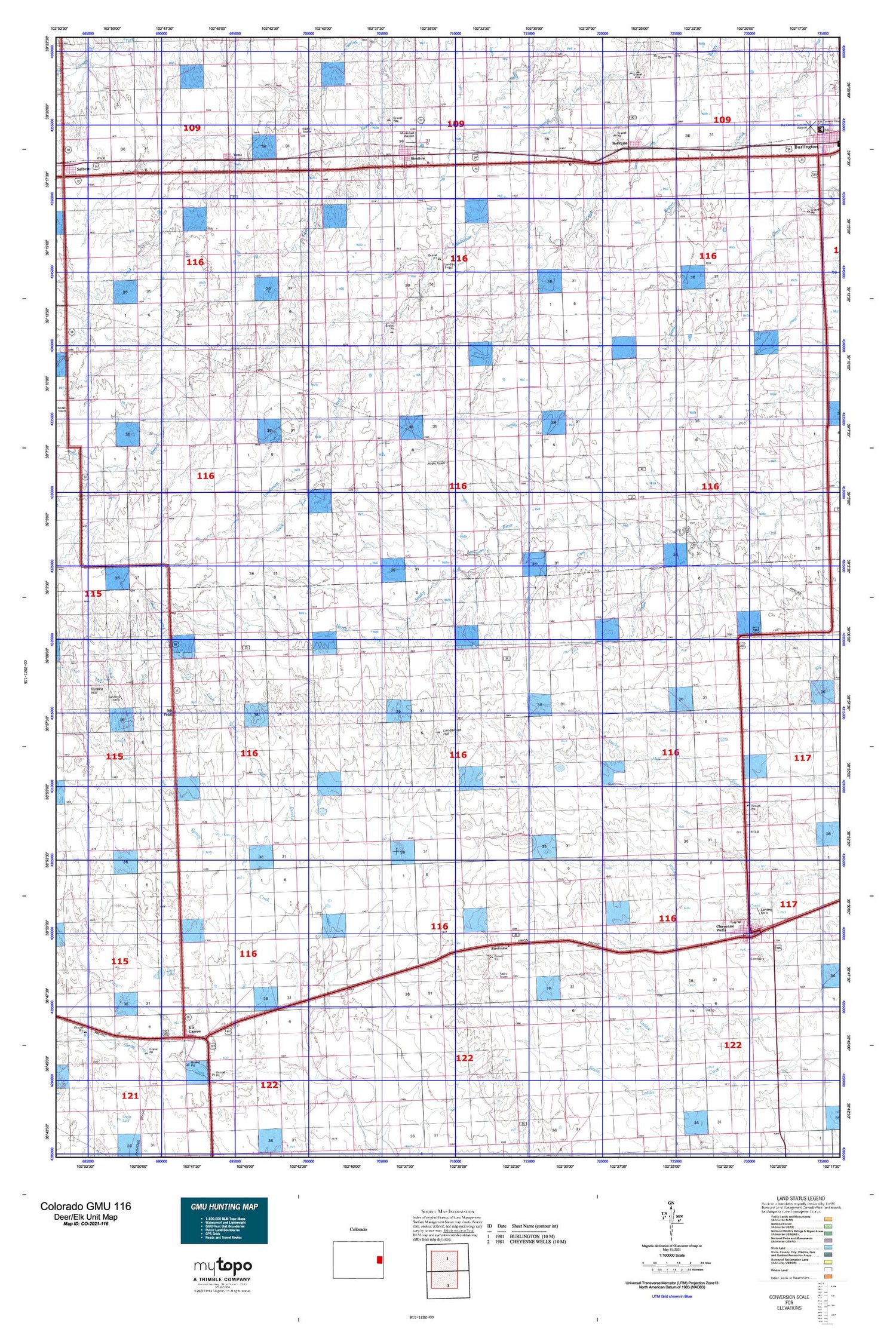
Colorado GMU 116 Map
Couldn't load pickup availability
Hunting unit map of Colorado Game Management Unit 116 with topographic lines and unit boundaries. This topo map features UTM / MGRS and Latitude/Longitude grids, plus public land ownership. It comes folded on waterproof paper. Be fully prepared for your hunt with a MyTopo GMU map!.
This map contains the following named places: 80805,80810,80825,80836,80861,Agate Mound,Alpine Ranch,Amy R Foote Dam,Amy R Foote Reservoir,Aviation Acres Airport,Bethune,Bethune Junior - Senior High School,Bethune Post Office,Big Spring,Calvary Cemetery,Cheyenne County,Cheyenne County Ambulance Service,Cheyenne County Sheriff's Office,Cheyenne Oil Field,Cheyenne Wells,Cheyenne Wells Fire Department,Cheyenne Wells Middle School,Cheyenne Wells Post Office,Clairmont Cemetery,Cow Creek,East Fork Big Spring Creek,Eureka Creek,Fairview Cemetery,Firstview,Fort Big Spring,Hildebrandt Airport,Keefe Memorial Hospital,Kit Carson,Kit Carson Cemetery,Kit Carson County,Kit Carson County Landfill,Kit Carson Fire Department,Kit Carson Post Office,Ladder Creek Oil Field,Landsman Hill,Little Spring Creek,Logie Lake,Merritt Blowout,Middle Fork Big Spring Creek,Mount Pearl,New Freidensberg Cemetery,New Freidonburg Church,Old Wells,Rock Creek,Sand Creek Heliport,Sevenmile Creek,South Fork Landsman Creek,Stratton,Stratton Division,Stratton Fire Department,Stratton Post Office,Town of Bethune,Town of Cheyenne Wells,Town of Kit Carson,Town of Stratton,Town of Vona,Twin Buttes,Union Exchange Shopping Center,Vona,Vona Cemetery,Vona Fire Department,Vona Post Office,Wild Horse Creek,Windrift Ranch


