MyTopo
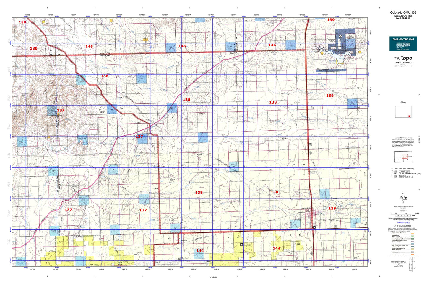
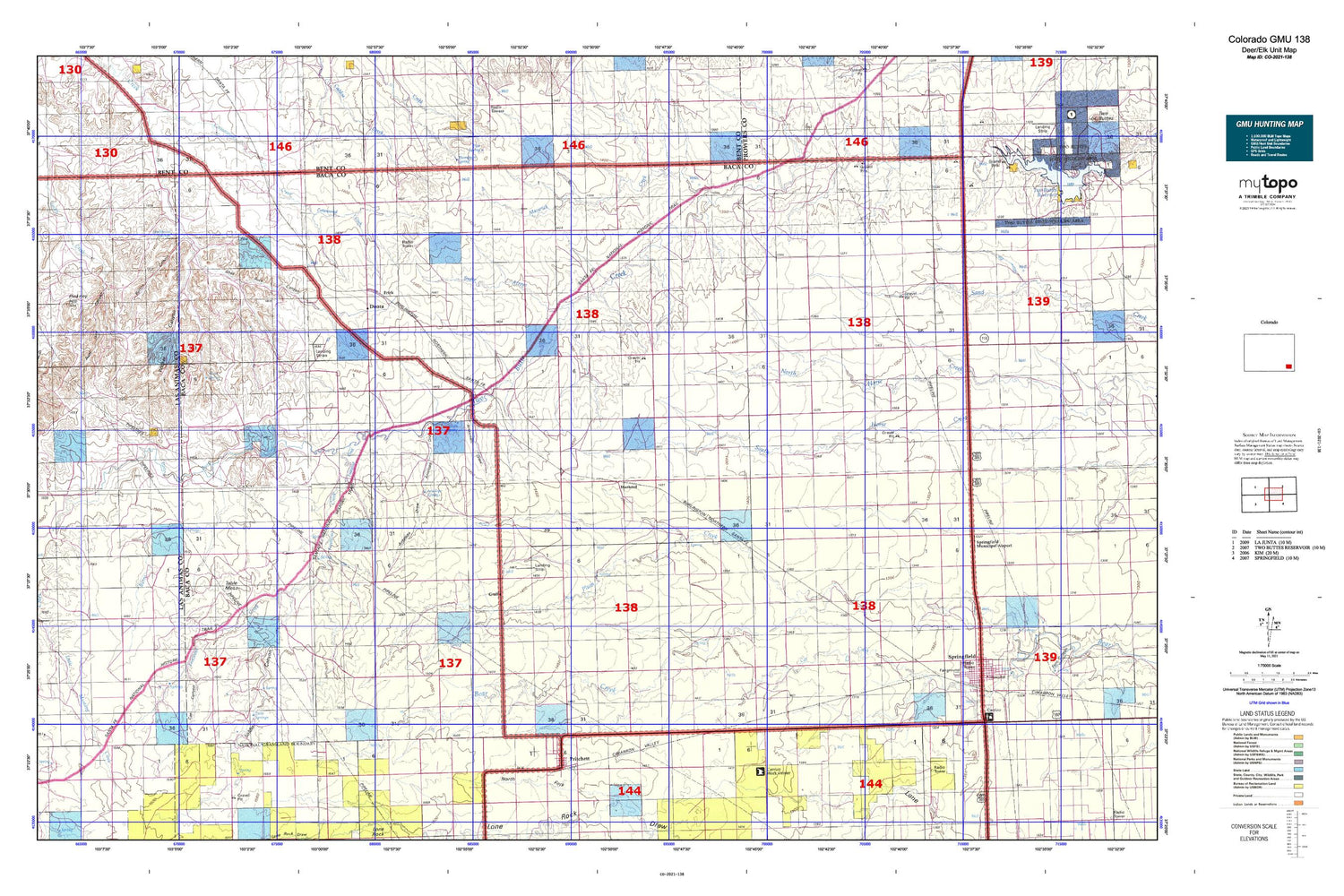
Colorado GMU 138 Map
Couldn't load pickup availability
Hunting unit map of Colorado Game Management Unit 138 with topographic lines and unit boundaries. This topo map features UTM / MGRS and Latitude/Longitude grids, plus public land ownership. It comes folded on waterproof paper. Be fully prepared for your hunt with a MyTopo GMU map!.
This map contains the following named places: 81073,Alexander Mesa,Alkali Spring,Alum Spring,Antelope Draw,Antelope Springs,Arrasmith Draw,Atlanta,Aunt Jane Canyon,Baca County Fairground,Baca County Sheriff's Office,Big Rock Grange,Brookfield,Brown Canyon,Burro Arroyo,Burton Canyon,Cat Canyon,Cat Creek,Cedar Edge School,Cedar View School,Clay Ranch,Cottonwood School,Deora,Dry Creek School,Fan Top Tree,Freezeout Creek,Frick,Graft,Granada - Fort Union Route of Santa Fe National Historic Trail,Hackberry Springs,Harbord,Israel Store,Little Mustang Creek,Maverick Creek,Maxey Cemetery,Maxey Church,McAfee Godwin Vega,McEndree Ranch,Murray Place,Mustang Creek,O'Hair Spring,Pinkney Hill,Plug Hat,Plug Hat Ranch,Plum Creek,Plum Creek Stock Dam,Plum Creek Stock Reservoir,Prichett,Pritchett,Pritchett Cemetery,Pritchett Fire Department,Pritchett Post Office,Robb Cemetery,Robb School,S Crossing,Shell Rock Canyon,Snake Arroyo,Soldier Canyon,Soldier Creek,Soldier Spring,Southeast Colorado Hospital District,Springfield,Springfield Cemetery,Springfield Division,Springfield Emergency Medical Services Association,Springfield Fire Department,Springfield Municipal Airport,Springfield Police Department,Springfield Post Office,Table Mesa,The Chimneys,The Windsplitter,Thompson Spring,Town of Pritchett,Town of Springfield,Twin Springs,Valley View School,Walker Canyon,Watt Spring