
MyTopo
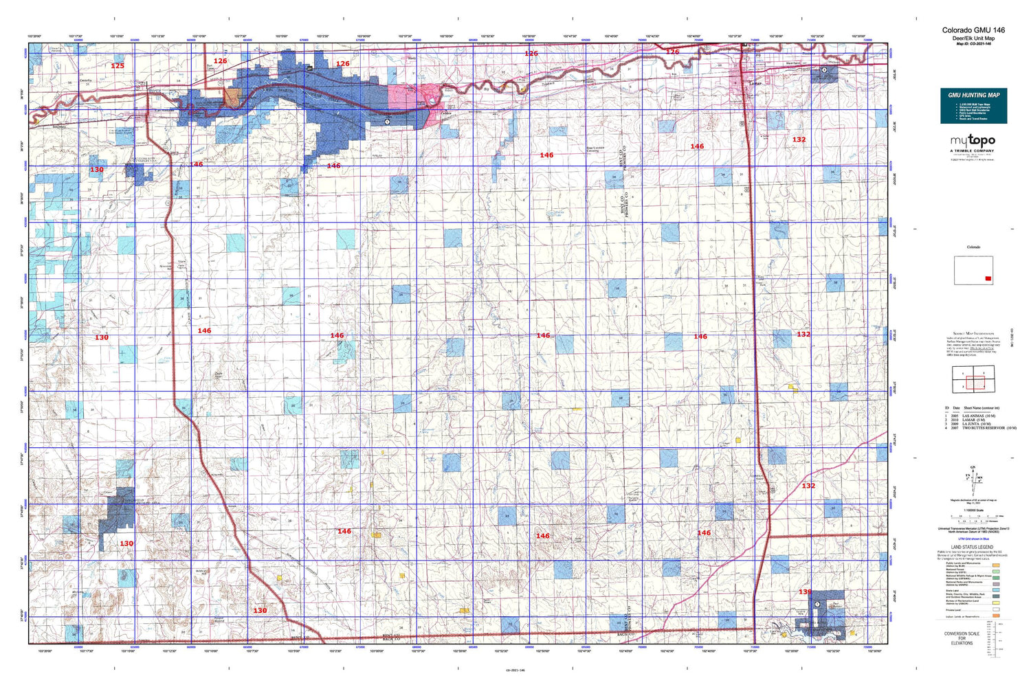
Colorado GMU 146 Map
Couldn't load pickup availability
Hunting unit map of Colorado Game Management Unit 146 with topographic lines and unit boundaries. This topo map features UTM / MGRS and Latitude/Longitude grids, plus public land ownership. It comes folded on waterproof paper. Be fully prepared for your hunt with a MyTopo GMU map!.
This map contains the following named places: 81044,81052,81054,Alkali Arroyo,Antelope Creek,Antelope Draw,Antelope School,Antelope Spring,Bent County,Bentco Mine,Bethel Cemetery,Boggsville,Box Springs,Caddoa,Cat Creek,Chimney Spring,City of Las Animas - Bent County Airport,Clay Creek Store,Consolidated Extension Ditch,Cottonwood Creek,County Canal,Crooked Arroyo CA-3 Detention Reservoir,Crooked Arroyo CA-4 Detention Reservoir,Crooked Arroyo Detention CA-3 Dam,Crooked Arroyo Detention CA-4 Dam,Denny Lake,Dripping Spring,Dry Creek,Eagle Nest,Eagle Rock Ditch,East Clay Creek,East Dry Creek,East Mud Creek,East Parsons Tanks,East Parsons Windmill,England Spring,Fairmount Cemetery,Farrington Draw,Farrington Spring,Floating W Ranch,Four Corners Crossing,Getchel Hill,Gilpin,Gobblers Knob,Good Intent School,Hand Springs,Hasser Ranch,Heinan Flats,Heinan Lake,High Rock,Highland Canal,Hight Cemetery,Hood Draw,Horse Creek,Indian Rock Cemetery,James Draw,Johnny Creek,Jones Ditch,Keller School,Kelly Water Hole,KSEC-FM (Lamar),Lamar Reservoirs,Landsat Number A-44A Dam,Landsat Number A-44A Reservoir,Las Animas Cemetery,Little Angry Creek,Little Kansas Cemetery,McAfee Windmill,Medford Spring,Mixon Canyon,Mooth Waters,Mothers Hill,Mount Olive Cemetery,Muddy Creek,Muddy Creek Reservoir,Ninemile Hill,North Mule Creek,Penrose Draw,Pine Hill School,Pleasant Heights Church,Poor Mans Ditch,Prairie Hill School,Prairie View School,Pruett Cemetery,Rattlesnake Creek,Riverdale,Road Canyon,Rock Arroyo,Rock Canyon,Rule Creek,Ruxton,Ruxton Draw,Santastevens Spring,Scott Pierce Ditch,Selders Ranch,Shelton Creek,Smith Draw,Snif Creek,South Bent Division,South Mule Creek,Springfield Landing Strip,Springfield Pumping Station,Tarbox Arroyo,Toe Jam Spring,Toonerville,Turkey Canyon,West Clay Creek,West Mud Creek,Wildcat Hill,Willow Springs


